
Comments
No comments posted yet.
|
|
Trip Report |
|---|---|
|
|
40.81020°N / 110.6231°W |
|
|
Jun 4, 2005 |
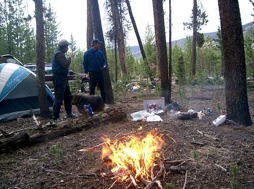 What about Tokewanna, then? No river crossing, and the trail swiftly switchbacks all the way to 10,600. But from there to the timberline, there is a couple miles through the woods which might be mighty unpleasant if the snow doesn’t freeze well. So we tentatively plan our adventure on June 4th, and keep watching the weather. Memorial Day brings cold front and mountain snow, and cooler, wet weather stays for much of the week. It is forecasted to clear on Friday night. Supposed to be a starry, freezing night, followed by a cold day. It’s a go!
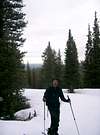 There are no stars that night, but there is some rain. It doesn’t even freeze at 9,250. The trail hits a few snowbanks as it hugs the north-looking slopes before setting into a series of switchbacks, and the snow is all soft through. But at 10,300, we are able to put on skis. This is the 2nd Rule of Summer Skiing:
 We leave the summer trail at 10,600 and head South towards the timberline. The snow isn’t that bad, and by the time we leave the woods just shy of 11,000 ft, it feels fairly well consolidated. And we even begin to see some mountains! First it is just the chains of 11,000-footer hills leading towards the elusive Tokewanna, but then the Lovenias appear in the South, and then, under still stormy clouds, the Henrys Fork group of 13’ers emerges in the East. We have to drop nearly 300 ft to the saddle which Scott recommends for summer camping (“there is a hard-to-find spring nearby”). Right now, there is a swollen creek flowing across the saddle, and some riparian flowers on its banks! We opt against fording this obstacle, and cross it higher on the left. The gradual ascent up the Hill 11,773 is a blaze, but then a chain of steeper humps on the ridge has a lot of melted out spots, and icy snow. After some ski-on, ski-off-again fun, we finally give up and leave the skis just short of a mile off the summit, on the slopes of Hill 12,047. In hindsight, it’s a mistake. The boulderfields part and the ridge widens, creating a good skiable corridor at least to 12,600 elevation. But of course it is easy to walk, too.
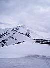

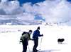
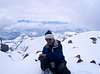
 The summit is still shrouded in clouds, but as we reach the top just minutes before noon, the fog parts just long enough to let us see rugged Beulah to the West and Wasatch to the South. The summit register cairn is encrusted in beautiful crystals of rhime. Judging by the contents, it looks like the most recent ascent was ours, back last August. The GPS reads 9 miles travelled since morning. Feels pretty good, we haven’t skied to any 13er this fast yet!
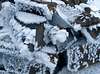

 We reach Hill 17,773, where we stashed lunch and water, and relax until 2pm. The Sun is finally shining, and the views are great. Then, we are treated to a great glide down, but of course have to reascend the slopes of Hill 11,364, negotiating our way between melted-out bands and spots of sun-softened snow. Then a shorter nice glide into the woods, where, much to our relief, we find that the snow mostly remained supportive. Another mile and a half, and we take off the skis, seemingly for the last time this season. But we’ll find them useful again soon!