Thanks to DayHiker's
superb annotation, I realized that I cropped out the main range of San Juans in the Sneffels - Uncomphagre area on
the original picture. The range recedes from the view to the left and didn't look as prominent on the skyline as the slightly closer 14ers of El Diente - Mt Wilson group to the right.
OK, so an excercise with coordinates and elevations shows the following:
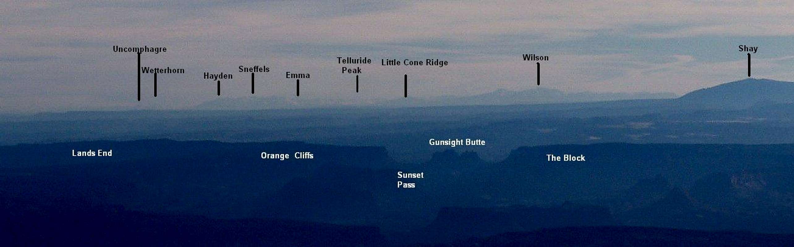
1stly the foreground, a long blue mesa interrupted by dual gaps with multi-pointed butte (aptly named Gunsight) in the middle. To the right, the mesa is called The Block and to the left, beyond the rounded gap of Sunset Pass, the mesa edge is called Orange Cliffs.
Little Cone Ridge, 149 miles away at 93.86°, towers on the horizon above the
Sunset Pass.
Snowy Telluride-Ophir Mountains continue the skyline to the left, with Three Needles, Telluride Peak (168 miles at 93.28°), and finally
Mount Emma at 92.18°.
Further to left, a prominent dark massif of Sneffels Range has Mt Sneffels right in its center (165 miles at 91.48°). A North-Western spur ridge of the massif, topped by
Hayden Peak (90.95°, 158 miles) peters into the ground on the left. Uncomphagre is further to the left, fully 80 pixels below the spur's end and some 15 pixels below the tip of Sneffels on the original image. In other words, it is just a shadow barely visible on the horizon, 182 miles away at 89.69°.
Still it is Mt Ellen's claim to world record - the longest transmission of Morse code by a heliograph, wholly paid for by Uncle Sam's War Dept.


