
|
|
Route |
|---|---|
|
|
39.30940°N / 113.3653°W |
|
|
Hiking |
|
|
Spring, Fall, Winter |
|
|
Half a day |
|
|
Class 1-2 |
|
|
Approach
See the Getting There section on the main page for directions to the start of the hike.Route Description
Round Trip Distance : 11 mi (measured from start of 4WD trail)Elevation Gain : 2300 ft (measured from start of 4WD trail)
Start of Hike: N 39.2761 W 113.3140 (WGS 84)
 Hike Overview
To reach the start of the 4WD trail, high clearance or 4WD is not needed. If you have high clearance you will be able to shave off approximately 3 miles (round trip) and 500 feet of elevation gain. The hike to the summit of Howell Peak is not spectacular, however the view from the overlook most definately is.
 Entering the Canyon
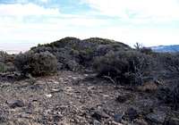 The Official Highpoint
Once at the 4WD trail follow it westward into the small canyon. The first mile of the trail heads towards canyon, then enters the canyon. Once in the canyon the 4WD trail begins to head southwest for about a half a mile. Then the 4WD trail heads northwest, heading towards the peak. Soon after the 4WD trail begins to head northwest it fades out into a cow trail. The trail continues heading northwest along the same drainage. The next mile is easy going and the trail doesn’t gain much in elevation. You will pass several cliffs entering into the canyon. A mile after this the steepness is increased and there are more trees, at the end of the mile you will reach a split in the drainage. Go left, it is less steep and heads towards Howell Peak. Once here continue another mile up the drainage, the trees begin to thicken.
You will soon reach what looks like to be close to the top of the drainage, before this approximately 200 feet below. You will want to head southwest, up the north slope and towards the summit of Howell Peak. This section increases in steepness but nothing more technical than class 2. You can pick anyway up; there is a small cliff band that can be navigated by going to the left. Make you way to the saddle between the two highpoints seen. The highpoint to the right is the overlook of Howell Peak and where the 1000 foot cliff resides. The highpoint to the left is the official highpoint of the middle range and the Howell Peak summit. You can choose which to visit first. I would suggest visiting the official highpoint, and then heading a half a mile (mostly north) to the overlook, from here you will have a great view. The distance between the two is approximately a half mile and you will have to loose and gain about 100 feet.