
|
|
Trailhead |
|---|---|
|
|
42.13416°N / 74.10083°W |
|
|
Spring, Summer, Fall, Winter |
|
|
1990 ft / 607 m |
Overview
This parking area/trailhead gives close access to 2 of the Catskill 3500'ers and also serves as the eastern terminus of the Devils Path, one of the most beautiful and ruggged hikes in the Catskills. The Devils Path, a 25 mile hike, traverses over the summits of 5 of the Catskill 3500'ers and comes within a close proximity to 4 others. The western terminus of this trail is located on Spruceton road.Mountains closely accesable from this parking area/trailhead
-Indian Head (3573 ft.) 4.6 Mi. 1583 Ft elev gain (one way)Follow the Devils path for 4.6 miles to the summit of Indian Head. Continue over summit into Jimmy Dolan Notch and turn right onto the Jimmy Dolan Notch Trail for 1.6 Mi. then turn left (back onto the Devils Path) and continue for .5 Mi. back to the trailhead. A fine loop!
-Twin (3640) 3.1 Mi. 1650 gain (one way)
Follow the Devils Path for .5 Mi. and turn right onto the Jimmy Dolan Notch Trail. Continue for 1.6 Mi. and turn right onto the Devils Path, traveling over Twin's east summit and reaching the western summit in 1 mile.
 The Devils Path eastern terminus area
Other mountains along the Devils Path
-Sugarloaf (3800)
-Plateau (3840)
-Hunter (4040)
-Westkill (3880)
Recommended maps/books
I highly suggest the maps by the New York/New Jersey Trail Conference. These maps are quite accurate making both trail travel and trailhead locating by road very easy.For further details on this area & trails, a copy of the Catskill Mountain Guide by Peter W. Kick, an Appalachian Mountain Club book, would be an excellent resource.
Getting There
-Quickest route (seasonal)From exit 20 on the New York State Thruway (I-87), go west on Rt 212 for 2 miles then turn right onto CR 35 (Blue Mountain Road) and travel for 1.4 Mi. Bear left to continue on CR 35 for .2 Mi.
Stay straight here and the road becomes CR 33 (Saugerties Rd.) and continue for 4.8 Mi. (becomes CR 16, Platte Clove Rd.)
Turn left onto Prediger Road and go to the end of the road.
NOTE: Parking is only allowed on the right (northwest) side of the road. Please observe all signs as the first few hundred yards of the trail cross private property. The landowners are very generous to allow foot travel on thier land.
CR 33 and CR 16 on the way to this trailhead is a skinny cliffside twisting road that is not maintained from Nov. 1st through April 15. If there is any chance of ice or slippery conditions DO NOT TAKE THIS ROAD.
-Year round (maintained route)
From exit 20 on the New York State Thruway (I-87) go north on route 32 fot 5.7 Mi. then bear left onto Rt 32a and travel 1.8 Mi.
Turn left onto Rt 23a and go 6.9 Mi., traveling through the town of Tannersville. From Tannersville Center go left onto Railroad Ave. (Cr 16) (follow signs for Cr 16 as the road names change) eventually Cr 16 becomes Platte Clove Rd. Total travel on Cr 16 is 5.6 mi. At this point, turn right onto Pediger Road and follow directions above.
Red tape/backcountry camping
NOTE:Parking is only allowed on the right (northwest) side of Prediger road. Please observe all signs as the first few hundred yards of the trail cross private property. The landowners are very generous to allow foot travel on thier land.-If camping in the wilderness, these regulations are to be followed:
-For backcountry camping permits (when neccesary, see below) visit the DEC website under services.
-Pack it in-pack it out
-No more than three succesive nights or more than ten nights per year can be spent in trailside lean-tos.
-A permit must be obtained from the DEC forest rangers if camping more than three succesive nights or in groups of ten or more. No permits will be issued to anyone under the age of 18.
-The DEC may take down & remove any tent or camping structure that is left alone for more than 48 hours
-No camping above 3500' between March 22 and December 20.
-No fires shall be left unattended
-No camping within 150 feet of any road, trail, spring, stream, or other bodies of water except in camping areas designated by the DEC.
-Rangers do Frequent these mountains
Some images from this area
 Some colorful growth on a tree along the Devils Path
 The view from the western summit of Twin
 The view from the eastern summit of Twin
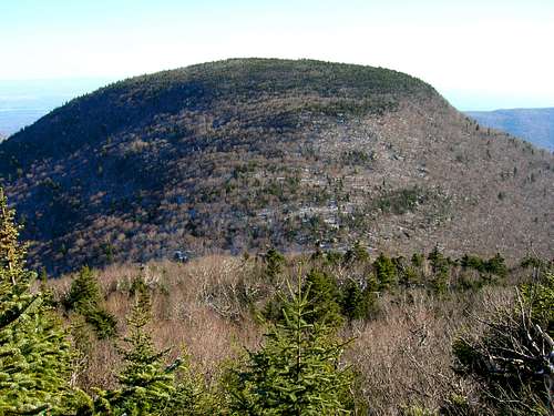 Indian Head from the east side of Twin