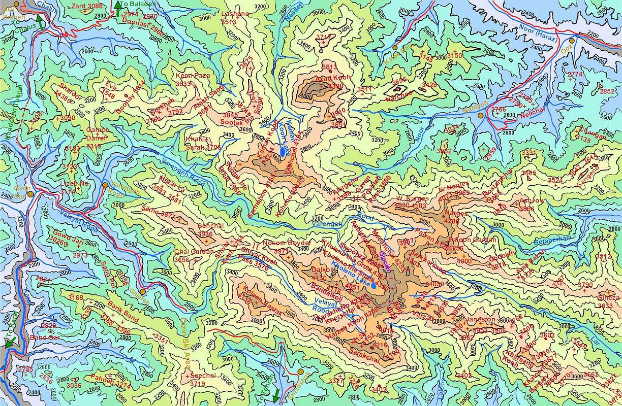
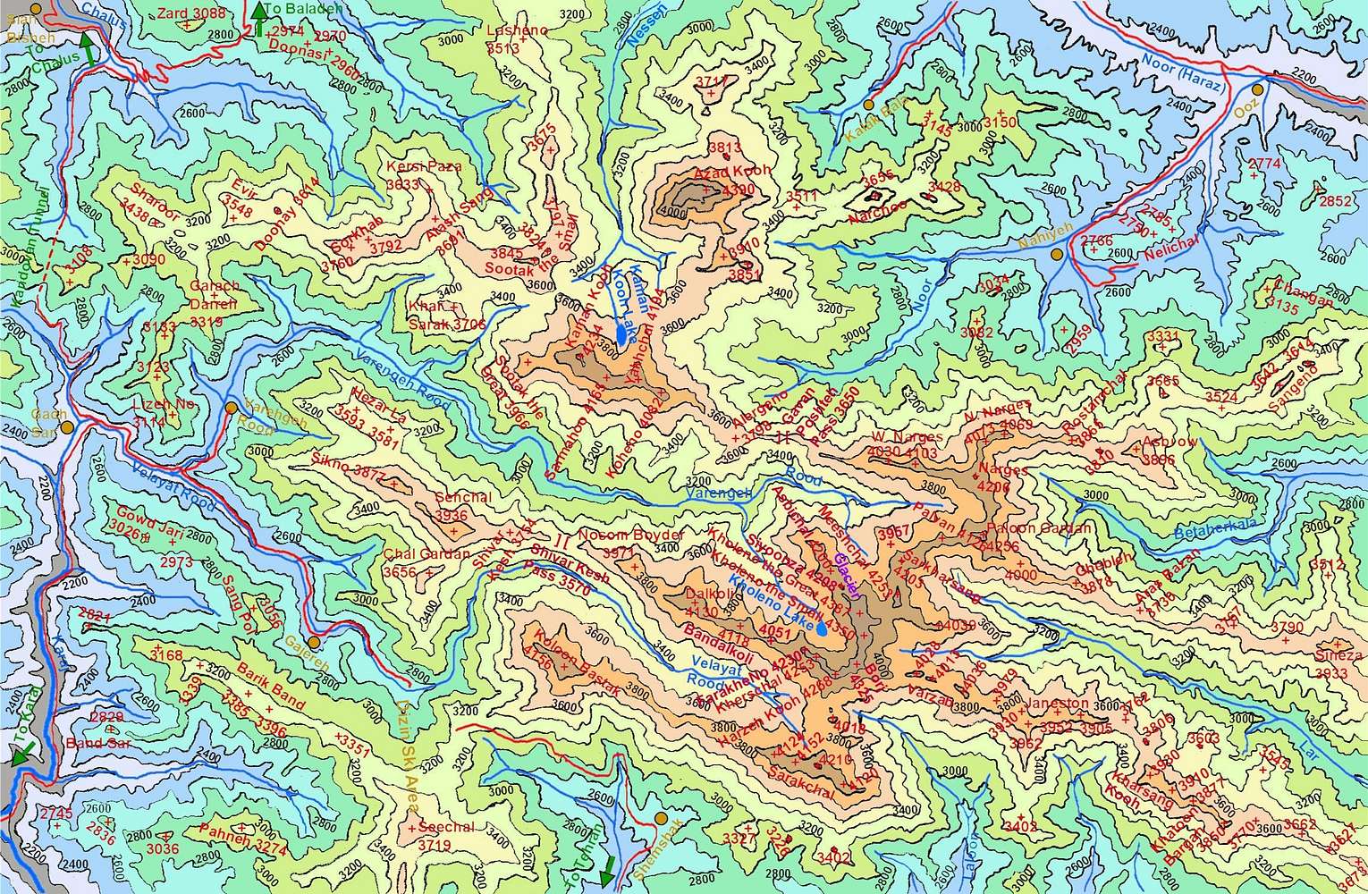
Click on "View High Resolution Image" and then the magnifier/plus sign to see large map.
Map of Kholeno Massif created by me based on the 1:50 000 maps. This map is to scale and covers the area between 51:18 to 51:42 East and 36:00 to 36:13 North (36 Km East-West by 24 Km North-South).
Click here to zoom out on the overall map of Central Alborz.


