One day Scrambling trip to Chief Mountain, Montana
Chief Mountain is a prominent square topped peak that immediately attracts the attention of climbers and travellers. A lot of people from Calgary travel to the Flathead valley or Glacier Park and a common route goes past Chief Mountain. After driving by for 25 years I decided we had to climb it.
I did some research and decided to go by the Humble oil approach which meant we needed Blackfoot Fish and Wildlife Conservation Permits. I phoned and found out that everywhere that sold permits would be closed on Sunday on both side of the border. The lady at the store in Cardston came up with a friendly suggestion that she could leave them at the convenience store/gas stop which would be open by the time we went through. Perfect- gotta love small town attitude and trust. The Caraway Border crossing would also be open by the time we got there. A little over three hours down to Cardston and we picked up and paid for the permits from another friendly lady. The border crossing was easy although the guard was a little suprised when we said we just wanted to cross for the day to scramble Chief mountain.
South for 17 km and then turned west on the Chief mountain highway(# 17) for about 16 km and then turned south onto the "humble oil road". It is an old gravel/dirt lease road that follows the ridge up to a reclaimed drilling lease. It was a little rough and if it was wet you might need a 4x4. Park at the old lease site or about 1-200 m past on the ridge. A very good trail starts here and follows the ridge. It was very windy and we were hit by repeated squalls of snow pellets. All the pictures had to be lightened.
The trail was good except for the area through the mud slide deadfall part and the trail finally petered out above treeline.
We went up the open slopes/scree and around the North west end of the mountain on very broken rock with no trail.
The west slopes were loose scree and the first attempt to gain the ridge didn't go so we had to descend and traverse south along the upper rockband to gain the correct notch.
Correct Notch
Climbers on summit ridge from below notch.
It was easy scrambling along the ridge although some patches of frozen snow/ice and the high winds and snow pellet storms made it more interesting. We scrambled through three notches with the one closest to the summit being the 4th class one. The wind gusts caused funneling in the notches and we had to hold the rock on one side and then time your 2 or 3 steps to the other side.
Summit block from previous high point.
Coming down final strech to summit
Going down - climber has just climbed out of fourth class notch
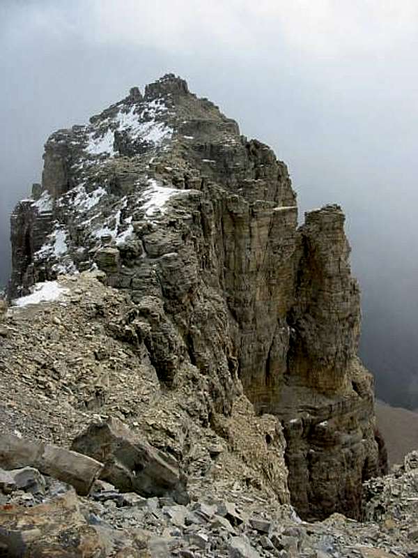
We did get a few semi-sunny breaks between storms and got some views along the ridge. On descent of the West scree slopes the Squaw and Papoose pillars popped out of the clouds.
A good trip to a very interesting mountain.
Comments
No comments posted yet.