Dealing Delano
After summiting Pyramid Peak in CO on 9/19, I lazed around for a weekend in Fort Collins with an old friend from college, drinking and watching the Pats get rolled over by the Dolphins. I knew that another buddy of mine was going to be in the Utah area, and we had talked earlier last week about meeting up. On Monday I drove into Salt Lake City and picked up Sean, who was in town for a meeting. I had planned to do some hiking in Utah, including Delano, and possibly Peale, Abajo, and maybe Ellen before moving on to Eastern Nevada.
However, it didn’t take long for Sean to talk me into a trip to Vegas, where he had left his car. We managed to get a good deal at the Wynn, and made reservations for Wednesday and Thursday night to avoid the weekend rates. Oh well. My car probably couldn't make it up La Sal Pass anyway.
After driving a few hours out of Salt Lake and admiring the monumental profiles of Timp and Nebo on I-15, we crashed in the little town of Beaver. Before heading into Vegas, we would attempt to knock down Delano and Brian Head.
Big John Flats is about a half hour outside of Beaver and pretty easy to find. I was a little concerned about the dirt road to the trailhead, but my Camry made it just fine. When you get to the main campground, bear right and stay on the edge of the meadow. We passed a few campsites and the road began to get a little rougher. At one site two very attractive girls wearing camo were unloading their Jeep. We stopped and made sure we were on the right track to Poison Creek. We were. We continued for another few minutes before I saw a good turnoff. I decided to park here probably a ridge and a curve from the standard trailhead, as the road was getting progressively worse.
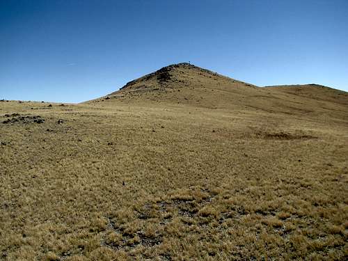
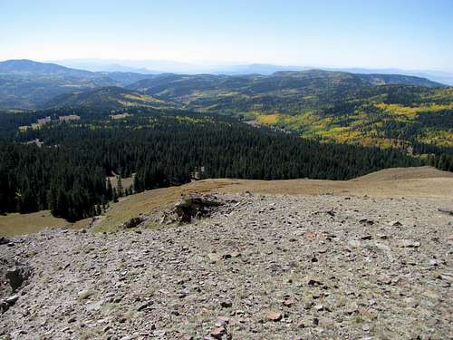
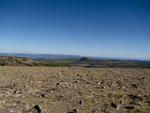
We parked on the south side of the main ridge leading up towards Delano, and right below a large basin. We made our way deep into the center of the basin, trying our best to avoid the deer and cow droppings. After reaching the last ramparts of the basin we decided to gain the ridge. I found a scree clearing and made my way up. Sean got stuck in the brush, which he found to his chagrin to be quite thorny. The terrain was mixed tundra and talus upon gaining the ridge, with hints of a trail. We crested at the top of a minor summit; we couldn’t tell where Delano was at this point, but figured (hoped) that it was behind some of the broad hills in front of us. We traversed around to gained a broad slope with views of Belknap behind us. Sean was a little unsure at this point, as we wondered whether Delano was one of the farther summits that looked to be quite a distance from us, and involving a lot of elevation loss and regain.
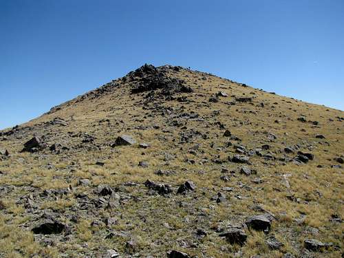
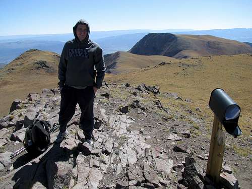
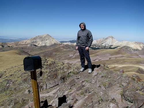
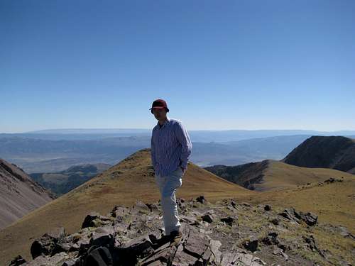
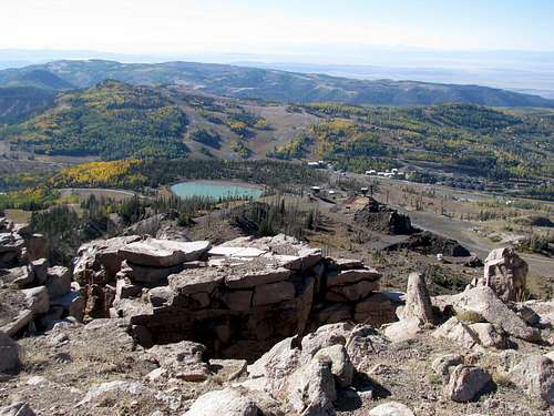
We bumped into a couple of hunters near the top of the slope. I asked them how far, or even which peak, Delano was. They had never heard of it. I asked where the highest peak was. Their reply made it seem like it would take days for us to reach. I hedged that it was going to be sooner, and we climbed on. After topping out on the slope, we saw another broad slope in front of us, and I was pretty sure that immediately behind this was Delano. I was right. We summitted, checked out the mailbox summit register, took some pictures, and headed back down.
![Looking south]() South South |
![Looking East-ish]() East East |
![South Southwest]() SW SW |
![Southwest]() SW SW |
![West Southwest]() SW SW |
![Baldy and Belknap]() West West |
![Northwest]() NW NW |
![Northeast]() NE NE |
![East]() East East |
![NE Gully again]() Nice drainage Nice drainage |
![Southeast]() SE SE |
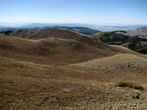
Sean mentioned his knee was only eighty percent (ugly incident at "The Greatest Bar" in Boston a year back involving some BC football players, now in the NFL and a dirty MA State Trooper; it was on espn.com). I had him try out my trekking poles, and he took to them pretty well. We slowly made our way down the mountain, staying on the crest of the ridge for the most part, and trying, unsuccessfully, to avoid the scattered patches of talus. Unfortunately the hunting girls weren’t around as we were driving out of Big John Flats. Oh well. May their aim be swift and deadly.
![Poison Creek Drainage]() Poison Creek Drainage Poison Creek Drainage |
|
![On the descent]() This could be Kansas, cept over 12K ft This could be Kansas, cept over 12K ft |
![Tushar Range]() Tushars Tushars |
|
|
|
Summit shots below:
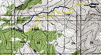
![Our approximate route]() Our approximate route
Our approximate routeBagging Brian Head
Nothing too exciting about Brian Head. We had a nice and easy climb a few miles up the road in the Tushars earlier this day, bagging Delano Peak. As I expected, we finished earlier enough in the day to do a quick drive up Brian Head Peak, even after eating a nice lunch at the Timberline Restaurant in Beaver UT (my omelet and home fries were amazing, Sean’s NY Sirloin left much to be desired).
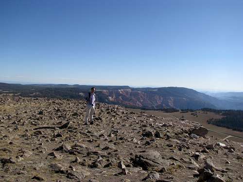
The drive up the Markagunt Plateau was surprisingly steep, and my Camry found itself struggling. The ski area below the main peak was abandoned, for the most part. A few miles afterwards you find yourself on a flat treeless area of the plateau, and there is a good sign pointing you onto the gravel road leading to the top of Brian Head. The road is neither steep nor exposed, but the Camry took a beating on some of the more rutted sections. We parked at the signed parking lot about a hundred feet below the summit.
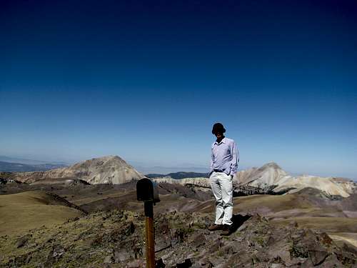
Both Sean and myself somehow managed spotty reception on this mountain, as both of us got work-related calls. My manager called me about an audit they were working through in my absence, and Sean had to walk some of his clients through the process of getting their printers to work. We could afford to be cavalier about this “ascent”, as it was an easy and straightforward road walk for about a half mile to the flat plateau summit of the peak (for me, a far cry from Pyramid Peak a half week ago).
|
|
|
|
![View South]() View south View south |
|
|
![Cedar Breaks]() Cedar Breaks Cedar Breaks |
|
|
![Fall colors in Utah]() Fall colors Fall colors |
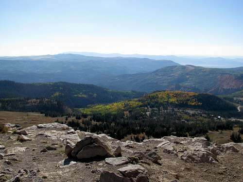
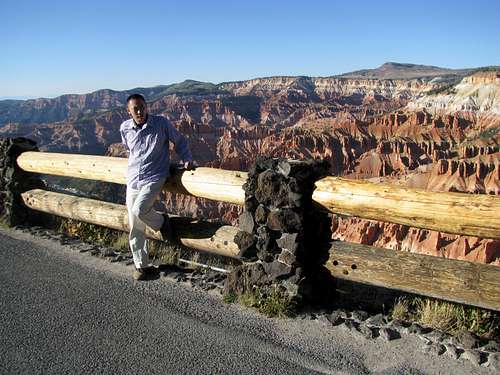
The summit was windy and more than a little chilly, but the views were amazing, especially with the sun starting to set in the west. Sean remarked that he was much more impressed with the view here, as opposed to Delano, as you could see more of the canyon country, Bryce and Cedar Breaks in particular. Brian Head is definitely one of those peaks that gives you a great return on investment. Not only is it a quick and easy road walk (or drive if you’re so inclined), for those of you who are list obsessed it is a range high point and a fairly prominent peak, the second such summit of the day for us.
|
|
![Tushars on the horizon]() Tushars and Delano Tushars and Delano |
|
|
![The ski resort below]() The ski resort The ski resort |
|
|
![Nature in action]() A hawk killing a rodent A hawk killing a rodent |
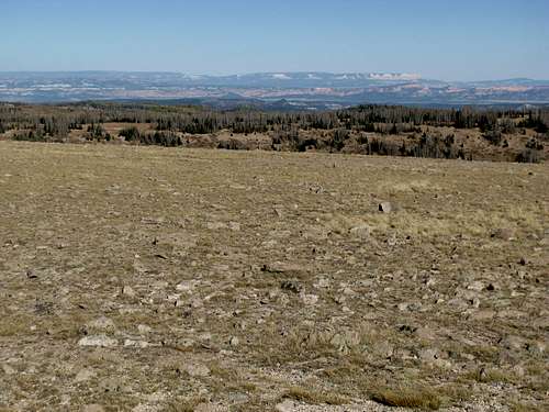
Cedar Breaks National Monument is only about three miles away from the junction of the Brian Head gravel road, and if you are heading south, it’s practically on your way as sort of a loop route back to I-15. There is no sign give you notice of the park entrance, so as a result I drove by a couple of overlooks that probably were pretty nice. There’s only four or five overlooks in the park overall, and if you’re heading north to south, the visitor center is located at the last overlook. The drive back to I-15 and Cedar City held in store a pleasant surprise; Cedar Breaks is located above 10K ft on a high plateau, and as you are descending you get a great view of Zion Canyon from above, to the south.
![Cedar Breaks]() Cedar Breaks Cedar Breaks |
![Cedar Breaks]() Cedar Breaks Cedar Breaks |
Another summit recorded. The Markagunt seemed an intriguing area, even by itself, and I regret now not being able to explore more exhaustively, but alas, the bright lights of Vegas were calling, and it was down to Nevada for two nights at the Wynn. Our stay there would not bode well for Sean. There were omens too. A black cat crossed the highway in front of us not even a mile into Nevada. About 50 miles outside of Vegas a bat sideswiped my windshield. And the moment I pulled off the highway in Vegas I spied a burning bush on the side of the road. A freakin’ burning bush. Literally, someone got it in their deranged little heads to set a bush on fire. Oh, but there were signs.
Summit shots:
|
|
|
![Yours truly]() Cedar Breaks Cedar Breaks |
![Sean]() Cedar Breaks Cedar Breaks |
Comments
No comments posted yet.

 South
South East
East SW
SW SW
SW SW
SW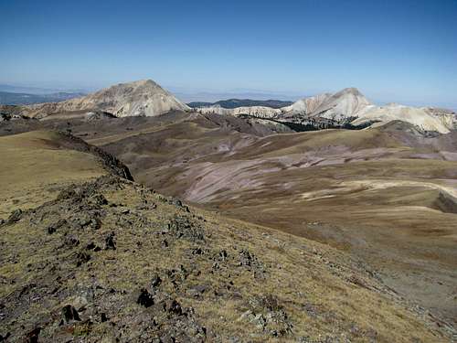 West
West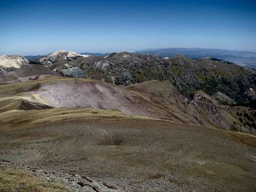 NW
NW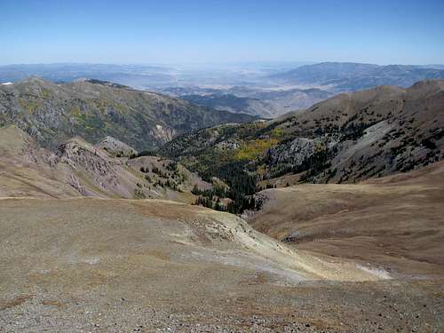 NE
NE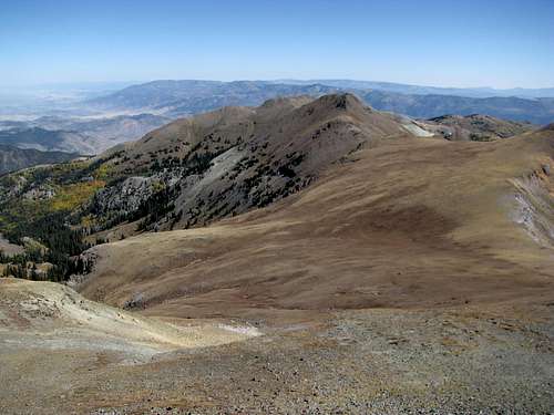 East
East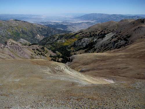 Nice drainage
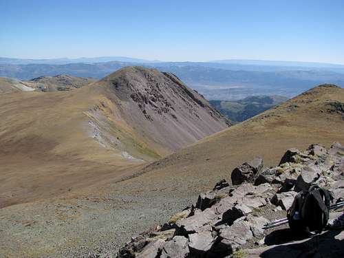 SE
SE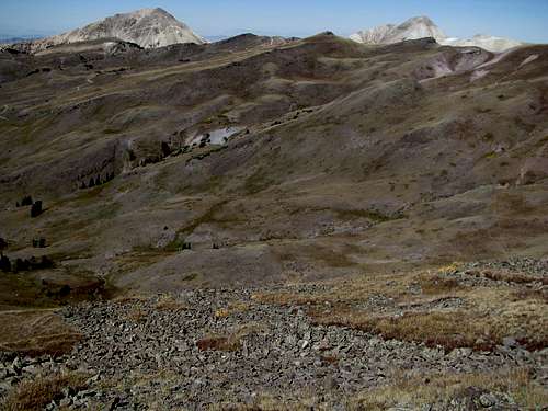 Poison Creek Drainage
 This could be Kansas, cept over 12K ft
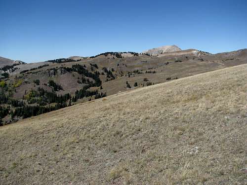 Tushars
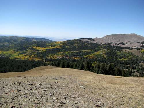

 View south
 Cedar Breaks
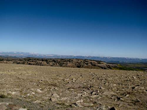
 Fall colors
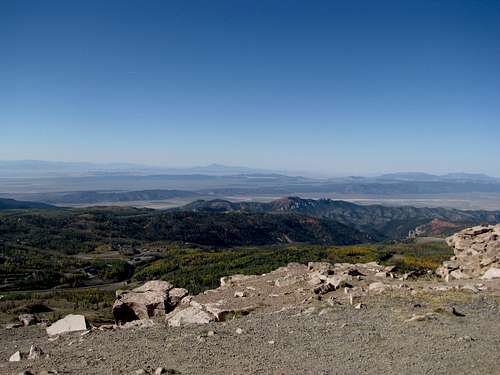
 Tushars and Delano
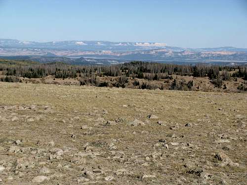
 The ski resort
 A hawk killing a rodent
 Cedar Breaks
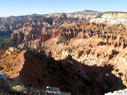 Cedar Breaks
 Cedar Breaks
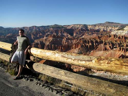 Cedar Breaks