Toggle navigation
Mountains
Routes
Images
Trip Reports
Forum
What's New
People
Areas & Ranges
Articles
Trailheads
Canyons
Huts & Campgrounds
Albums
Logistical Centers
Fact Sheets
Lists
Custom Objects
Gear
Plans & Partners
WELCOME TO SUMMITPOST
SIGN IN
REGISTER
The page was successfully edited.
×
Old Topo Maps of Guatemala
Additional Parents
Lake Atitlan
Image
Volcan San Pedro
View High-Resolution Image
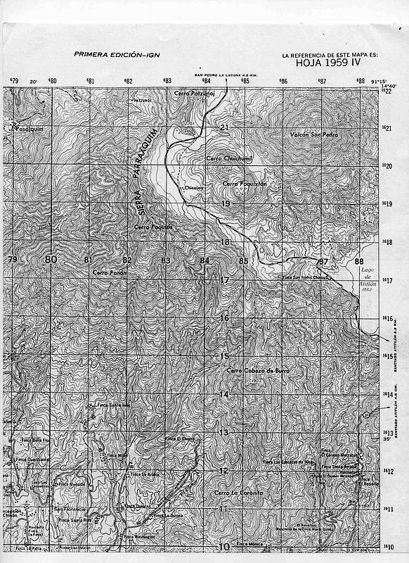
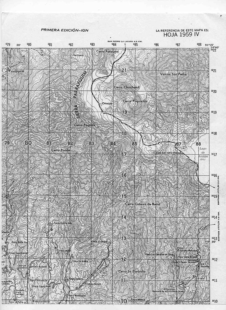
Volcan San Pedro
In addition to Volcan San Pedro, this map includes Cerro Patzunoj (2195m), Cerro Chuichumil (2400m), Cerro Paquixton (2455)Cerro Cabeza de Burro (1903m), Cerro la Coronita (1250m), Cerro Panan (2500m), and Cerro Paquisis (2831).
« PREV
NEXT »
mmcguigan
on
Oct 24, 2008 12:48 am
Comments & voting
Other parents
Lat/Lon:
14.63000°N / 91.23°W
Image Type(s):
Alpine Climbing
Image ID:
456298
2762 Hits
0
% Score
0
Votes
Log in to vote
Comments
No comments posted yet.
to post!
Don't have an account?
Old Topo Maps of Guatemala
(Album)
« PREV
Viewing
#6 of 28
GALLERY
NEXT »
mmcguigan's Image Gallery
« PREV
Viewing
#325 of 393
GALLERY
NEXT »
Lake Atitlan
(Album)
Loading....
×
You need to login in order to vote!
User Name
Password
Remember me
Forgot your password?
Log me out when I close my browser.
Keep me logged in all the time.
sign in as a user
Don't have an account?
Register now for FREE
Rating available
Suggested routes for you
People who climb the same things as you
Comments Available
Create Albums
Register Here


