
|
|
Route |
|---|---|
|
|
37.51442°N / 112.2474°W |
|
|
Overview
| Note: Under The Rim Trail is 23 miles long. In order to reduce the number of pictures on this page and to create reasonable day hikes, I have arbitrarily broken it into a northern and a southern section. Trail Description below is for the southern section (between Whiteman Trailhead and Rainbow Point). For the northern section click here . |
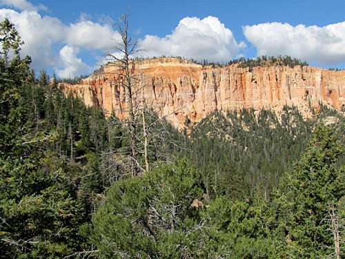
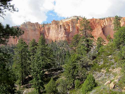
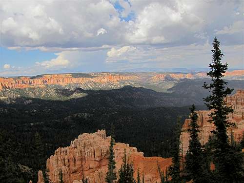
Bryce Canyon National Park is famous for its colorful hoodoos. These formations are primarily found in the northern parts of the park. The southern parts of the park (south of Bryce Point) are made of a long line of forested hills that run north-south. On the eastern edge of these hills, you will find a continuous line of pink colored cliffs that drop down several hundred feet. These cliffs go from Rainbow Point, the southern-most point on the park road, to Bryce Point to the north. Park road runs near the top of the hills and gives access to the many designated vista points on top of the cliffs. Under The Rim Trail takes you below the cliffs and gives you much less frequently seen views from the bottom of the cliffs away from the crowds.
The trail starts at the highest point in the park, the 9115 ft Rainbow Point and quickly goes down 1100 vertical feet. It then follows a path north at the base of the pink cliffs. Over its 23 mile length, the trail goes up and down many times creating a few thousand feet of vertical uphill. At its northern end, the trail goes up 1500 vertical feet to end at the 8300 ft Bryce Point (The trail can obviously be hiked in either direction).
In four places, where the cliffs allow it, short connecting trails descend from park road to Under The Rim Trail. South to north, these include:
1)Agua Canyon Trail
2)Whiteman Trail
3)Swamp Canyon Trail
4)Sheep Creek Trail
Whiteman Trail is one mile long and connects to Under The Rim Trail near its middle point. This allows you to break the Under The Rim Trail into a 13.3 mile northern section and an 11.7 mile southern section. The usual park shuttle bus does not go to the areas south of Bryce Point. You can, however, contact the park to arrange a shuttle ride. Designated camp sites along the length of the trail make multi-day backpacking trips possible. Camp sites require reservations before the trip. Please see the link to park site under Red Tape below.
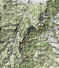 Under the rim, overall map |  Under the rim southern section map |
Getting There
Directions to Rainbow Point:From Park entrance, drive 18 miles south to the end of the road at Rainbow Point Parking Area.
Directions to Bryce Point:
From Bryce Canyon Visitor Center drive 1.5 miles south until you see the sign for Bryce Point. Turn east and follow the road to Bryce Point parking area. Parking is limited. Come early or take the park shuttle.
Directions to Whiteman Trailhead:
Drive the park road south to mile marker 9 and turn left to the small pull-off. There is parking area for only a few cars.
Hike Statistics
This information is for the southern section (Whiteman TH to Rainbow Point) onlyRoute Description
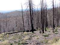
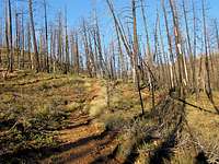
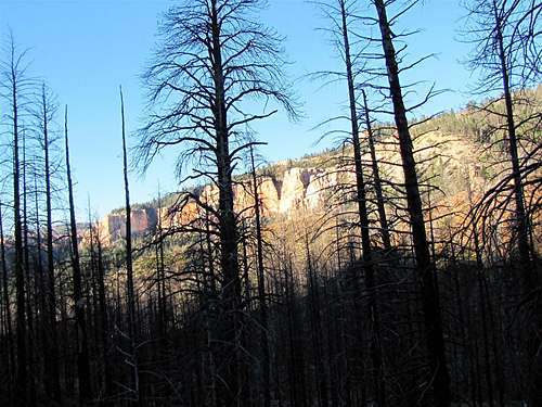
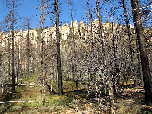
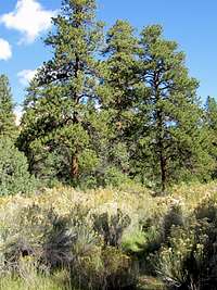
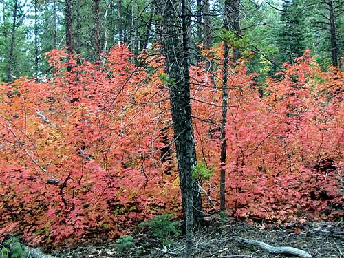
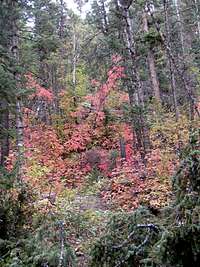
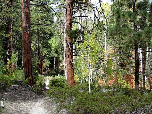
Whiteman TH to Under The Rim Trail, descend from 8700 to 8200 ftHike Whiteman Trail down a forest to the junction with Under The Rim Trail. When I was in the area, the forest appeared burnt.
 |  |
Descend to Willis Creek 7740 ft
Head south on Under The Rim Trail. You will find Noon Canyon Butte to your left and the long line of pink cliffs to your right. I lost the trail here and spent more than an hour trying to find it. Have a map and study it well.
 |
 |
 |
Ascend to 7960 ft
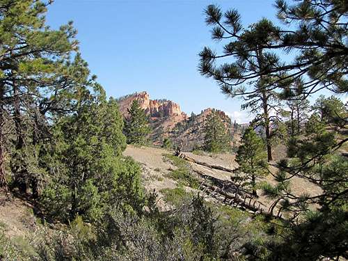
You will note a nameless rocky formation (Point 8515 ft) to the south. The trail begins to go up toward the base of this formation.
 Point 8515 ft |
 Point 8515 ft |
 |
You will then reach a sandy high point at the base of Point 8515 ft.
 Base of Point 8515 ft |
You can look north to see Noon Canyon Butte behind you.
 Looking north to Noon Canyon Butte |
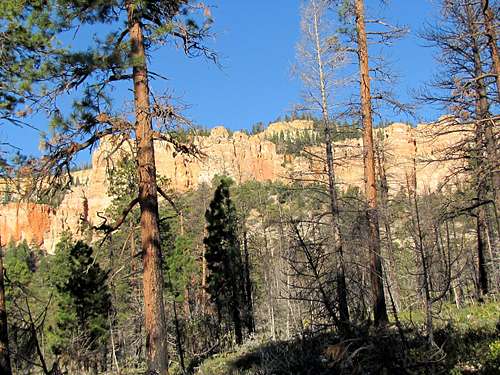
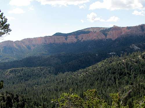
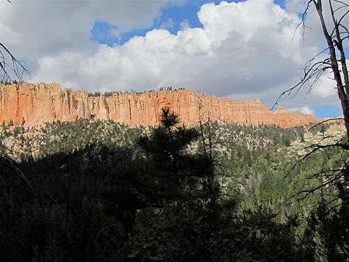
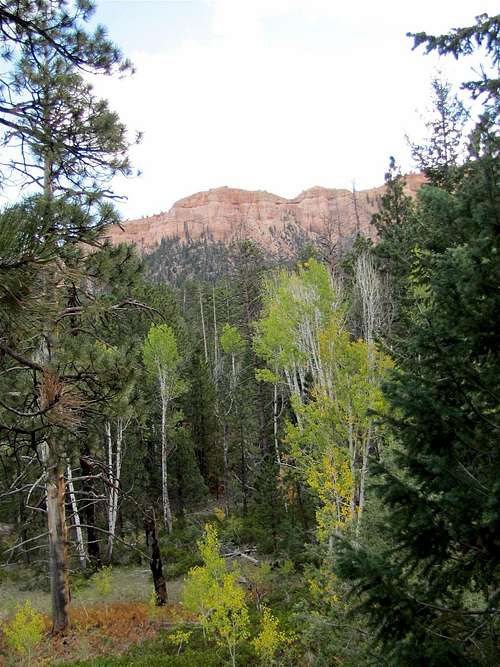
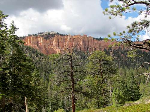
To the south, you will see a long line of cliffs rising above the western ends of Bridge Canyon & Agua Canyon.
 Looking south to Bridge Canyon & Agua Canyon |
Descend to Bridge Canyon/Agua Canyon 7520 ft
The trail begins to go down to reach the bottom of Bridge Canyon. You can supposedly look west to see a natural Bridge in the cliffs. The vegetation here is quite dense. I did not see the bridge.
 Bridge Canyon |  Bridge Canyon |
The trail then goes into the Agua Canyon drainage. You will soon reach a clearing where cliffs can be seen to the west.
 |
 |
 | ||
 |  |  |
Ascend to Agua Canyon Connecting Trail 8180 ft
A number of switchbacks, take you up to a junction point with Agua Canyon Connecting Trail. When the trees allow it, you can look back to the north to see Noon Canyon Butte and Point 8515 ft.
 Point 8515 ft & Noon Canyon Butte |
 |
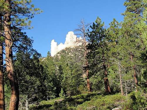
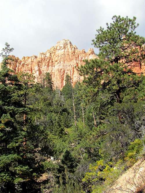
Rainbow Point comes to view to the south. You still have a lot of hiking to do.
 Rainbow Point |
Descend to North Fork of Ponderosa Canyon 7860 ft
Follow the trail downhill.
 |
 |
 |
 |
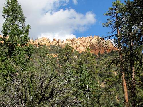 |
Ascend to a 8000 ft high point
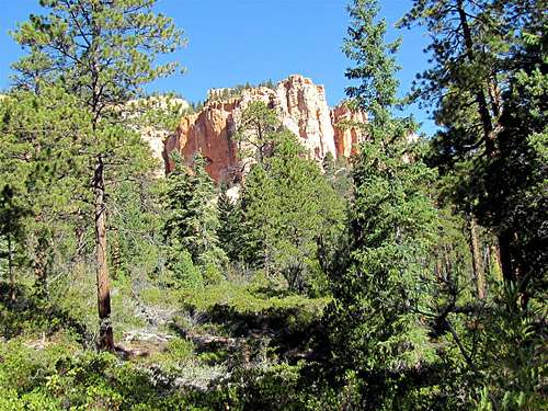
You will see white cliffs to the south. The trail takes you up to a high point near the base of these cliffs.
 White Cliffs |
 White Cliffs |
Descend to Ponderosa Canyon 7720 ft
The trail descends to Ponderosa Canyon. The vegetation is lush.
 Ponderosa Canyon |
 Ponderosa Canyon |
 | |
 |  |
Ascend to 8000 ft, descend to South Fork of Ponderosa Canyon 7880 ft
A few switchbacks take you to a 8000 ft point and then onto the upper parts of the South Fork of Ponderosa Canyon.
 |
 |
 |
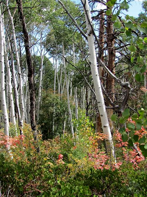
Iron Spring
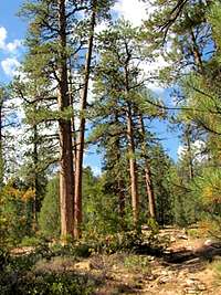
You will then reach Iron Spring. The forest here is very beautiful.
 |
 |
 |
North Fork of Black Birch Canyon
For the next mile or so, the elevation of the trail remains fairly stable at around 8000 ft. You will cross the North Fork of Black Birch Canyon.
 North Fork of Black Birch Canyon |
Black Birch Canyon
You will then cross into Black Birch Canyon. You are now directly under the cliffs below Rainbow Point.
 Black Birch Canyon |
 Black Canyon |
 Black Birch Canyon |
 Black Canyon |
South Fork of Black Birch Canyon
In the South Fork of Black Birch Canyon, you will see the cliffs from below for the last time.
 South Fork of Black Birch Canyon |
 South Fork of Black Canyon |
Ascend to Rainbow Point 9115 ft
The trail makes a 180 degree turn around the end of a ridge-line and begins to go up in elevation. The Pink Cliffs will no longer be visible. Only white colored hills can be seen below.
 White Hills |
 White Hills |
The 9091 ft Rainbow Benchmark (not Rainbow Point) will be visible as a forested hill.
 Rainbow Benchmark |
The trail will take you to the crest of the ridgeline. You are now on top of the cliffs of the South Fork of Black Birch Canyon.
 |
 |
The 10450 ft Barney Top Mesa is visible in the distant east/northeast.
 Barney Top Mesa |
You will then find yourself above the cliffs of Black Birch Canyon.
 |
 |
 |
Follow the trail to reach Rainbow Point Parking area.
 Looking north from near Rainbow Point |
Red Tape
You must pay park entrance fee.No permits required for day hikes. Camping on the trail is allowed only in designated campsites and requires prior reservations. For all rules and regulations see the official park site:
http://www.nps.gov/brca/index.htm