
-
 3584 Hits
-
 82.34% Score
-
 15 Votes
|
|
Mountain/Rock |
|---|---|
|
|
41.86742°N / 110.76758°W |
|
|
Hiking |
|
|
Spring, Summer, Fall, Winter |
|
|
7802 ft / 2378 m |
|
|
Overview and Route
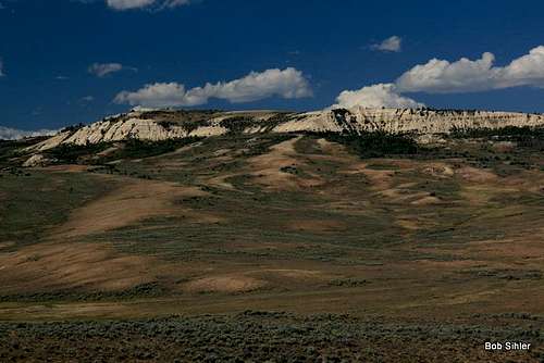
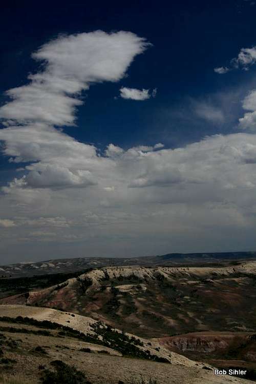
Atop Cundick Ridge, the curious hiker finds expansive views of the high desert of southwestern Wyoming, a sea of sagebrush, rolling hills, and eroded buttes. While this does not approach the thrill of topping out on a glaciated Class 5 pinnacle deep in a mountain wilderness, it is a nice escape from the world, and the views, which stretch all the way to the Uintas in Utah, and the wind in the grass evoke images of the prairie from the frontier days and earlier.
Where the name comes from I have no idea even after doing some googling. People with an appreciation of the lewd may enjoy thinking about what the name could have been!
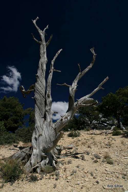
"Climbing" Cundick Ridge is a very simple matter. Probably the most scenic way is to hike the Chicken Creek Nature Trail, which is a moderate 1.5-mile loop. Going counterclockwise, look for an eroded trail a little downhill from the benches at the trail's highpoint. Follow this eroded trail up the steep, loose slopes until the terrain gets flatter and grassy. There are some cool dead trees you may want to check out near the top of the crumbling cliffs. The summit is not far away and provides sweeping views, including of nearby Fossil Butte. Unfortunately, there is some type of radio tower up there as well.
You might notice a dirt road leading almost to the summit. This road can be accessed from a little farther north of the trailhead. I believe it is closed to vehicular travel, though, and the road hike might be a bit longer though with less elevation gain (not that the gain from the TH is that significant-- well less than 500').
Also, when you are at the benches, you will see a quarry not far above you. This is an active quarry and is closed to the public unless you are accompanied by a ranger or otherwise have special permission to be there.
Collecting or otherwise disturbing fossils is strictly prohibited!
Fossil Butte
Getting There
The turnoff for the national monument is about 10 miles west of Kemmerer off U.S. 30. After leaving the highway and going under some railroad tracks, you drive west and then north to the visitor center. Keep driving north a few miles until you reach the well-signed TH and parking lot for Chicken Creek.Red Tape
There is no entrance fee, but donations are welcome.
As stated before, collecting or otherwise disturbing fossils is strictly prohibited. You will face a heavy fine and possibly even jail time if you are caught doing so. Also, collecting any other natural artifacts (i.e. antlers, minerals) is also prohibited.