Toggle navigation
Mountains
Routes
Images
Trip Reports
Forum
What's New
People
Areas & Ranges
Articles
Trailheads
Canyons
Huts & Campgrounds
Albums
Logistical Centers
Fact Sheets
Lists
Custom Objects
Gear
Plans & Partners
WELCOME TO SUMMITPOST
SIGN IN
REGISTER
Névé Peak
Additional Parents
Image
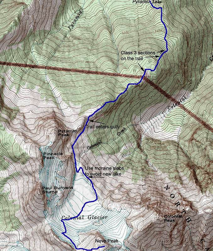
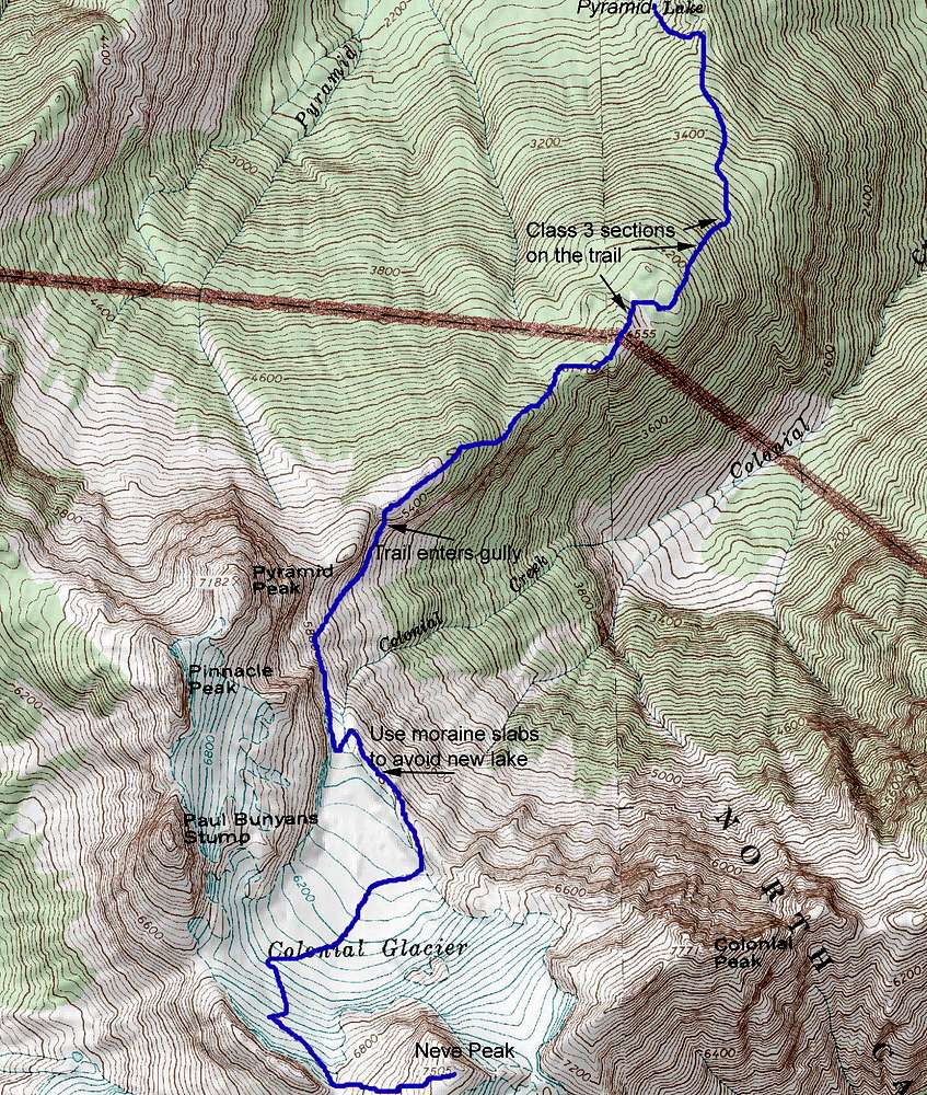
Neve Route
View High-Resolution Image
Neve Route
USGS Map with route to Neve Peak and annotations. The new lake at the base of Colonial glacier is probably frozen most of the year. The roue up the slabs around it follows an interesting pressure gradient that produces strong gusts.
« PREV
NEXT »
Mike Lewis
on
Aug 8, 2014 4:08 pm
Comments & voting
Other parents
Lat/Lon:
48.65667°N / 121.139°W
Image Type(s):
Alpine Climbing
,
Hiking
,
Topo/Diagram
Image ID:
908187
1465 Hits
71.06
% Score
1
Votes
Log in to vote
Comments
No comments posted yet.
to post!
Don't have an account?
Névé Peak
(Mountain/Rock)
« PREV
Viewing
#18 of 21
GALLERY
NEXT »
Mike Lewis's Image Gallery
« PREV
Viewing
#455 of 775
GALLERY
NEXT »
×
You need to login in order to vote!
User Name
Password
Remember me
Forgot your password?
Log me out when I close my browser.
Keep me logged in all the time.
sign in as a user
Don't have an account?
Register now for FREE
Rating available
Suggested routes for you
People who climb the same things as you
Comments Available
Create Albums
Register Here


