Mount Cleveland
![Unnamed Image]()
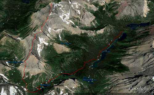
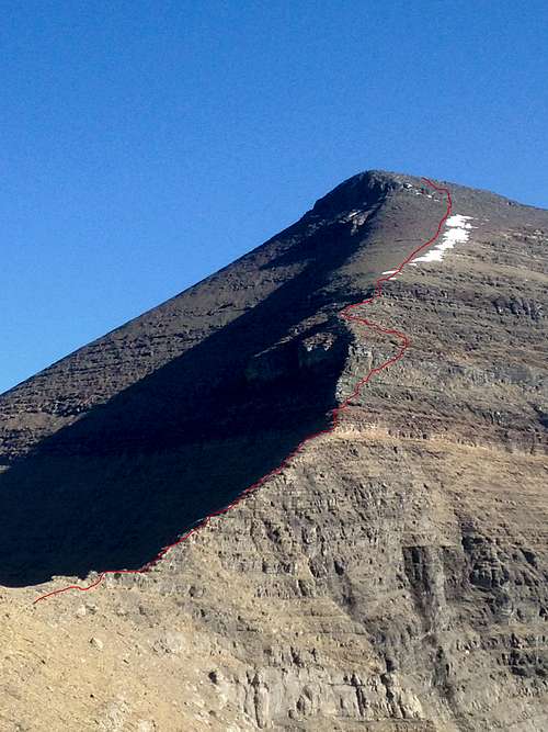
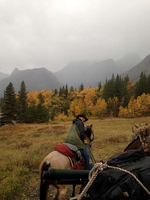
Mount Cleveland, Stoney Indian Route, from the foot of Glenns Lake
I recently had an opportunity to attempt a summit of Mount Cleveland, and since it was a successful trip I thought I'd share what I learned. I found suprisingly little information about the route when preparing for this trip, so hopefully my report will help fill in some of the gaps. Instead of the typical backpacker-friendly Waterton Lake/Goat Haunt approach, we rode horses up the Belly River from the Chief Mountain trailhead. We also spent a few days fishing and riding near Elizabeth Lake before heading over to Glenns Lake, but I estimate a round trip summit of Mount Cleveland from the Chief Mountain trailhead to take three days, even with horses.
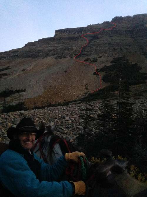
![Unnamed Image]() Sherpa Dan
Sherpa Dan
If you haven't horse packed in GNP, just know that it's not like other wilderness areas in Montana. You can only stay in a limited number of horse-friendly campsites, so I would recommend getting your permits way in advace. The hitch rails are big enough for about 6-8 horses to stand comfortably. Also, even though there are giant grass meadows everywhere, you can't graze your horses. You'll be required to pack in enough weed-free feed for all your horses for the duration of your trip, so plan on an extra pack horse. Propane cook stoves and hard sided bear boxes are preferred here as well.
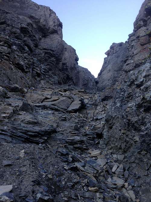
On summit day, we left the foot of Glenns Lake at approximately 4:00AM, and rode up Stoney Indian Pass in total darkness. Unfortunately, you do have to get off and walk the rest of the way. I departed from the horses at about 7:00AM. My dad was kind enough to play sherpa for the day, and led my horse around the Stoney Indian area for 8 hours while I climbed Mount Cleveland. We had two-way radios, but in this type of terrain we weren't in line of sight for long. The initial scramble is about 1500ft up loose rock on a south facing slope. The west slope traverse can be a little tricky to find, but just go up and around the only cliffy spot in the picture and you'll be fine. Look for a goat trail at the foot of a light colored rock band, about 2/3rds up the mountain.
![Unnamed Image]() Couloir Closeup
Couloir Closeup
![Unnamed Image]() In the couloir looking up
In the couloir looking up
As you approach the couloir, I would recommend dropping about 30-40 feet and scrambling straight up instead of staying on the goat trail. There's better footing down below, unless you're feeling extra rock-climby. As for the couloir itself, there's a 6-7ft boulder I actually had to climb over, but the rest is an easy scramble over loose rock.
![Unnamed Image]() Looking east from the top of the couloir
Looking east from the top of the couloir
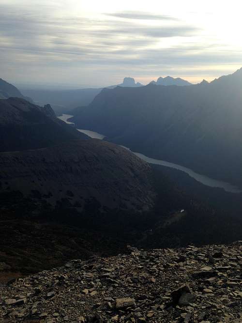
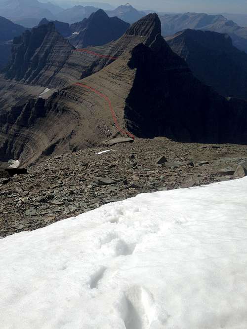
As you exit the Couloir, you'll get your first big view to the east. This is also the first chance to get a good look at Cleveland. The magnitude of what you're doing should be sinking in by now. This spot is about 700ft lower than the summit of Chief Mountain. I reached this point about 8:30AM, and had to take a moment to soak in the view. I watched the sunrise over Glenns and Cosley with Cheif in the distance, drank a little water and was on my way. You have to keep moving because there is still a lot of ground to cover, but wow. The view.
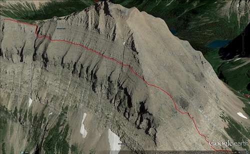
![Unnamed Image]() East slope traverse
East slope traverse
The goat trail picks up again right away, just head north from the big rock pile. You shouldn't have to downclimb at all, just exit the couloir and hang a left. you end up following what I believe is the same light colored cliff band that you follow on the west slope, but now you should be on top of it instead of below. This traverse will take you all the way to the west face of Cleveland with minimal route finding. There are a few spots with significant exposure in here, I had to remind myself to slow down a couple times. Don't forget to look up as you pass Stoney Indian Peaks!
![Unnamed Image]() East slope traverse
East slope traverse
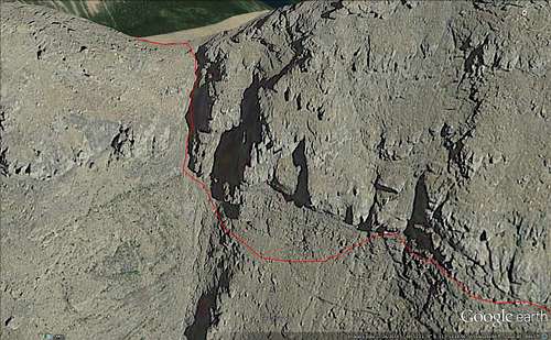
![Unnamed Image]() Cleveland route finding
Cleveland route finding
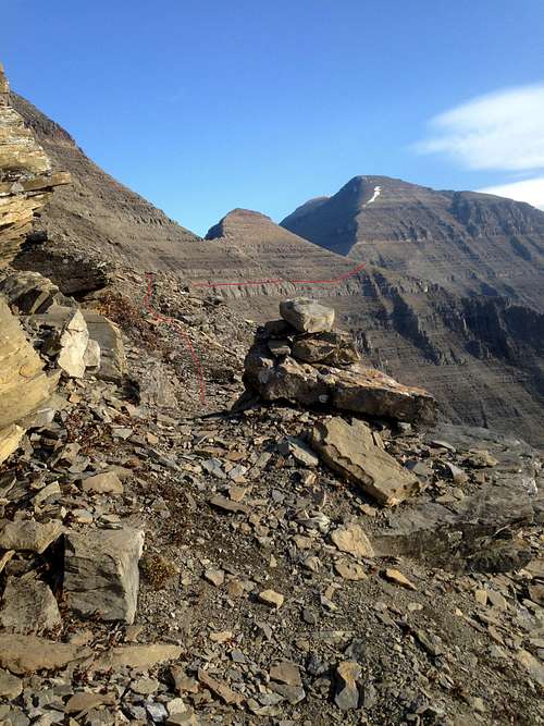
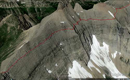
After about 1.5 miles of traversing, you'll reach a saddle before the final push up Cleveland. This is a good spot to take a break, hydrate, and recharge a bit because the traverse is over and you have to climb again. Route finding becomes paramount at this point, and if you get on the wrong ledge or follow the wrong goat trail it can become real vertical real fast. I know this because I chose a bad route and did a lot of unnecessary billy-goating before I found any cairns. I won't bother posting the route I took, just know that the red rock band gets cliffy on the southeast face so its best to go straight up the ridge line. On the ridge line, cairns should start showing up just above the red rock line. Trust the cairns, but if there are none just try to take the most logical route straight up the ridge line. Deviate as little as possible.
![Unnamed Image]() Snow! ULLR be praised!
Snow! ULLR be praised!
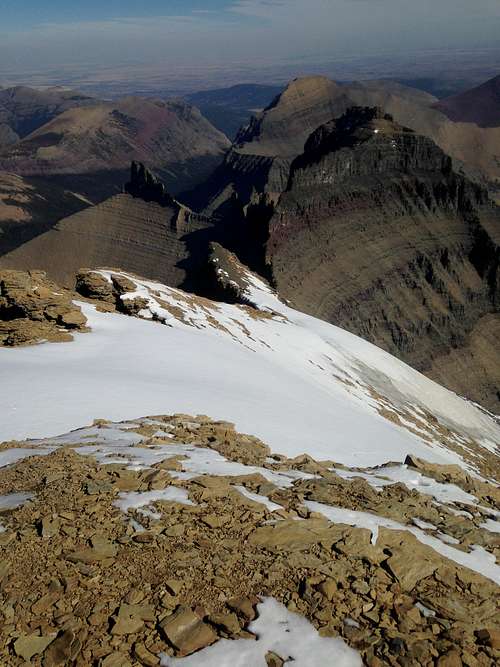
Route finding is done once you reach the snow, but there is still a fair amount of scrambling over big loose rock. Once you reach the south end of the summit block, you should be able to see Cleveland's true summit for the first time. If you brought binoculars, this is a good spot to glass for bears on the summit. I didn't see any, but there was sign everywhere.
![Unnamed Image]() Cathedral Spires and beyond
Cathedral Spires and beyond
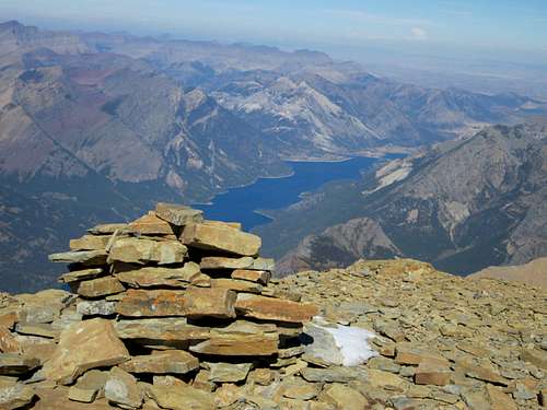
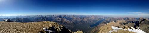
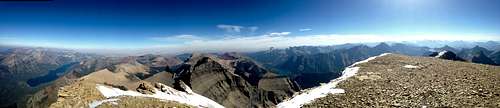
The summit itself is pretty open and flat, but it was super windy so I didn't stick around for long. I summitted at 12:30PM, and stayed just long enough to add a rock to the pile, snap some pictures, drink some water, and head out.
![Unnamed Image]() Summit
Summit![Unnamed Image]() East face snow field
East face snow field
![Unnamed Image]() Looking west
Looking west
![Unnamed Image]() Looking east
Looking east
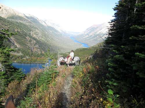
The route down went quickly, about three hours, but I still had to remind myself to slow down on the east slope traverse due to exposure. I got in radio contact with my dad, who had the horses ready on Stoney Indian pass for the ride back to Glenns Lake. It was nice to ride Stoney Indian pass in the daylight, and we reached camp at the foot of Glenns Lake just in time for dinner. Round trip: 12 miles, 1500-2000ft vert on horses, 8 miles, 3500-4000ft very on foot. I ate well, and slept better.
![Unnamed Image]() Riding down the pass
Riding down the passThe weather can turn in a hurry in this part of the world, especially in late september. I got extremely lucky to have a day like this. Here is a picture from the next morning, near Cosley Lake on our way out. Cleveland is socked in, and we barely stayed on the leading edge of that storm the whole ride out.
Thanks for looking, I hope this report helps someone reach the top!
Casey Majerus


Comments
Post a Comment