
|
|
Route |
|---|---|
|
|
46.86240°N / 11.01600°E |
|
|
Via Ferrata |
|
|
Spring, Summer, Fall |
|
|
Less than two hours |
|
|
Grade C |
|
|
Overview
In times gone by, Obergurgl was a tiny mountain dwelling deep in the Gurgler valley, which in turn is an extension of the larger Ötztal valley. The big glaciers dominating the southern parts of the Ötztal Alps were not far away, and life must have been hard for the locals. In the 20th century, the birth of the tourist industry changed all that. Nowadays it is still fairly small, but in winter it's a busy ski resort, and its high elevation of just over 1900 m ensures that it will still have a future for a while, despite the warmer temperatures of late.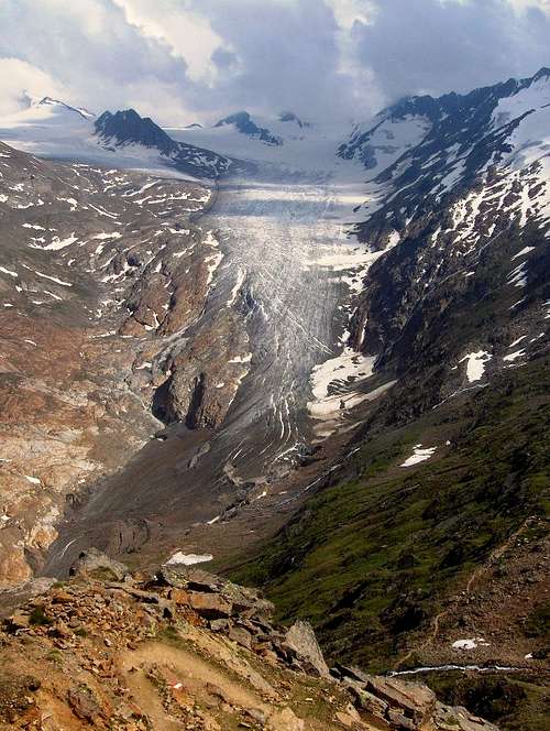
Summertime view from the Ramolhaus down on the Gurgler Glacier
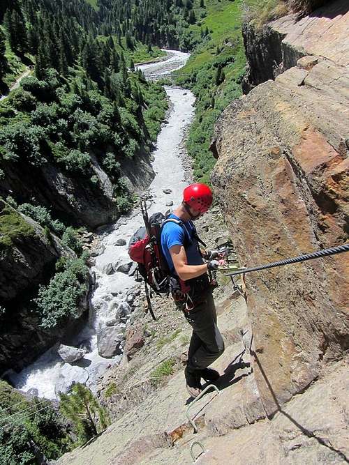
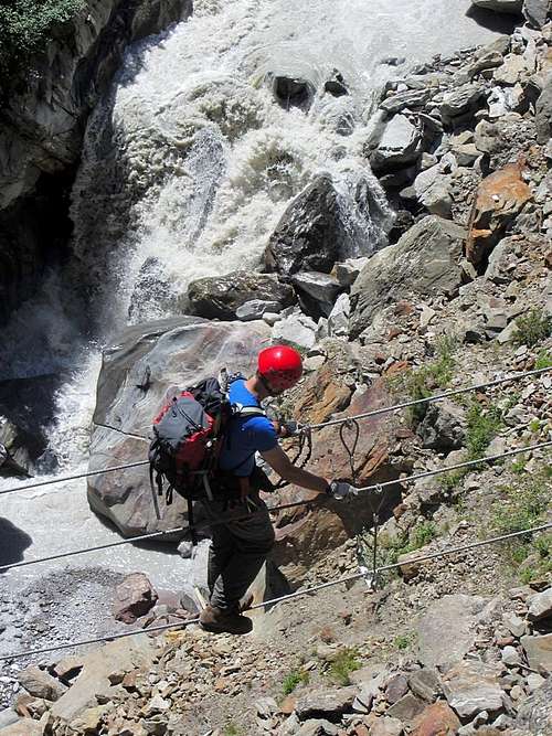
Wilco on the route, high above the raging Gurgler Ache
The route has borrowed its name from the "Zirbenwald", a small, old dwarf pine forest that is now a special protected area.
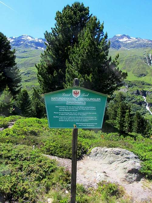 Sign in the Zirbenwald | 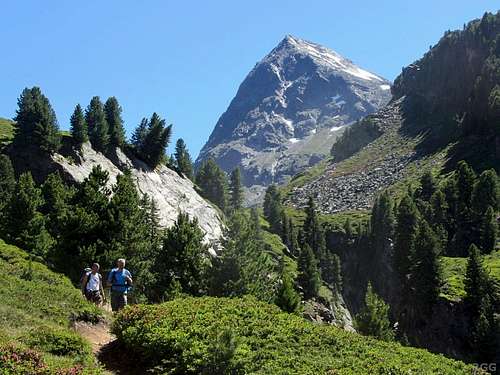 Hikers in the Zirbenwald, with Hangerer dominating the background |
...
Getting There
From the north
The Ötztal valley can be reached all year round from the north, entering at the village of Ötztal Bahnhof. The nearest big city, just to the east of Ötztal Bahnhof, is Innsbruck, well connected by trains and buses, and with a small international airport. Alternatively, Munich is only a couple of hours to the north.From Ötztal Bahnhof, buses travel south the length of the Ötztal, and the last stop on the line is in the center of Obergurgl.
Satelite view of our parking spot.
We came by car instead, and parked by the side of the road right outside Obergurgl.The first orientation point along the route is David's Hütte, almost 1 km to the southwest from the bus stop in Obergurgl, and, like the village itself, on the east side of the Gurgler Ache. From our parking spot, it's straight down the Gaisbergweg, following trail nr 5/6 to the Zirbenwald.
Right past David's Hütte, the road turns into a trail and enters the forest. A few minutes later you'll come to a sign that marks the start of the Via Ferrata.
From the south
From Italy in the south, the Ötztal can only be reached when the high Timmelsjoch pass is open. If there is too much snow, the pass is closed, which is normally from late fall to somewhere in spring. In that case, the normal way to get there from the south is to take the long way around over the Brenner pass, via Innsbruck.Route Description
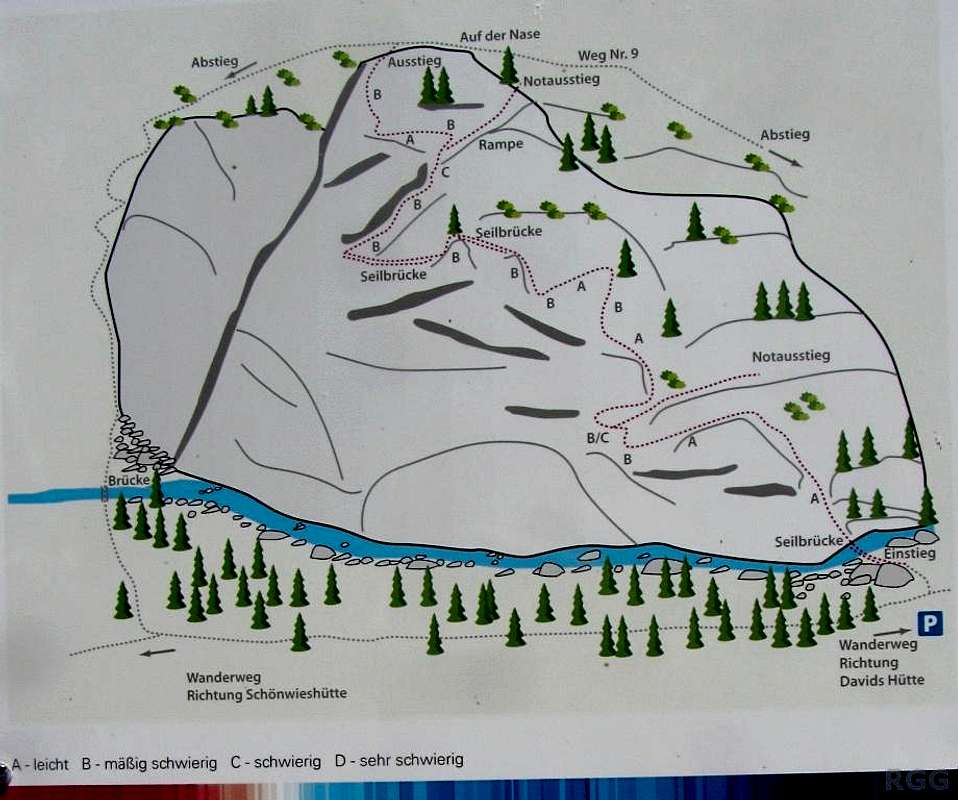
A big information panel at the start of the route clearly explains what to expect.
Crossing the wobbly bridge at the start of the Obergurgler Klettersteig
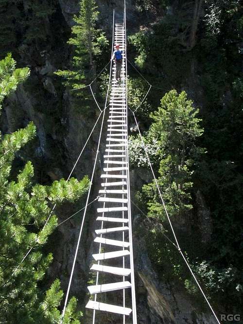
It starts with a wobbly bridge ("Seilbrücke" in german) over the river. At first glance it doesn't look trustworthy, but a closer look reveals that the unorganized appearence of the boards is intentional. The bridge builders must have had a sense of humor. Just looking at it again makes me smile...
Once across, a short walking section leads to the real fun.
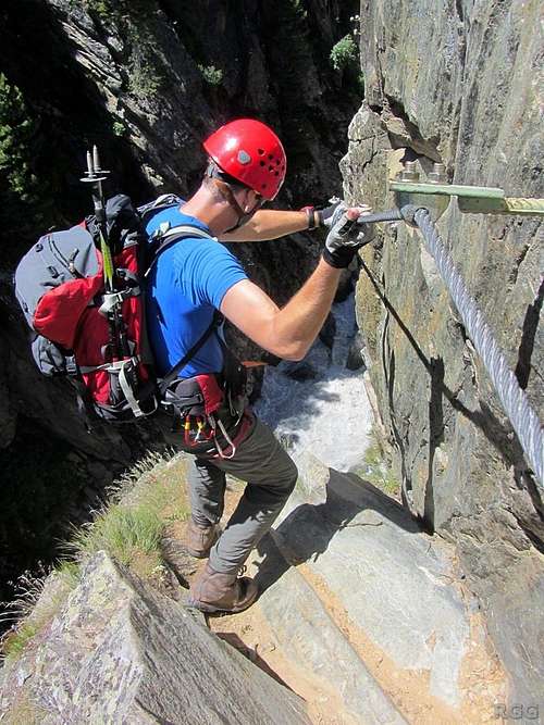
The route clings to the face, and goes around a couple of blind corners. Plenty of footholds make it easy climbing, and all the exposed parts are well secured by steel cables.
 Going around a blind corner... |  going... |  gone! |
Apparently it's going to get harder from here on
Crossing a wire bridge on the Obergurgler Klettersteig
For now, more easy climbing follows, until the route reaches the first of a couple of wire bridges. You have to walk the steel wire, which, in contrast to the rocks, will move a bit in response to your movements. Still easy, and good fun.
After the bridges it's one more easy section before reaching the crux of the route. The route goes straight up, and a bit of upper body strength is useful. However, because it's short, it is only rated C.
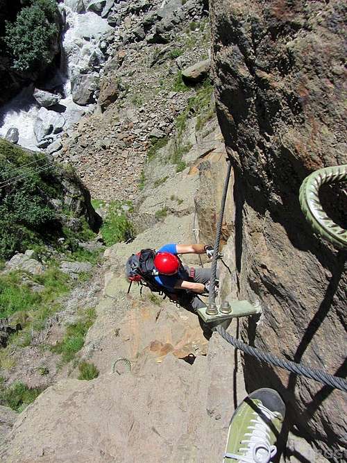
Climbing the steepest part of the Obergurgler Klettersteig
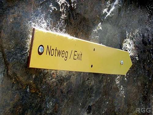
Strangely enough, there is another "Notweg / Exit" sign right after the crux. Makes no sense to me: if you manage to get this far, you'll be able to finish the route. The few remaining sections are easy again.
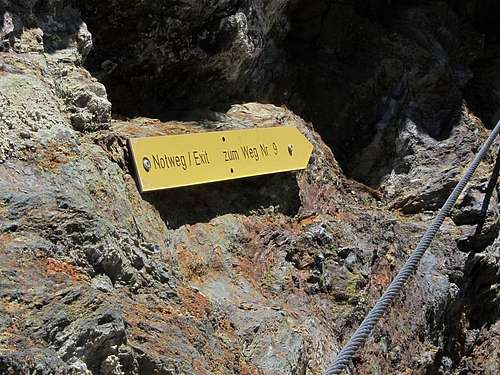
Escape route high on the Obergurgler Klettersteig - strangely enough right after the crux!
The route ends on a nice viewpoint, at trail nr 9. Go to the right to get back to Obergurgl in 15 minutes, or left if you have other plans. How about hiking to the Gurgler Glacier, or ascending Hangerer?
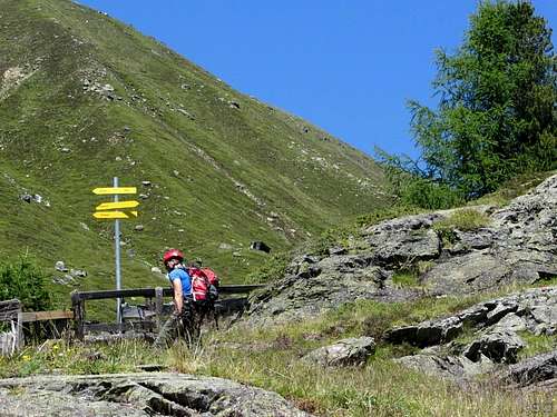 Signpost at the top of the route. Go right for the quickest return to Obergurgl... | 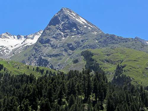 ... or turn left and go to Hangerer, seen here from the top of the via ferrata |
Red Tape
None.When to Climb
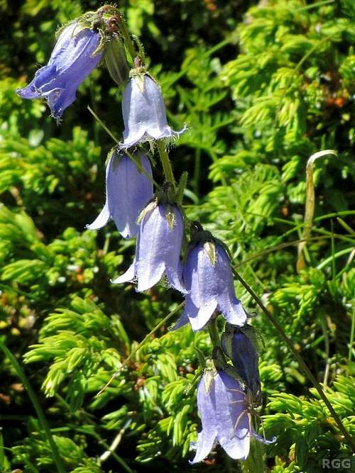
Bearded Bellflower (Campanula barbata)
Essential Gear
- Harness
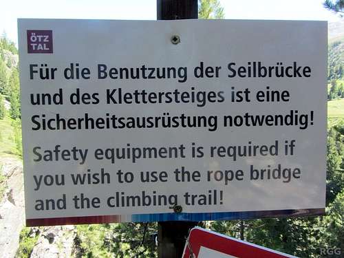
![Warning sign at the start of the Obergurgler Klettersteig]()
Warning sign by the wobbly bridge at the start that you need gear. - Via Ferrata set
- Helmet
- Boots (fairly light ones are sufficient)
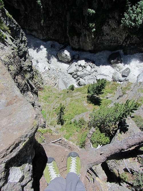
My (camouflaged) feet at the edge of a big drop. These light shoes were fine.
External Links
Obergurgl Zirbenwald Via FerrataOEBB - public transport in Austria.