
|
|
Mountain/Rock |
|---|---|
|
|
19.07510°N / 98.3462°W |
|
|
San Pedro Cholula |
|
|
Hiking |
|
|
7808 ft / 2380 m |
|
|
Overview
Cerro Zapotecas (Spanish for 'Zapotecs Hill') is located just west of Cholula de Rivadabia, in the state of Puebla in South-Central Mexico. As the only considerable elevation within an otherwise mostly flat municipality, it has been a paradise for mountain bikers, runners, hikers, picnickers and motocross riders for the last decades. The local government, finally understanding its recreational importance, has recently made efforts to restore the pine forest the hill had gradually lost to agriculture and grazing.Despite its modest prominence, the Zapotecas' extensive slopes can make well for a half-day hike. Its true beauty lies in getting lost in the hill's multiple paths and looking, on a clear day, at the snowy peaks of the Trans-Mexican Volcanic Belt.
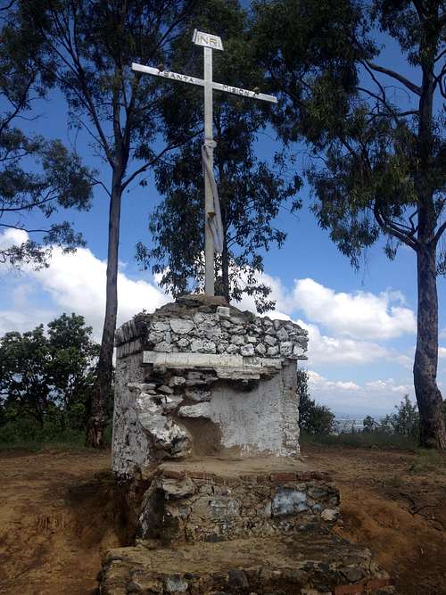
Cerro Zapotecas summit cross
Getting There
The foot of the Zapotecas is just 3 km from Plaza de la Concordia, Cholula's main square. While the hill can be accessed from all sides, the most practical ones are:- from the north: Take the Mexican Highway 190 (Mexico City-Puebla) and turn southwest (left if coming from Puebla) at the road to San Andrés Calpan. After less than 2 km, turn left at the path that leads uphill.
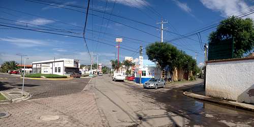
- from the southeast: In Cholula, take Calle 15 Sur. At the corner with Calle 15 Poniente is Plaza Las Glorias, a shopping mall with a big parking lot. There are city buses from Puebla that leave you just there, too. They depart near Paseo Bravo and can be taken at 6 Poniente, Prolongación Reforma and Teziutlán Norte. Be sure to ask for the Directo-Zerezotla route.
Following the route I describe, you'll keep straight ahead here and return coming from the street on the right.
Route
There are multiple paths used for hiking, mountain biking and motocross, so there is no "correct" route. I will describe the southeast route which I have taken multiple times.From Plaza Las Glorias, continue on 15 Sur to the west. You will see many fraccionamientos (gated communities) on both sides of the road. After about 1.5 km, where the stone paver ends, turn right at the Bosques de Tepoya fraccionamiento. This is the foot of the hill, where you will start ascending a very rocky path, first between eucalypts, then between pines. This path ends at a sports complex from where the summit is visible for the first time.
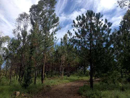
Eucalypts and pines near the sports complex
From here you have to go round the maize and prickly pear plantations. You can take either the left or the right and look for a connecting path. I usually take the left, stopping at a few viewpoints where you can have a look at the Sierra Nevada with the Tecajete and Teotón hills before the majestic volcanoes. A road leading uphill from the southern town of Zacapechpan connects with a paved road that leads to the microwave antennas near the summit.
Theoretically, most of the route can also be done by bike. Only the last couple of meters above the antennas are too steep and have to be scrambled up.
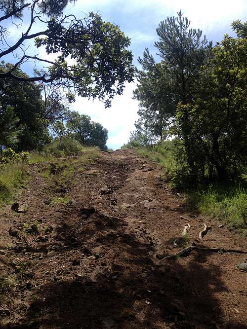
The last few meters to reach the top
Although you can take the same way back down, I would advise you to explore the other parts of the hill. For example, the northern slopes are better preserved and still have some native Texas madrones (Arbutus xalapensis) and netleaf oaks (Quercus rugosa), while on the western slopes there are many explorables gullies and a "devil's cave" steeped in legend. You can descend through a rocky meadow which faces the town of Tepontla, then turn right and go round an old hacienda. From there, take a beautiful allée full of ash trees. In fact, it is Calle 15 Poniente, which returns you to Plaza Las Glorias.
Red Tape
Only the antennas near the summit aren't accessible. Furthermore, there is no restriction of any kind — but, of course, keep away from the plantations, especially the spine and fly-ridden prickly pear fields.
When to Climb
The hill can be climbed and is effectively climbed by the locals every day of the year. During the wet season (May to October), be sure to check the weather forecast, especially if you plan on staying there in the afternoon.Camping
You could theoretically camp there, but it would make little sense being so close to the urban area. If you desperately wish to camp in the zone, better go to nearby Cerro Tecajete.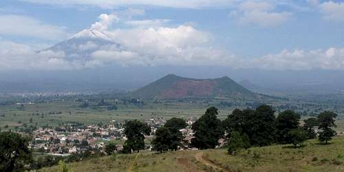
Cerro Tecajete from the Zapotecas. The snowy peak of Popocatépetl volcano is visible in the back.
External Links
- Cerro Zapotecas on the Spanish Wikipedia
- Cerro Zapotecas on Facebook (with multiple photos)
- Cerro Zapotecas on Wikiloc (this route starts and ends at Plaza Las Glorias)