A unique viewpoint
Mt. Konocti is a massive multi-summited lava dome volcano. It sits on the south shore of Clear Lake on the Clear Lake Volcanic Field which includes a collection of small domes and cones spreading to the south. The area is considered still active potential threat by the USGS but currently normal.
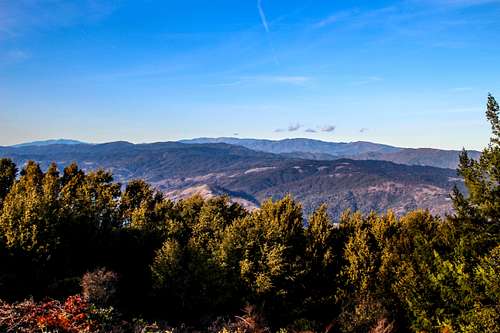
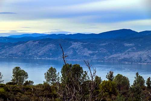
The isolated location on the edge of one of North Americas largest freshwater lakes with the volcanic field spread out to the south, east and west give it outstanding unobstructed views in all directions. The nearly 360 views include most of the mountains and ridges of the Mayacamas Range to the west and south, the Mendocino National Forest to the north and the Cache Creek Wilderness, Cortina and Blue Ridges to the east..
![Looking north from Mt. Konocti]() North from Wright peak
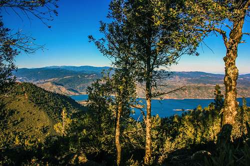
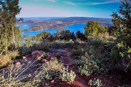
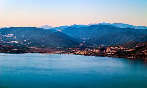
North from Wright peak![Mt. Konocti from Clear Lake]() Konocti from Clearlake
Konocti from ClearlakeView from Buckingham Peak
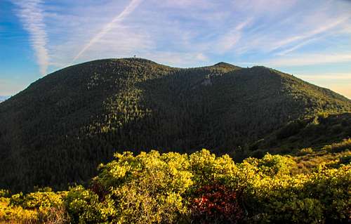
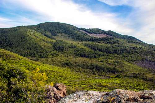
Buckingham Peak 3,967' is the lowest of the main peaks and rises directly above Soda Bay on the south shore of Clear Lake. It has good views down to the east out to the Cortina and Blue Ridges before the Sacramento Valley and back to the main Konocti massif. View west and north are partial due to trees
![North from Buckingham Peak]() North from Buckingham Peak
North from Buckingham Peak![Southeast from Buckingham Peak]() Southeast from Buckingham Peak
Southeast from Buckingham Peak![East from Buckingham Peak]() East from Buckingham Peak
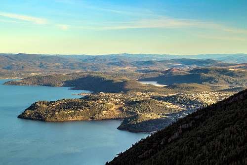
East from Buckingham Peak![Mt. Konocti from the off-shoot road to Buckingham Peak]() Mt. Konocti from Buckingham Peak
Mt. Konocti from Buckingham PeakFrom Howard Peak
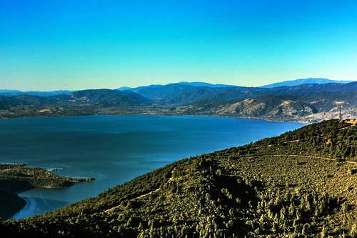
This is the second highest 4,286'. It is a small rocky summit easily accessed from a short road just off the main trail to Wright Peak. The best views are to the south, west and northwest.
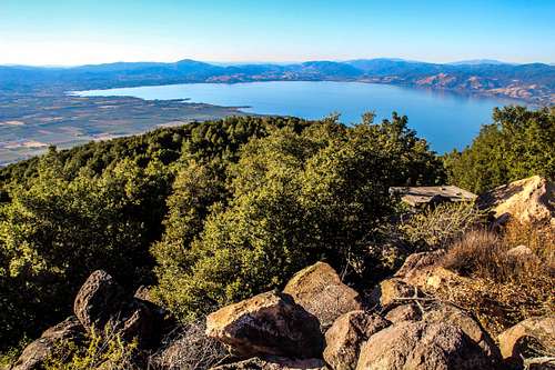
![Northwest Clear Lake from Howard Peak]() Northwest Clear Lake from Howard peak
Northwest Clear Lake from Howard peak![South from Howard Peak]() South from Howard Peak
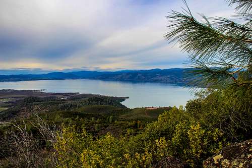
South from Howard Peak![Northwest shore of Clear Lake with peaks of the Mendocino National Forest above]() Northwest Clear Lake from Howard Peak
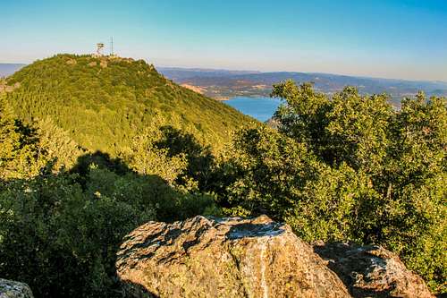
Northwest Clear Lake from Howard Peak![Wright Peak from Howard Peak, Mt. Konocti]() Wright Peak from Howard Peak
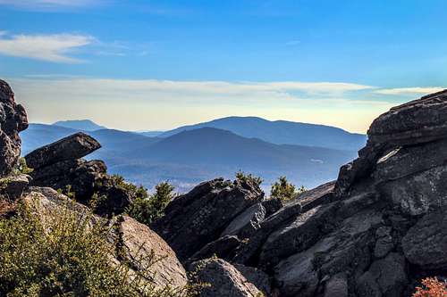
Wright Peak from Howard PeakWright Peak
This is the high point on Konocti 4,299'. It is the end of the trail .4 mile past Howard Peak. There is an informative sign post with arrows pointing in the direction of prominent peaks that are supposedly visible. Some of the info is incorrect (like listing Shasta at 14,440'. They where probably confusing it with Rainier). The view directly east is blocked by trees. The view northwest has been opened up more with the clearing of trees to build a foundation for a building of some sort. If you go down beyond the pines just north of the tower more is visible from a few rock outcrops.
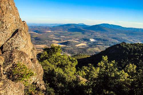
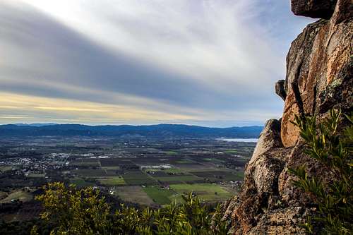
The overall horizon views include Mt. St. Helena and the Napa Valley Palisades over to Cobb Mountain and Geyser Peak to the south. To the west is Cow Mountain and Cow Mountain Ridge. To the north is Hull and Snow Mountains and to the east is ths Cortina and Blue Ridges before the Sacramento Valley.
![Konocti east view]() East from Wright peak
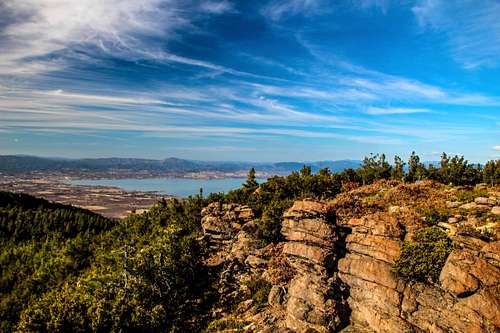
East from Wright peak![West over Clear Lake from Wright Peak]() West from Wright Peak
West from Wright Peak![South from Wright Peak (Mt. Konocti)]() South from Wright Peak
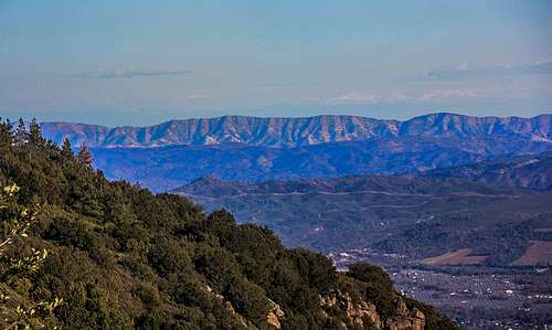
South from Wright Peak![Northwest from Wright Peak (Mt. Konocti)]() Northwest from Wright peak
Northwest from Wright peakClark Peak
At 2,900' down on the northwest side of Konocti Clark is an afterthought for views but has a route up and is actually the only challenging peak in the bunch due to dense brush and class 3 summit rocks.
![North over Clear Lake from Clark Peak trail]() North over Clear Lake from below Clark Peak
North over Clear Lake from below Clark Peak![West view from Clark Peak summit rocks]() West from Clark Peak summit rocks
West from Clark Peak summit rocks![Mt. Konocti from Clark Peak]() Konocti from Clark Peak
Konocti from Clark Peak![Northwest Clear Lake from Clark Peak]() Northwest Clear Lake from Wright Peak
Northwest Clear Lake from Wright PeakHistory and legend
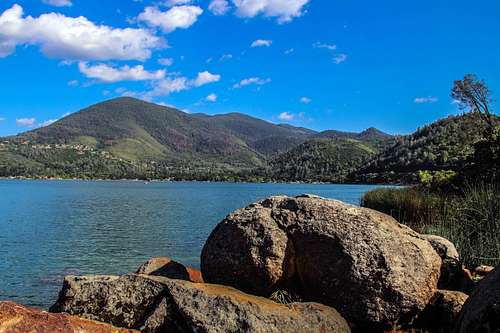
![Mt. Konocti from the State Park shoreline]() Mt. Konocti from Clear Lake State Park beach
Mt. Konocti from Clear Lake State Park beachThe mountain is about 350,000 years old and last erupted 11,000 years ago. The name means 'mountain woman' in Native American.
The geology at the base of Konocti leads to the belief that a huge empty underground magma chamber partially filled with Clear Lake water is below. Possibly the largest on earth. This is difficult to prove because the volcano core is unstable and eroding.
There were many natural caves that collapsed or were filled in early 20th century.
Legend has it that a severe drought in 1818 brought the lake level down low enough that Pomo Indians entered and found a huge cave with an underground lake on the east side inhabited by blind fish. Later repeated attempts by divers to dicover the cave were unsuccessful.
The local Indians have always respected and feared the mountain.
The indian legend is that a tribal woman had quarrel with her husband, bolted in a huff telling him she would never see her again. They later found her on the mountain crushed by a giant snake.
The top of the mountain was privately owned until Lake County bought it in 2009 and created the Mount Konocti County Park.
Tragic plane crash on Wright Peak
On January 26 1970 Mervin and May Enzler crash their 1946 Navion A single prop plane near the summit in bad weather. A piece of the fuselage is still there along with a commemorative plaque.
Comments
No comments posted yet.