-
 46271 Hits
-
 88.6% Score
-
 27 Votes
|
|
Mountain/Rock |
|---|---|
|
|
38.97456°N / 122.76604°W |
|
|
4299 ft / 1310 m |
|
|
Overview
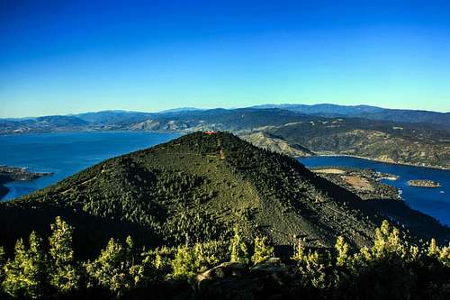
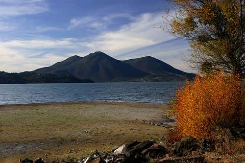
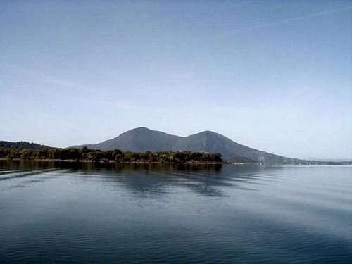
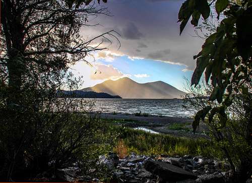
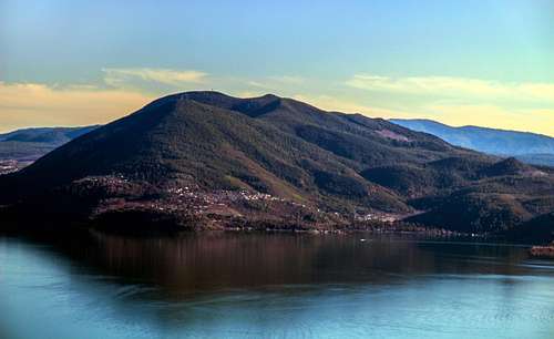
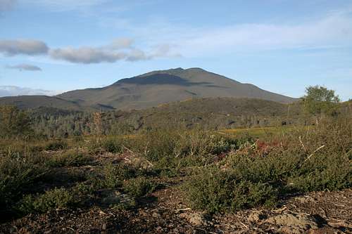
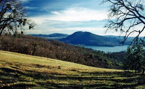
Mount Konocti is a majestic landmark in Lake County, CA that can be seen from almost any point along the Clear Lake shoreline. The name for the enormous mountain that over-looks Clear Lake comes from the Pomo words “Knoktai” taken from “Kno” for mountain and “hatai” for woman, according to historical account. Mount Konocti is a dormant volcano that sits at an elevation of 4,299 feet. Mount Konocti is a multiple volcano. Geologist estimate that the first and mayor eruptions occurred approximately 350,000 years ago, and evidence suggests the most recent volcano activity took place within the last thousand years. However geologist have concluded that much but not all of the volcano has become extinct. The remaining portions of Konocti from which activity could occur are dormant. Konocti is next to a beautiful lake called Clear Lake which is one of the largest most prolific freshwater lakes in the country, Clear Lake is a natural phenomenon born some 2.5 million years ago. Clear Lake is probably the oldest lake in North America since most lakes this old would be natural grasslands instead.Getting There
From just off Hwy. 29 on the south side of Clear Lake take the Kelseyville exit Main Street. Go north .35 of a mile. Turn right on Konocti Road 1 mile until it turns into a dirt road. Continue up the mountain 2 miles to the lower parking lot. Another parking lot is located 400 ft. up the road.Route Description to Wright Peak and others
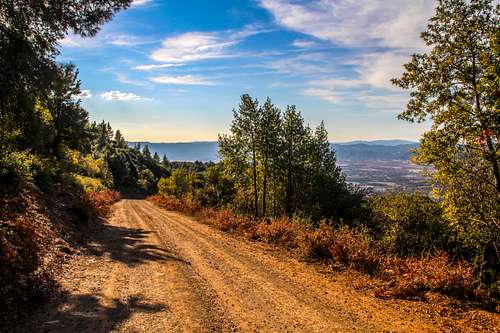
I could write in a trail description but the one in this link gives a very detailed version with everything you need to know.There are other sub peaks with clearly marked signs at the trailhead giving mileage and directions. Safe to say it's a fairly boring route up a long switchback fire road until the last turn to Howard and Wright Peak where the view opens to the south.
It is 6 miles round trip and 1,650' gain to Wright Peak.
Clear Lake State Park offers a nearby camping option.
Conditions are mostly pretty good in the daytime, that’s if you can handle a little cold/wind. It is pretty cold and windy or both in the evenings year-round. So be very prepared for any type of weather on the mountain!
AVERAGE HIGHS LOWS
____________________________
Jan-March-------60°-------32°
April-June--------80°-------48°
July-Sept---------95°-------57°
Oct-Dec-----------65°-------44°
____________________________
AVERAGE RAINFALL IS 26 INCHES
AVERAGE HUMIDITY IN WINTER IS 50%
AVERAGE HUMIDITY IN SUMMER/FALL IS 30%
(Click on the (((Info.))) links to get more information)
Konocti Harbor Resort & Spa -> (((Info.)))
Hiking, bird watching, horseback ridding, and
hunting -> (((Info.)))
Hang gliding-> (((Info.))) 707-275-2361
Sailing/boating-> (((Info.))) & (((More Info.)))
Sport fishing-> (((Info.)))
Wineries-> (((Info.))) & (((More Info.)))
Casinos-> (((Info.))) & (((More Info.)))
Golfing, cycling, and any other information go to LakeCounty.com.
State Park reservations 1-800-444-PARK
____________________________________
-OTHER NEARBY MOUNTAINS-
Black Butte - 7,448 ft <-Glenn County!
Mt Saint Helena East - 4,343+ ft <-Napa County!
Cobb Mtn west slope - 4,480+ ft <-Sonoma County!
Cobb Mountain - 4,706 ft <-Lake County!
Snow Mountain West - 7,056 ft <-Lake County!
Snow Mountain East - 7,040+ ft<-Colusa County!
Anthony Peak - 6,954 ft <-Medocino County!
Little Blue Peak - 3,120+ ft <-Yolo County
Click the links for mountain information: (((Snow Mountain East))) & (((Cobb Mountain)))
Red Tape
This sign gives you the red tape info. Click to enlarge.Camping
Clear Lake State Park offers a nearby camping option.
Mount Konocti Weather Conditions
For current weather and 5 day forecast click here.Conditions are mostly pretty good in the daytime, that’s if you can handle a little cold/wind. It is pretty cold and windy or both in the evenings year-round. So be very prepared for any type of weather on the mountain!
AVERAGE HIGHS LOWS
____________________________
Jan-March-------60°-------32°
April-June--------80°-------48°
July-Sept---------95°-------57°
Oct-Dec-----------65°-------44°
____________________________
AVERAGE RAINFALL IS 26 INCHES
AVERAGE HUMIDITY IN WINTER IS 50%
AVERAGE HUMIDITY IN SUMMER/FALL IS 30%
Other Surrounding Mountains/Activities
-ACTIVITIES IN THE MOUNT KONOCTI AREA-(Click on the (((Info.))) links to get more information)
Konocti Harbor Resort & Spa -> (((Info.)))
Hiking, bird watching, horseback ridding, and
hunting -> (((Info.)))
Hang gliding-> (((Info.))) 707-275-2361
Sailing/boating-> (((Info.))) & (((More Info.)))
Sport fishing-> (((Info.)))
Wineries-> (((Info.))) & (((More Info.)))
Casinos-> (((Info.))) & (((More Info.)))
Golfing, cycling, and any other information go to LakeCounty.com.
State Park reservations 1-800-444-PARK
____________________________________
-OTHER NEARBY MOUNTAINS-
Black Butte - 7,448 ft <-Glenn County!
Mt Saint Helena East - 4,343+ ft <-Napa County!
Cobb Mtn west slope - 4,480+ ft <-Sonoma County!
Cobb Mountain - 4,706 ft <-Lake County!
Snow Mountain West - 7,056 ft <-Lake County!
Snow Mountain East - 7,040+ ft<-Colusa County!
Anthony Peak - 6,954 ft <-Medocino County!
Little Blue Peak - 3,120+ ft <-Yolo County
Click the links for mountain information: (((Snow Mountain East))) & (((Cobb Mountain)))
External Links
- LakeCounty.com
For more information go to LakeCounty.com
- vulcan.wr.usgs.gov
Volcano information on Mount Konocti!





Brownside - Feb 5, 2002 5:52 am - Hasn't voted
Untitled CommentClear Lake, California's largest natural fresh water lake is at an elevation of 1,326 feet with 43, 785 surface acres, and depths up to 60 feet. The average depth is 28 feet; average lake temperature is 61°. Fishing season is 365 days year; fish species include black bass, catfish, crappie, and bluegill.
---
AVERAGE CLEAR LAKE WATER TEMPERATURE
---
December 48°
March 53°
June 66°
August 75°
John - Mar 19, 2002 5:02 pm - Hasn't voted
Untitled CommentMount Konocti has 5 main peaks (heights from California Coastal Peak List):
- Wright Peak - 4299'
- Howard Peak - 4286'
- South Peak - 4050'
- Buckingham Peak - 3967'
- Clark Peak - 2850'
References:mpbro - Mar 23, 2002 11:10 pm - Voted 10/10
Untitled CommentThe website to Snow Mountain Camp seems to have nothing to do with the Snow Mountain north of Clear Lake. Snow Mountain Camp is in Nevada City, east of Sacramento.
mpbro - Jul 12, 2002 9:26 am - Voted 10/10
Untitled CommentNOAA Station.
Area Map
D2 - Oct 27, 2008 3:15 pm - Hasn't voted
New contacts for climbingI think new people have acquired the land at the top of Mt. Konocti since this was written. The new contact is at www.topofkonoti.com or call 707-245-7322. Hope to do this soon and I'll post about what the "guided" trip up is like. Apparently you can't just hike up on your own.
Jesus Malverde - Dec 11, 2011 2:01 pm - Hasn't voted
Mount Konocti Summit AccessIn September 2011 Lake County opened its newest (and largest) county park: Mt. Konocti County Park. There is now public access to Mt. Konocti's summit via a 3-4 mile trail. info: http://www.konoctitrails.com/trails-information/mt-konocti-regional-park/wright-peak-summit-trail-1 pdf brochure link: http://konoctitrails.com/WrightPeakTrail0911.pdf
DayHiker2011 - Apr 2, 2016 12:26 pm - Hasn't voted
Re: Mount Konocti Summit AccessOn the way up while on a group hike a few years ago, we passed what appeared to be a recent plane crash. The plane was smallish of the Piper variety (or Cessna). The colors were still well seen as was the tail marking. One of the group was a private pilot and we took note of the crash which was alongside of the public trail. Once home, we simply did a google search for the tail number. Turned out, that crash wasn't recent at all. It happened (as I recall) back in the late 1970s when a pilot & friend took off from Santa Rosa enroute to the north of the state. The weather was sketchy and the pilot was NOT instrument certified. He thus was attempting to fly just below the cloud cover. As such, he crashed directly into the mountain. Both he and his passenger were killed on impact. The plane was simply partially dismantled, the engine retrieved, and the remainder left there. Yes, the "park" staff just left it. No use in cleaning up a public space. Why bother?
ericnoel - Jun 23, 2013 8:04 pm - Voted 10/10
KonoctiAll summitpost pages are appreciated but this one needs an update. This is now a Lake County Park and public access is allowed so that needs to be fixed. More route info could be given although it is very straight-forward. Also, the driving directions talk about Fairway Drive but Konocti Road is the correct name of the access road. Googling Mt. Konocti and use the links in the previous 2011 comment for more info. Edit 2016: Page has been updated and so has my vote. Thanks!
Bubba Suess - Jun 23, 2013 8:44 pm - Voted 10/10
Re: KonoctiI know this one needs updating. It has been on my to do list for a while. I needed a kick in the butt on this one.
DayHiker2011 - Apr 2, 2016 12:27 pm - Hasn't voted
Re: KonoctiCorrect. I hiked that public trail with a group about 2012.
Noondueler - Nov 28, 2013 1:14 pm - Voted 10/10
Just a noteHappy Thanksgiving Bubba! Just correction a note. The word which in the overview is spelled witch a few times. I'm up in Lake County thinking about climbing Konocti if I have time. -Windsor
Bubba Suess - Nov 28, 2013 1:31 pm - Voted 10/10
Re: Just a noteThanks Windsor. Not all of the content on this page is mine and I need to cut out that which I did not write. The page needs a major update too, reflecting the change in land ownership and the opportunity to hike the mountain. I have not been down to the Bay Area as much as I used to...
Noondueler - Nov 29, 2013 1:00 am - Voted 10/10
Re: Just a noteI just hiked to the top (Wright Peak) today and got some good shots plus a scoop on the hike, red tape etc.. It's a fairly popular hike from about half way up the mountain on the Kelseyville side. It's Konocti County Park now. I was going to put it up as a route on the mountain page. If you want we could split ownership and I could add what i got or I could just do the route page and you are welcome to take anything from it to add to the mountain page.
Bubba Suess - Nov 29, 2013 11:31 am - Voted 10/10
Re: Just a noteI just gave you the page. Have fun with it!
Noondueler - Nov 29, 2013 12:46 pm - Voted 10/10
Re: Just a noteOk! Thanks Bubba. I'll bring it to speed.
Bubba Suess - Nov 30, 2013 12:29 am - Voted 10/10
Re: Just a noteI never added this to the page, but I always meant to include a note that there is camping available at the foot of Mount Konocti at Clear Lake State Park: http://www.parks.ca.gov/?page_id=473 Thanks for improving the page!
Noondueler - Nov 30, 2013 1:42 am - Voted 10/10
Re: Just a noteThanks again Bubba, I put the link in the camping section.
DayHiker2011 - Apr 2, 2016 12:29 pm - Hasn't voted
Re: Just a noteMosquitos. But, hey, whats a little blood donation for the opportunity?
Klenke - Dec 25, 2017 5:18 pm - Hasn't voted
dead linkthe link to the map in the route description section is dead or no longer useful.