Specific Itineraries Roads and some small Hike
Two are the possibilities towards the Valgrisenche:
1)- whether arriving from West to East that (Aosta State Road n. 26 to 15 km) to reach the Hamlet of Leverogne
(740m), nearby Arvier Municipality, and with winding road, going up the steep rocky hill above dominated by the
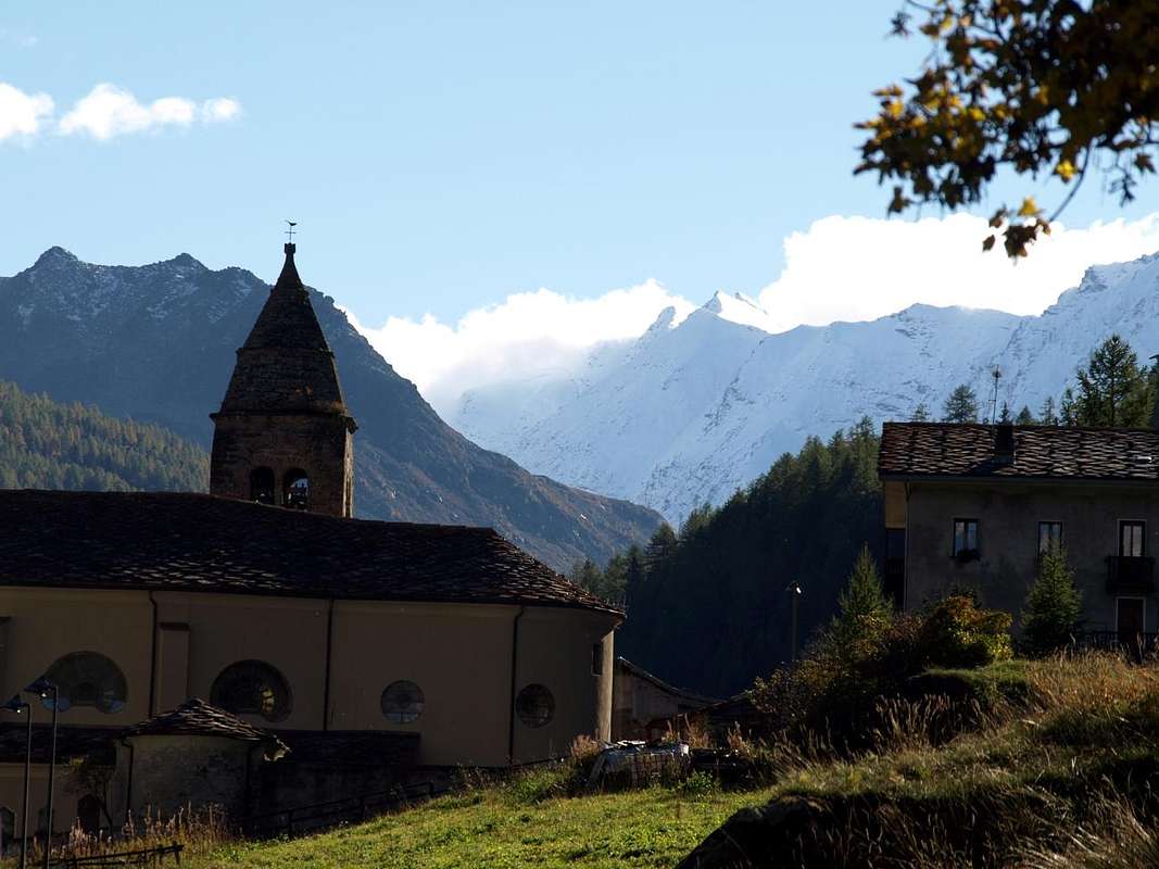
Church of Rochefort currently being restored, to reach in succession the small Villages of Garin
(796m), Ra(e)voire (
950 metres; San Pietro in Vincoli Chapel; gym rock) and, with beautiful views to the ruins of the grim
Castle Montmajeur or Montmayeur sited on hanging rocky promontory, to reach Villages of Chamençon
(1278m) and Chamin
(1278m), both are left to the East. The next Fraction of Planaval (
1557 metres; Church and "Maison-forte" of XIII° Century), mouth of the vallon, is discarded right and continue to the South to the Villages of Revers
(1615 metres; yellowish Chapel of 1902 with mini Steeple).
"Sentier d'antan" (of yesteryear) and trip to the Alpage of Bòregne (2000 metres)
Wanting instead to walk, from Revers, starting in the village and just before the Church (signaling paths in yellow) you can make two different solutions:
a)- to reach the Chief-town of Valgrisenche and the next little Village of Mondanges through trail
n° 22, which goes up with a long diagonal to the East of the Doire de Valgrisenche, reaching in succession the little localities of Prariond
(1548/58m), La Frassy
(1658/76m), Planté
(1656m), Gerbelle
(1621/29m) and then passing on the other side of the Valgrisenche's Doire, the Capital of Valgrisenche and the small Village of Mondanges just across the Beauregard Dam, currently in an advanced stage of dismantling (the last part is closed at this time for the work in progress;
1660 metres; average with routes from
0h'35 to 1h'30, taking as reference for
1h'00 Hamlet La Frassy.
b)- or by Revers up with path
n° 4B decidedly Eastwards reaching Alp Bòregne
(2000m);
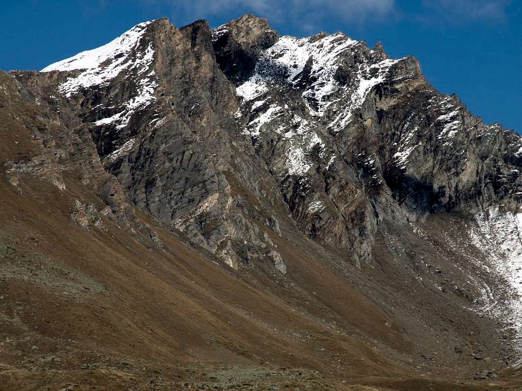
1h'15/1h'30), located at the foot Grand Revers, Becca Verconey
(3165m, 2925m).
Continuing instead on the Regional Road, always with short detour to the East, you will reach the Villages of Prariond
(1548 metres; Chapel with tiny belfry, built aigainst the houses and with
windows ogival), Céré (
1605 metres; Chapel with a fresco in front) and La Bethaz (
1655 metri; brief excursion towards the Alp Miollet, 1895 metres, with small path
n° 18;
0h'45/1h'00) to finally reach the Chief-lieu of Valgrisenche
(1661m) and the nearby of Mondanges (
1652 metres; yellowish Chapel with tiny bell).
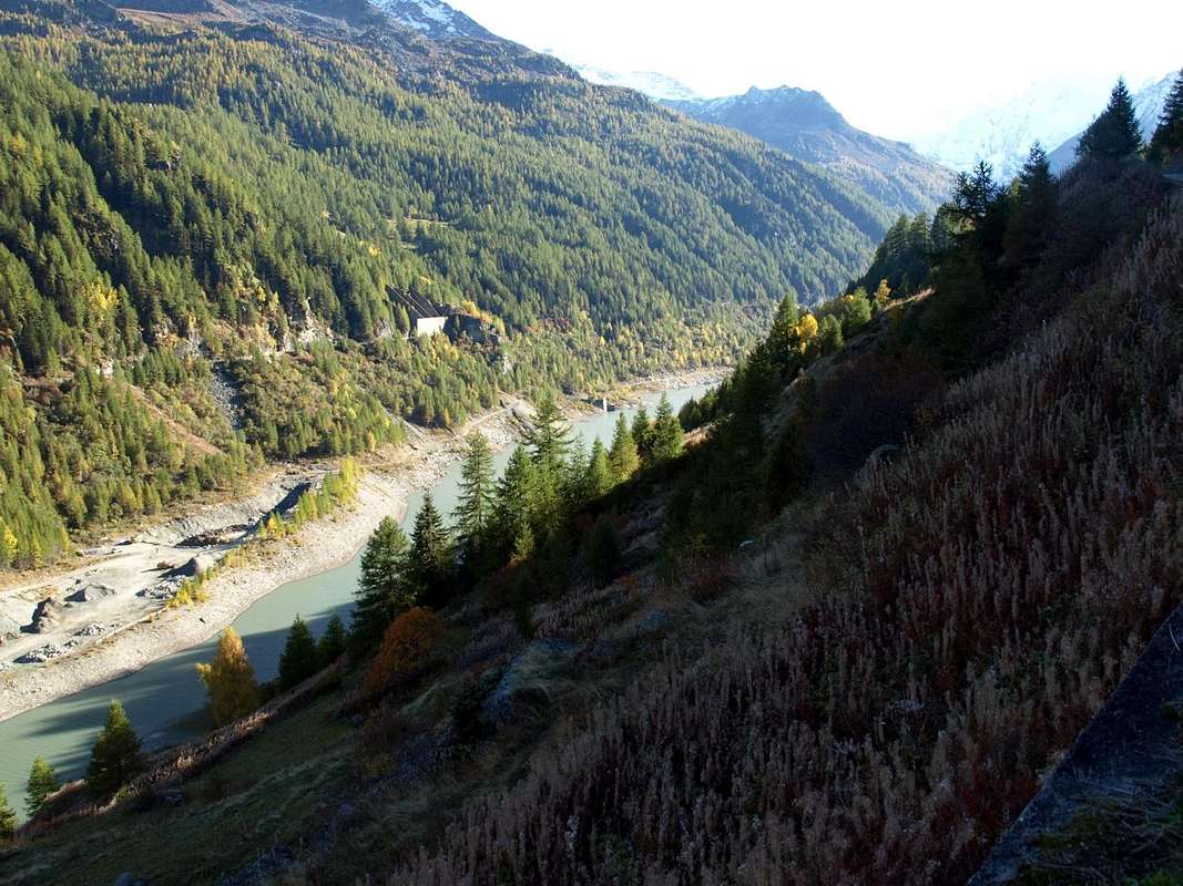
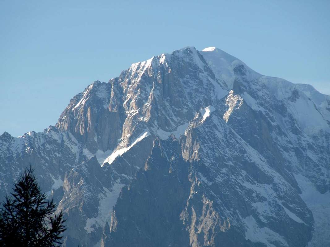
Returning from Bonne Village (Valgrisenche Municipality) towards Planaval Fraction (Arvier) in the mid valley, by Osw 2015
2)- Or, as already proposed in
"One-week trip around Castles Churches and Shrines: North Valley High (Valdigne) / R-1", from Villeneuve Common to take the Regional Road to Introd Commune but not reach the same why you visited already since the second day. Instead reached the junction
806 metres for
Villes Dessous small Hamlet at the
Chapel of St. Giacomo of 1867 cross the country reaching
Ville Dessus with little
Church of St. Hilary always 1800. Here
(863m) can also be reached by continuing briefly on Regional Road and with short descent that leads to the tiny square in front of the same, where as part of a much shorter nice walk on an
ancient paved and signaled path and adressed to the immediately above little
Chapel of Santa Anna (0h'15) on the road that goes down to Arvier Municipality. From this, with mini
"Picnic area" and small car park as well as magnificent views over the Central Valley of Baltea and the Group of Mount Emilius
(3559m), continue straight on the right, leaving the detour to
Les Combes Village, just below the Mont de l'Âne and Becca del Merlo or of Chamin, (
1341m; San Lorenzo Chapel), the place of spiritual summer retreats of the Popes
"John Paul II° Benedict XVI°" in recent years, always passing high above the
"Comba Neye de la Mort". From Les Combes descend, always with paved road to the Village of Grand Haury (
1178m; Chapel of St. Mary Magdalene; small hike through the forest and to the Northwest via small path
n° 2A to the remains of the
Château de Montmayeur 1149 metres) and Petit Haury (
1050m; Chapel of Santa Margherita), Verney
894 metres; Chapel of St. Leonard), Crête
821 metres; Chapel of St. Rocco and Anna) and hence to Avier Leverogne junction in the previous way. So doing stretches a little the way, but definitely making the most beautiful, charming and attractive.
Due sono le possibilità per recarsi in Valgrisenche:
1)- sia arrivando da Ovest che da Est (Aosta Strada Statale n. 26 a 15 Km) raggiungere il Borgo di Leverogne
(740 m), presso il Comune di Arvier, e con stretti tornanti, risalendo la ripida collina rocciosa soprastante dominata dalla
Chiesa di Rochefort attualmente in fase di restauro, raggiungere in successione i Villaggetti di Garin
(796 m), Ra(e)voire (
950 metri; Cappella di San Pietro in Vincoli; palestra di roccia) e, con bella vista sui resti dell'arcigno
Castello di Montmajeur o Montmayeur sospeso sul soprastante promontorio roccioso, raggiungere quelli di Chamençon
(1278 m) e Chamin
(1278 m), che entrambi vengono lasciati ad Est. La successiva Frazione di Planaval (
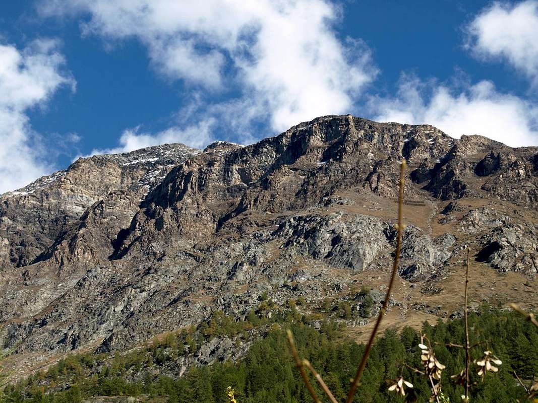
1557 metri; Chiesa e Casaforte del XIII° Secolo), all'imbocco dell'omonimo vallone, si scarta a destra continuando a Mezzogiorno verso il Villaggetto di Revers (
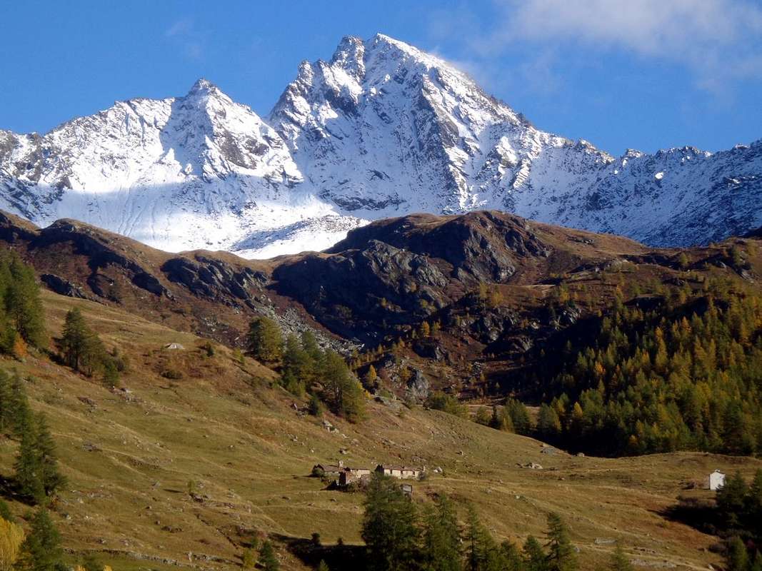
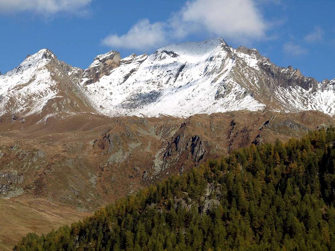
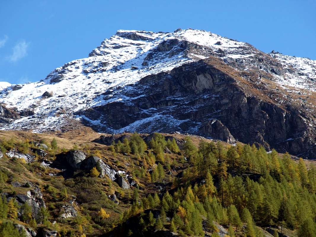
1530 metri; Cappella giallognola del 1902 con campaniletto), collocato alle pendici Settentrionali di Grand Revers, Becca di Tos e Becca Verconey
(3164/5 m, 3301 m, 2925 m).
"Sentier d'antan" e gita all'Alpeggio di Bòregne (2000 metri)
Volendo invece camminare, da Revers, partendo dentro il villaggio e subito prima della Chiesa (segnalazione dei sentieri in giallo) si possono effettuare due soluzioni diverse:
a)- raggiungere il Capoluogo di Valgrisenche ed il successivo villaggetto di Mondanges tramite il sentiero
n° 22, che sale con un lungo diagonale ad Oriente della Doire de Valgrisenche, raggiungendo in successione le località di Prariond
(1548/58 m), La Frassy
(1658/76 m), Planté
(1656 m), Gerbelle
(1621/29 m) e poi, transitando sulla sponda opposta della Doire, il Capoluogo di Valgrisenche ed il Villaggetto di Mondanges proprio di fronte alla Diga di Beauregard, attualmente in fase avanzata di smantellamento (lo ultimo tratto risulta in questo momento chiuso per i lavori in corso;
1660 m; mediamente con percorsi da
0h'35 ad 1h'30, tenendo come riferimento
1h'00 per La Frassy.
b)- oppure da Revers salire col sentiero
n° 4B decisamente ad Est raggiungendo l'Alpe di Bòregne (
2000 m);
1h'15/1h'30), posta alle pendici della Becca Verconey
(2925 m).
Continuando invece sulla Regionale, sempre con breve deviazione ad Oriente, si raggiungono i Villaggi di Prariond (
1548 metri; Cappella con Campaniletto, costruita in corpo alle abitazioni e con
finestre ad ogiva), Céré (
(1605 metri; Cappellina con affresco frontale) e La Bethaz (
1655 metri; breve escursione all'Alpe Miollet, 1895 metri, con sentierino
n° 18;
0h'45/1h'00) pervenendo infine al Capoluogo di Valgrisenche
(1661 m) e la vicina Frazione di Mondanges (
1652 metri, Cappella giallina con campanella).
A little tour from Valgrisenche towards Bonne and Menthieu Villages in the upper valley with Beauregard Dam, by Osw 2015
2)- Oppure, come già proposto in
"One-week trip around Castles Churches and Shrines: High North Valley (Valdigne) / D-1", dal Comune di Villeneuve prendete la strada per
Introd ma non lo raggiungete poiché lo avete visitato di già nella seconda giornata. Raggiunto invece il bivio
806 metri per
Villes Dessous presso la
Cappella di San Giacomo del 1867 attraversate il paese raggiungendo
Ville Dessus con Chiesetta di Sant'Ilario sempre del 1800. Qui
(863 m) si può giungere anche continuando per breve tempo sulla Strada Regionale e con breve discesa che porta alla piazzetta davanti alla medesima, dove parte una tanto corta quanto bella passeggiata su d'un
antico sentierucolo lastricato nonché segnalato verso la soprastante
Cappelletta di Santa Anna (0h'15) sulla Strada che scende ad Arvier. Da questa, con mini parcheggio e minuscola
"Area Picnic" nonché magnifico panorama sulla Valle Centrale della Dora Baltea ed il Gruppo del Monte Emilius
(3559 m), si prosegue, lasciando la stada che scende ad Arvier, si prende subito sulla sinistra (Ovest) la deviazione per
Les Combes (
1341 m; Cappella di San Lorenzo), luogo dei ritiri estivi spirituali dei Papi
"Giovanni Paolo II° e Benedetto XVI°" negli ultimi anni, sempre passando alti sopra la
"Comba Neye de la Mort". Da Les Combes si scende, sempre con strada asfaltata, ai Villaggi di Grand Haury (
1178 m; Cappella di Santa Maddalena; piccola escursione attraverso la foresta e verso Nordovest tramite il sentiero
n° 2A ai resti del
Château de Montmayeur 1149 metri) e di Petit Haury (
1050 metri; Cappella di Santa Margherita), Verney
894 metri; Cappella di San Leonardo), Crête
821 metri; Cappella dei Santi Rocco ed Anna) donde ad Avier e Leverogne allacciandosi alla precedente via. Così facendo si allunga di un poco il percorso, rendendolo però sicuramente più bello, suggestivo ed attraente.
Comments
No comments posted yet.