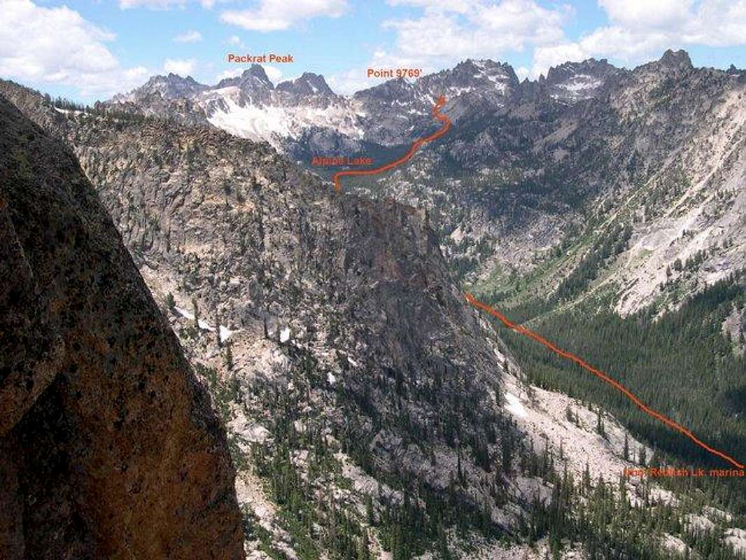
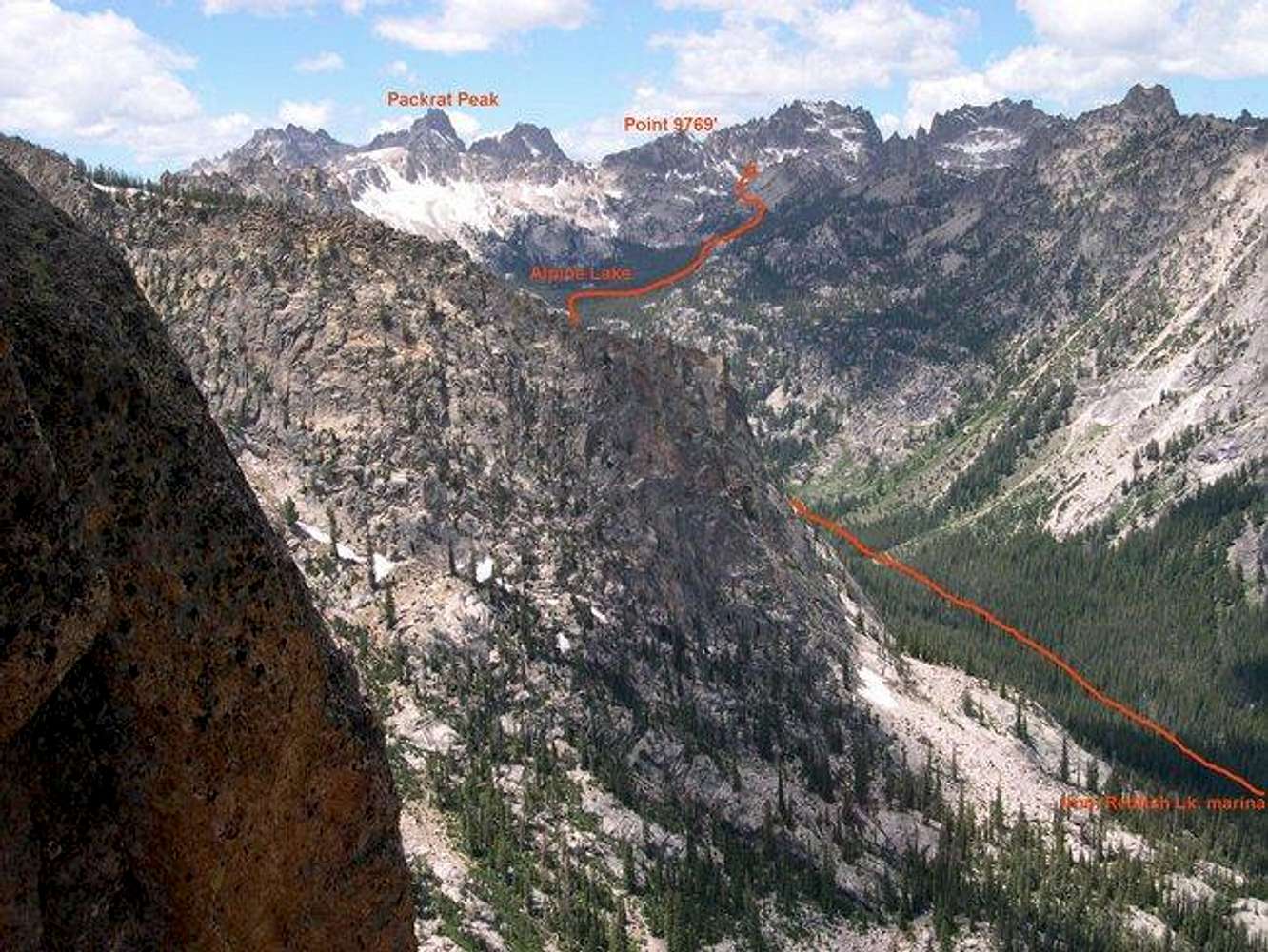
Approach route to Warbonnet Peak as seen from high up on
Mountaineers Route of
Elephants Perch. The approach leaves the trail just above Alpine Lake and goes largely cross-country at that point (you're mostly above timber at that point so it's no big deal). The summit visible between Packrat Peak and Point 9769 is most likely The Mayan Temple. I'm also wondering if Warbonnet can be seen in this photo at far right (high point on far right?)? For a shot of
Elephants Perch from above Alpine Lake, see
this photo.


