
|
|
Route |
|---|---|
|
|
15.58570°N / 61.4755°W |
|
|
Hiking |
|
|
Spring, Summer, Fall, Winter |
|
|
Less than two hours |
|
|
Class 1 |
|
|
Overview
This is the standard route up West Cabrit first visits Fort Shirley before climbing a well graded trail to the summit of West Cabrit. Although the well-marked trail follows and uphill gradient, the distance isn't far and reaching the summit is a relatively easy endeavor.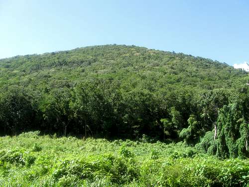 The upper slopes of West Cabrit as viewed from the east.
Getting There
The first destination is the town of Portsmouth, which is the second largest town in Dominica. Portsmouth can be reached by bus from the Melville Hall Airport on the NE part of Dominica and the capitol city of Roseau on the west coast. Buses to Portsmouth from Roseau leave from the bridge on the north side of Roseau.From Portsmouth, you can walk or take a bus (which is pretty inexpensive) or taxi north to the area of the Purple Turtle Beach or possibly even to the entrance of Cabrits National Park.
If driving or walking, head north from Portsmouth through Lagoon along the coastal road between the beach and Cabrits Swamp. Just beyond the site for the International Maritime Training and Development Institute, keep straight (instead of right) and the road leads directly to Cabrits National Park. It’s a fairly long walk from the south end of Portsmouth (but certainly doable), but only 20 minutes from Lagoon.
 The Cabrits as viewed from Portsmouth.
Route Description
From the visitor center (where you must show or buy your site pass), follow the trail through the stone archway and follow the wide trail up to the fortress of Fort Shirley. Take time to poke around and explore Fort Shirley before continuing up the hill. There are signboards explaining some of the history of the area.A sign indicated the West Cabrit Trail to the left and Commandant’s Quarters, East Cabrits Trail and the Douglas Bay Battery to the right.
To climb the West Cabrit, follow the trail to the left. The trail climbs rather steadily, but not to steeply through the forest. There are naked Indian trees (gome wouj) and savonnets, which are the most common trees on the Cabrits. Also along the way you will likely see land crabs, many hermit crabs and lizards, and perhaps even a kouwes snake or iguana.
The climb to the summit takes 30-45 minutes from Fort Shirley. From the top you will have some fine views over and almost straight down to the Caribbean Sea below.
A cannon adorns the summit of the West Cabrit. Over 200 years ago, this was also the location for a battery, hospital (including surgery), surgeon’s quarters, troops barracks, artillery quarters and commandant’s quarters.
After enjoying the fine views, reverse the route to Fort Shirley. If time is available, you can continue on to the Douglas Bay Battery and East Cabrit.
 Part of the trail to the summit of the West Cabrit.