
|
|
Route |
|---|---|
|
|
43.73110°N / 114.126°W |
|
|
Difficult Scramble |
|
|
Most of a day |
|
|
Class III |
|
|
Approach
from Ketchum, Idaho, drive south on Highway 75 for 4 miles and turn left at the stoplight reading East Fork Road. From Hailey, Idaho, drive north on Highway 75 for 6 miles and turn right at stoplight reading East Fork Road.
Drive 4 miles through the town of Triumph on the East Fork Road until the road turns to dirt. Half a mile after the changeover, the road splits. Go left.
This much improved dirt road follows the North Fork of Hyndman Creek. The first 4 miles are very easy going, while the last 1 mile to the trailhead is a little rough at most in spots. Four-wheel drive is not required.
From the large pullout, two major access points for the Pioneer Mountains begin here, Hyndman Creek Trail, and the North Fork Loop Trail. Take the Hyndman Creek Trail.
 |
Route Description
Requirements For Climbing Cobb's West Ridge
Route Stats
The trail immediately crosses Hyndman Creek and descends toward the Hyndman Basin. At first, the Hyndman Creek Trail slowly, but surely, works its way uphill occasionally giving you head-on views of Cobb Peak.
After three mellow miles and a few small stream crossings, the trail then turns left (north) and begins chugging steadily uphill.
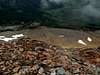
Once you have reached the base of the Cobb's enourmous southwest face and some waterfalls, the trail ascends directly up a steep hill that will bring you into Hyndman Basin.
The trail continues uphill through a meadow, near a lake, and a yurt that can be reserved year-round. Once you have reached the 9,400' line on your topo map, leave the trail.
Cross the creek and head east toward a grouping of trees and talus fields on a slope just below Cobb Peak's west ridge. There are several suitable lines in this area just be careful of the isolated pockets of sand-like soil that erode rapidly when stepped on.
Once you have finally gained the west ridge, scramble up several different types of scree, boulders, talus, and shale slopes to about 11,200'.
To this point, the ridge has only been moderately steep. At 11,200', the boulders increase in size and become difficult to navigate. Leave the ridge here and traverse onto the open southwest face of Cobb Peak.
Scramble up and over some rocky ribs until coming to a prominent gully that leads directly to the summit.
The gully begins as steep loose shale. It then, quickly steepens and does a slight turn to the right. The crux of this gully comes about 75' below the summit where it narrows and you come across, large, slick slabs with small cracks that run parallel to each other.
To navigate these exposed cracks between the large slabs, hike diagonally along them uphill using small footholds and class three climbing to ascend from one to another. This area of the gully presents great route finding problems and creates considerable exposure for a climber.
Once you have made it past these bands it is a steep scramble to the incredibly small and sheer summit block.
 |  |  |  |  |
Essential Gear
If attempting this route in late spring or early summer, bringing an ice axe and crampons may be a good idea in case the final gully to the summit is snow-filled.
If exposure is an issue with your party, bring a rope in case you find yourself off course.
Miscellaneous Info
If you have information about this route that doesn't pertain to any of the other sections, please add it here.
derekperc - Jul 28, 2016 2:59 pm - Hasn't voted
No wading requiredI recommend cutting the part about wading shoes. The first two creek crossings have bridges. The final crossing (when leaving the trail) is easily done by boulder hopping. It's also much safer since this part of the creek is steep and swift.