
-
 1372 Hits
-
 72.08% Score
-
 2 Votes
|
|
Route |
|---|---|
|
|
36.29992°N / 118.78257°W |
|
|
Spring, Summer, Fall |
|
|
A long day |
|
|
Class 3 |
|
|
Overview
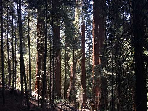
If you enjoy bushwhacking, scrambling, and side-hilling, this is the hike for you. Dennison Mountain really possesses three West Ridges, but this route takes advantage of the middle ridge between the one that is furthest N and the one that is furthest S. While there is a bit of trail for the first 3/4 mile or so, most of this climb is off trail, either in thick bush, leaf-dusted granite, or amidst deadfall, the sign of many casualties of the California drought. Beginning on a 4WD road departing N from Blue Ridge Road, the route takes you from around 3600' up to the summit of Dennison Mountain at 8650', involving around 5000' of gain.
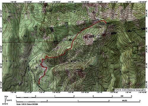
A possible version of the West Ridge route
Getting There
Begin by driving North of Springville on Balch Park Rd. After around 10 miles, turn left onto Blue Ridge Rd. After around 4 miles, you will see a 4WD road on your right (picture below is looking down the road, technically). Park on the other side of the road and start walking (note: there are many of these 4WD roads. They likely all lead to Rome but it would be best to make sure you have the right one. See map above for reference.
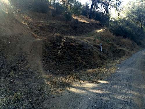
Beginning of the W Ridge route
Route Description
Continue along the rough trail for as long as it lasts (less than a mile). At this point you'll be at around 4500'. The ridge will be visible in front of you, and your job is simply to approach it via the path of least resistance. Aim for the flat spot on the ridge roughly 1km to the East.
The trail quickly disappears
During your ascent you will likely encounter areas of heavy bush. Work around them as best you can; at times you may have to travel through them. Be as gentle as possible on the fragile ecosystem you find yourself within.
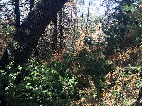
Incense Cedar nursery, a good sign after so many deaths
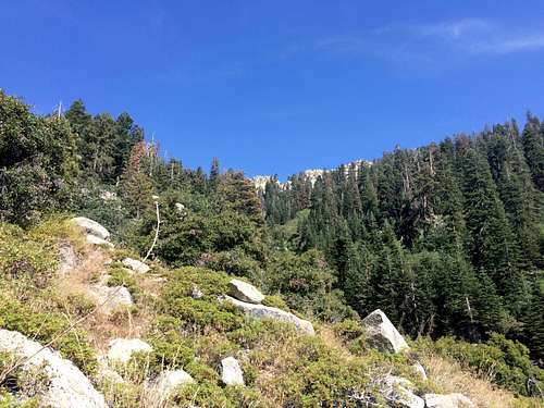
As you climb, the bush will thin out, eventually giving way to (slightly) less dense woodland, and granite boulders of various sizes, among and obscured by leaf litter. At times this terrain can be a bit slippery.
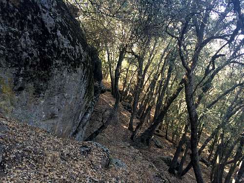
Oak leaves mask granite underneath
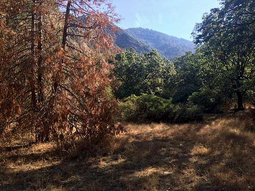
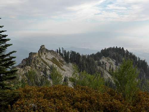
Upon occasion, a view will open up, giving a glimpse of what lies ahead. For the time being, it is possible to continue more or less on the spine of the ridge.
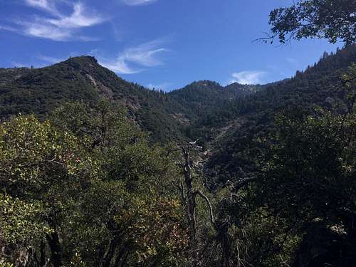
Kramer Creek visible from W Ridge
At a certain point soon after the vegetation thins out, colored tape will begin to appear on oak trees here and there. These strips of tape can be followed, as they seem to lead a fairly well designed route up the ridge.
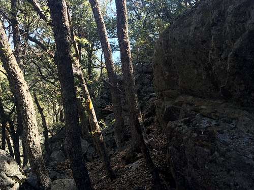
Tape of various colors marks the route. Look carefully.
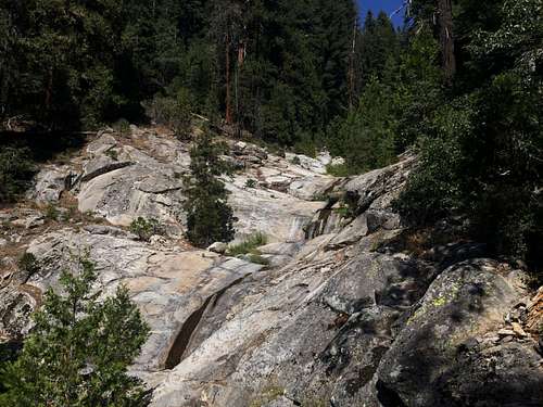
Another flat spot of topography lies roughly another km ENE of the first. Aim for this as you follow the tape (or not). As you draw closer, larger rocks start to appear, and it becomes useful to move among them rather than around them. The tape continues, and remains useful here. Most of the rock is class 2, with a few class 3 moves without significant exposure here and there. Notably, there is a short and narrow chimney on route, directly right of the rocks shown below. It is also possible to climb the wall pictured directly, and possibly less dusty and more fun.
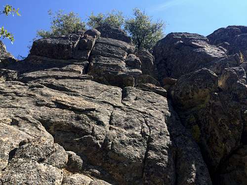
Class 3 wall; the route goes to the right (off image) and ascends a narrow chimney.
After reaching the next flat spot at around 6000', the taped route sort of disappears, heading N and leaving the spine of the ridge. Deadfall quickly renders following the tape useless, but the objective is simple. As the tape begins to go North, contour along the ridge as you see fit until you reach Kramer Creek. A redwood grove will reward the agony of crossing thorny bushes and deadfall, right around the National Forest/ National Park boundary. There is something truly calming about the Giant Sequoias, and being in their presence is an honor...
Redwood stand traversing to Kramer Creek
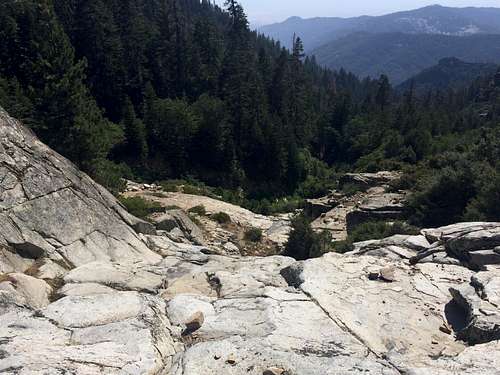
When you reach Kramer Creek, it may be possible to climb its slabs for a while, but it eventually becomes choked with riparian plants. At this point, cross the to North of the creek, and continue up through the trees, staying close to the creek but not too close, as the Creekside terrain is difficult.
Kramer Creek
After a short gain, the North side of Kramer will thin out as well, leaving a more visible path towards the summit of Dennison. Continue upward, until you encounter a Northern tributary of Kramer Creek. Remain North of the main V of the gully as you climb, and it should become visible as an accessible and easy upward path.
Ascending N of Kramer Creek
Continue up the tributary, high-stepping and climbing the occasional class 3 slabs. After about 1200' of gain from when you left Kramer Creek proper, you will find yourself at the top of this particular tributary. Favor the Northern side of the slope to avoid tall manzanita and ceanothus blocking a direct ascent on the map. When in doubt, select routes that indicate higher tree density to your (climber's) left, as the trees block light that would allow thicker bush to thrive.
Looking down Northern tributary of Kramer Creek
Finally, you will encounter very pleasant, trail-esque terrain about 100' shy of the summit. From here, contour ESE to the top of Dennison Mountain. Although the summit 'block' itself is modest, the views are very interesting, and the register sparse (itself contained in a small can about 4" long and 1.5" wide). Enjoy your time here, and descend when you please.
Finally, at the top!
Essential Gear
Bring a lot of water; I would lean toward 4 liters+, especially if hiking in the summer, as the lower elevations can be brutal. Also, to mitigate this, and to accommodate for a long, almost exclusively cross-country approach, start early in the day. Navigation is not always easy, and visibility of landmarks is sometimes scarce.