Toggle navigation
Mountains
Routes
Images
Trip Reports
Forum
What's New
People
Areas & Ranges
Articles
Trailheads
Canyons
Huts & Campgrounds
Albums
Logistical Centers
Fact Sheets
Lists
Custom Objects
Gear
Plans & Partners
WELCOME TO SUMMITPOST
SIGN IN
REGISTER
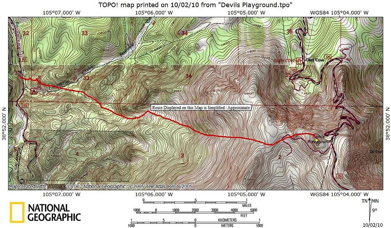
Western Slopes Route Map
View High-Resolution Image
Western Slopes Route Map
This is a pleasant if somewhat steep (3,100 feet in 3.5 miles) hike on the western slope of the Pikes Peak massif to gain the Teller County Highpoint.
Map designed October 2010
« PREV
NEXT »
Sarah Simon
on
Oct 19, 2010 12:29 pm
Comments & voting
Other parents
Lat/Lon:
38.86410°N / 105.0706°W
Image Type(s):
Topo/Diagram
Image ID:
672322
1384 Hits
75.81
% Score
6
Votes
Log in to vote
Comments
No comments posted yet.
to post!
Don't have an account?
Western Slopes
(Route)
You are at
the First
Image
Viewing
#1 of 1
GALLERY
You are at
the Last
Image
Sarah Simon's Image Gallery
« PREV
Viewing
#893 of 5480
GALLERY
NEXT »
Western Slopes
(Route)
Loading....
×
You need to login in order to vote!
User Name
Password
Remember me
Forgot your password?
Log me out when I close my browser.
Keep me logged in all the time.
sign in as a user
Don't have an account?
Register now for FREE
Rating available
Suggested routes for you
People who climb the same things as you
Comments Available
Create Albums
Register Here


