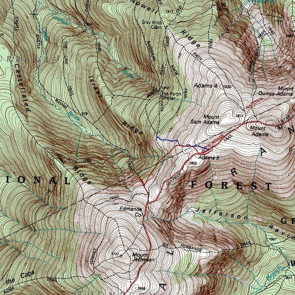
Where I lost the Gulfside Trail
Here is my re-creation (in red) of the approximate route of travel that I took when I lost my way between Thunderstorm Junction and Edmands Col. Evidently, this is an older map that doesn't include the upper portion of the Israel Ridge Path which connects the Gulfside Trail with the Randolph Path, so I drew it in blue. Note how deep into Castle Ravine I descended; in fact this is a conservative estimate; in reality I may have gone ever a little further down than this image shows.


