A Good Little Hike with a Summit
On February 12, 2014 my hiking partner Lee and I, along with my dog Minnie, hiked the northwest ridge of White Rock Hills to the summit of (unofficially named) White Rock Springs Peak. This is a great little hike that includes easy accessibility, minimal crowds, a little bit of scrambling and a nice (albeit minor) summit.
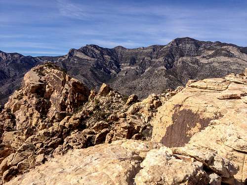
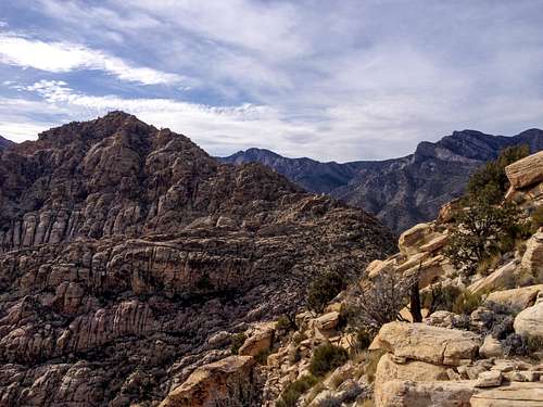
![White Rock Spring Peak]() White Rock Spring Peak
White Rock Spring Peak
We parked at the White Rock Springs Trailhead, took a few steps north along said trail and then hopped on the white rocks that begin the ridge line just to the left of the trail. I thought this was really cool as I prefer to travel on rock whenever possible, especially at Red Rock. If you enjoy boulder hopping along the top of a ridge, this hike is totally for you.
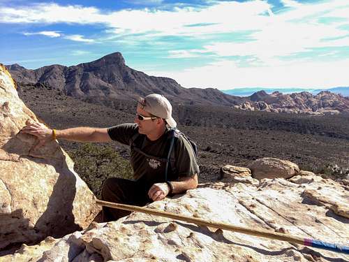
![Unnamed Image]() Lee Cranking
Lee Cranking
We hiked, hopped and scrambled to the false summit (.9 mi/+ 1,135 ft) which reads as point 5977 on the topo map. From there we scrambled down a small amount of class 2/3 terrain and traversed the last bit of the ridge to the summit proper (.15 mi/+ 30 ft?). This final section is definitely the crux of the route as it does require some minimal route finding and perhaps one tricky class 3 move (at least the way I went). There were a few different options to get over or around the false summit and I chose a line that spiced it up just a bit. It took some coaxing and a little help to get my dog to make that move!
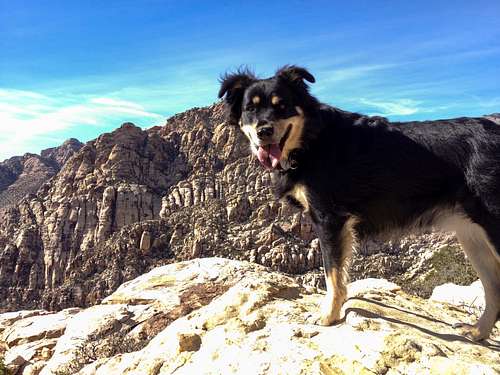
![Happy Dog]() Happy Dog
Happy Dog
The last push to the summit is a fun jog up slabby sandstone and an old tree trunk sticking up out of the top marks the peak. We enjoyed the near 70 degree temps up top as we had lunch and hung out. It took us 1 1/2 hrs from trailhead to summit going at a moderate pace. If one wanted to Uli Steck it they could probably do it in half that time. Descent time was about an hour.
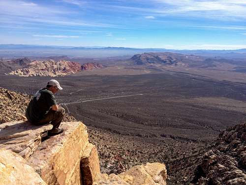
![Unnamed Image]() Peak Seat
Peak Seat
All in all this was a really fun hike in a beautiful setting. If you're looking for an accessible peak that can be done quickly I would highly recommend it. It also offers some reprieve from the crowds over on the more mainstream trails in Red Rock.
![Unnamed Image]() White Rock Peak
White Rock Peak
Side note: We couldn't help but scope out the larger peak on the south end of White Rock Hills, White Rock Peak (6,462 ft). After a failed attempt on that peak the week before due to improper planning and a late start, we were determined to find a more enjoyable route to it's summit. We decided that the two obvious non-technical routes (a side hill traverse or a bushwhack up the gully) both suck from bitter experience the week before. The WRSP ridge seems to be a much better way to at least get near the saddle. The tricky part is obviously descending to the saddle from the ridge line below WRSP. Hopefully I will have a successful report on that route soon.
-Jon Ullon


Comments
Post a Comment