
|
|
Mountain/Rock |
|---|---|
|
|
54.14000°N / 2.24000°E |
|
|
2414 ft / 736 m |
|
|
Overview

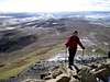
Whernside, Ingleborough and Penyghent, the Three Peaks, all around 700 metres high, are probably the most popular outdoor areas in the Yorkshire Dales National Park due to the wild landscape, the limestone features, and the hill walking potential.
At 2,373 ft, Ingleborough, with its famous flat topped profile, is perhaps the best known of the Yorkshire Dales famous "Three Peaks". Although many would not consider these hills to be of sufficient height to qualify for mountain status any true Yorkshireman would have no hesitation in stating their claim. Locally, these three hills are most certainly held in high regard.
The distinctive shape of Ingleborough is due to the local geology, a broad cap of millstone grit atop a broader plateau of carboniferous limestone. Streams running off the millstone grit meet limestone rock further down the slopes where they disappear underground, falling into deep potholes and caverns such as those at Gaping Gill on the moors above Clapham and Alum Pot near Selside.
The combination of high rainfall, poor drainage, and the trampling of thousands of boots brought to this beautiful area from the nearby conurbations of Leeds, Bradford and Manchester have brought massive footpath erosion and damage to the natural ecology. In places anti erosion schemes have been introduced that have minimised such damage.
There are a couple of main roads which bisect these hills and therefore access can be gained no more than a couple of miles from all three summits. As such any reasonably fit walker will be able to rise to the occasion and climb these hills one at a time. However, many individuals take up the challenge of climbing all three in one long walk. This 26 mile anti clockwise hike is usually started and finished at the Penyghent Café in Horton in Ribblesdale.
 |  |  |  |
Getting There
From the Penyghent café, in Horton take the road to the railway station, follow the sign post across the railway line over the pasture and across the limestone pavement of Sulber Nick. This route will then take you to the West ridge of the hill.
An alternative, but shorter route (if you don’t mind walking on duckboards) is the walk from the Hill Inn on the B6255. This signposted route takes you over pastureland, over some pretty good quality limestone pavements and then along the duckboards to the base of Humphrey Bottom. From there the steep climb up to the west ridge can be made via the stone footpath that has been laid in an attempt to keep erosion to a minimum.
A third alternative is to start in Clapham and take the forest trail towards Ingleborough Cave. Having passed the cave entrance continue through the enclosure of Trow Gill and out onto the open moorland. The route will take you directly past the entrance to Gaping Gill and up the steep ascent to Little Ingleborough. From there the summit is a short half mile northerly walk along the ridge.
Whernside. Historically most people have climbed Whernside from the famous railway viaduct at Ribbleshead. Their route would have taken them under the viaduct, through Winterscales Farmyard and directly up the south eastern flank of the hill. This route can not be recommended due the terrible erosion that has occurred. The alternative and much easier route is to leave from the same starting place, follow the east side of the railway line as far as the aqueduct and then take the rising westward path all the way to the north west summit ridge.
Penyghent. Due to Penyghents proximity to Horton in Ribblesdale virtually everyone makes this ascent from its café. Simply turn right out of the café, pass the church and take the country lane to Brackenbottom. From there the route will take you directly up the side of an old dry stone wall right to the southern ridge. This last part of ascent may involve a little use of hands as well as feet, but is nothing more than mild scrambling. The flat topped summit will be found a short distance beyond.
Getting there.
By car, most people will drive north of Settle on the B6479 and park up in the national trust car park in Horton-in-Ribblesdale.
Trains from the south can be caught from Leeds, Bradford, Keighley, Skipton and Settle. Whilst to the north the stunning railway line runs all the way to Carlisle. For rail time tables check out http://www.thetrainline.com/
 |  |  |  |
Red Tape
The are no permits needed. However, Erosion is a major concern. Please keep away from the southern approach to wherenside. I have included a photo from a few years ago which shows the state of affairs.Dependent upon which starting point is used there may be a small fee for parking.
 |
When To Climb
These hills can be climbed at any time of the year. Clearly if the intention is to climb all three consideration must be given to the number of daylight hours available. I have completed this walk in anything from seven hours to eleven. Therefore most people climb between March and October.A single ascent of any of these hills can be equally rewarding at any time of the year.
Mountain Conditions

For weather forecsasts check out http://www.mwis.org.uk/engwales.php
 |
Yorkshire Three Peaks Race
For details on this annual 26 mile event please see the following link. http://www.3peakswalks.co.uk/about/ For those with cyclecross in mind there is also a so called mountain bike race around the same course. Needless to say the bike will have to be carried from time to time.Gaping Gill
Gaping Gill is an emense underground cavern that has been eroded out of the soft limestone hills of the Yorkshire Dales. It is situated underneath Ingleborough and can be reached via the Ingleton to Ingleborough route.For further information please see the following link.http://www.bpc-cave.org.uk/gaping_gill.htm
 |  |  |