-
 3952 Hits
-
 79.78% Score
-
 11 Votes
|
|
Mountain/Rock |
|---|---|
|
|
47.15452°N / 9.28544°E |
|
|
Hiking, Mountaineering, Trad Climbing, Sport Climbing, Aid Climbing, Big Wall, Mixed, Scrambling, Via Ferrata, Skiing |
|
|
Spring, Summer, Fall, Winter |
|
|
7333 ft / 2235 m |
|
|
Overview
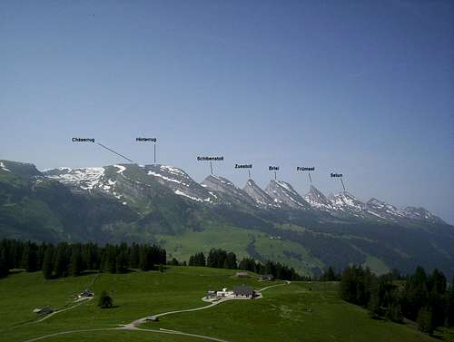
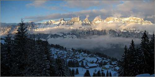
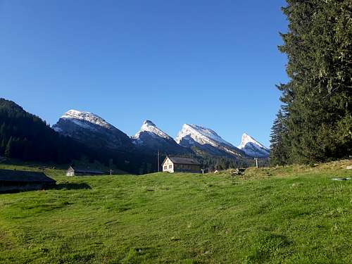
Zuestoll is a peak within the Churfirsten group of the Alpstein, in the Kanton of Saint Gallen, northeastern Switzerland. It sits in the middle of the group, with Selun, Frümsel, and Brisi to the west and Schibenstoll, Hinterrugg, and Chäserrugg to the east of it (see annotated photo). The peak appears a bit more steep and craggy than the other Churfirsten, and indeed is the most difficult summit in the group, as the standard trail to the top is about class 4 (with fixed cables, of course), on the north side. The south side of the mountain features a very vertical wall of limestone about 300 meters tall, which in turn sits atop an additional 1000 meter tall steep slope of near vertical grass and forest. Beneath this slope sits the Walensee, a very scenic lake. There are quite a number of technical rock climbs of varying difficulty on this south face.
This mountain can provide nice outings to fit anybody's agenda. The trail up is a "Bergweg" (white and blue marked, not white and red like regular hiking trails) that is not death defying at all, and secure with solid cables to aid in any difficulties. Any seasoned hiker can make an ascent of Zuestoll. For those looking for more of a challenge to the summit, multi-pitch rock routes on the south face rate from 5.10 to 5.13 projects. Zuestoll is climbable in the winter, with appropriate gear and proper avy danger assessment. Like the surrounding mountains, Zuestoll might not boast a super impressive elevation, it still packs a punch in terms of vertical relief and slope steepness. Views from the top are very expansive; to the south, the summit plunges away via precipitous drops to the Walensee, nearly 1800 meters below and the glaciated peaks of the Alps stretch on seemingly forever. To the north, the Alpstein commands the view, with the flatter forests of Germany stretching into the far distance. The Austrian Alps are visible to the east.
Getting There
Follow directions to the town of Unterwasser on the main page for the Churfirsten. In Unterwasser, look for signs pointing south to Schwendese/Alp Sellamatt. Follow this narrow paved road up the mountain, turning right at a signed junction, towards Alp Sellamatt. Soon find a little pay kiosk next to a garage on the left, and pay 10 CHF fee before driving all the way to Alp Selamatt. This is the logical start for Zuestoll. There are two alternative approaches to Sellamatt: park at the lot in Alt Sankt Johann at the base of the Selamatt gondola and either take the gondola (18 CHF one way, 24 CHF roundtrip), or hike from Alt Sankt Johann to Sellamatt (see first part of route description for Brisi North Flank).Standard Trail description
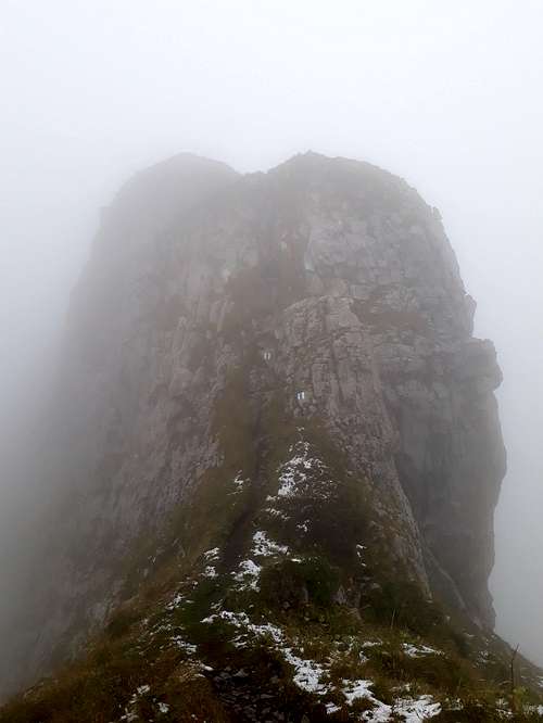
The trail up Zuestoll is more difficult than any other of the Churfirsten summits, and is a "Bergweg" (aka scrambling route). There are fixed cables and metal steps at the steepest parts of the trail. From Alp Sellamatt, follow blue and white marked signs towards Zuestoll. If the weather is clear, it will be obvious which direction you should be traveling. The trail to Zuestoll will split off at a point, and clearly marked. Follow the trail up some initial class 3 steps with metal steps bolted into the rock. Soon the trail will reach the base of the actual peak and steepen significantly. Follow the switchbacking trail up the steep slope to a false summit, and downclimb the back of it (class 4, fixed cables) to get onto the main upper stretch of the mountain. Surmount some final class 3 (fixed cable) in the summit cliff band and traverse the thin summit ridge to the summit cross. Re-trace your steps back to Alp Sellamatt.
Red Tape
None. When to Climb
For hiking, Zuestoll is best done in late Spring, Summer, and early Fall. In winter expect full conditions.
Camping
Wild camping is officially forbidden, but unofficially tolerated as long as you are discrete. There are developed "European style" camp grounds at Alp Sellamatt and Unterwasser.


