
|
|
Route |
|---|---|
|
|
38.41707°N / 111.47934°W |
|
|
Hiking |
|
|
Summer |
|
|
Half a day |
|
|
Overview

We drove in via the good description mentioned on the "getting there" section and spent the night at the Elkhorn Campground (along with a lot of ATV'ers.
Originally we had thought we'd go up from Snow Lake but when we checked it out there were a lot of others camped practically on the "trail" at Snow Lake so we backtracked to where there was a trail sign for getting up to the top of the plateau. I have provided a map which will show our route. This turned out to be a good choice as the trail was in great shape and easy to follow and provided an good way to get to the top. Also, it was the kind of trail that an ATV couldn't use so it was rather peaceful. It wasn't the shortest way but it made for an overall enjoyable hike.
Getting There
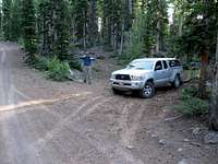
From the Elkhorn Campground it is about 2 1/2 miles to the TH. The trail is signed and is just before Deep Creek Lake. Parking for two or three vehicles just off the road (see pic).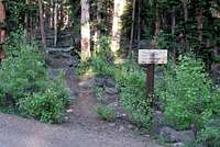
Route Description

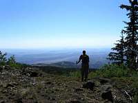
From the trail sign (indicating Snow Lake), it is just a bit more than a mile to the summit area and the terrain allows for good time. We found that it was 2.65 miles from the TH to the summit and we had an elevation gain of around 800 feet. The plateau you walk on is at 11,000 feet so if you are not acclimatized, you will need to pace yourself. An amazing area but there aren't any lakes up there. We did see cattle and one area that was torn up by ATV's. A mailbox is in place at the rocky little summit and a benchmark is located right underneath the mailbox. I found that there was no notebook in the register jar so I added my own container with a little notebook. Look for it in a red lidded plastic container.

Our time: For the round trip and time at the summit was under three hours.
Essential Gear
Warm jacket (if windy) and adequate water and footgear. Hiking poles helped on the steep descent from the top of the rim to the TH. damaged meadow
External Links
Add External Links text here.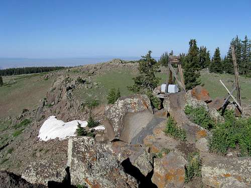
Summit area
