

Comments
No comments posted yet.
|
|
Trip Report |
|---|---|
|
|
Jan 12, 2013 |
This is just a simple log to keep track of our 2013 trips.
See the 2012 Trip Log for 2012.
See the 2011 Trip Log for 2011.
See the 2010 Trip Log for 2010.
See the 2009 Trip Log for 2009.
See also the 2008 Trip Log for 2008.
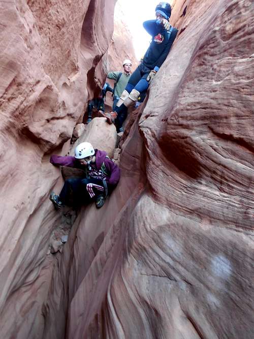
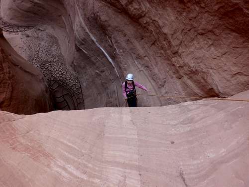
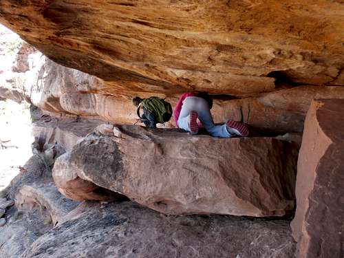
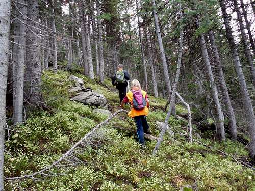
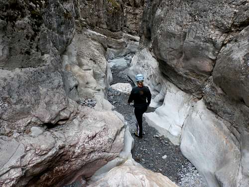
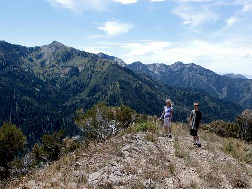
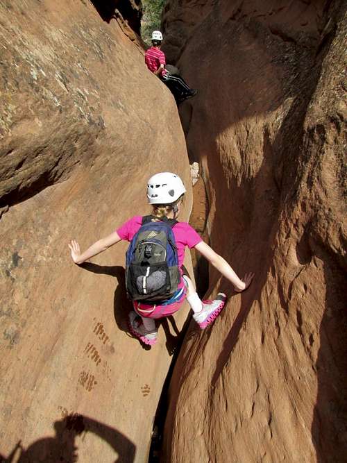
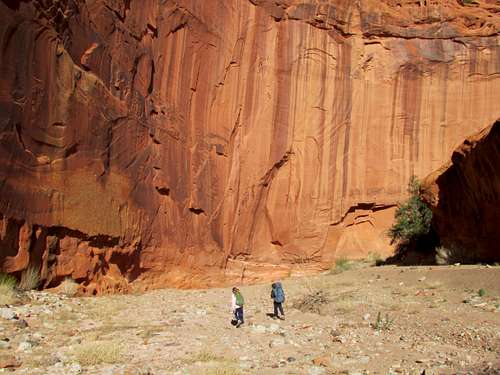
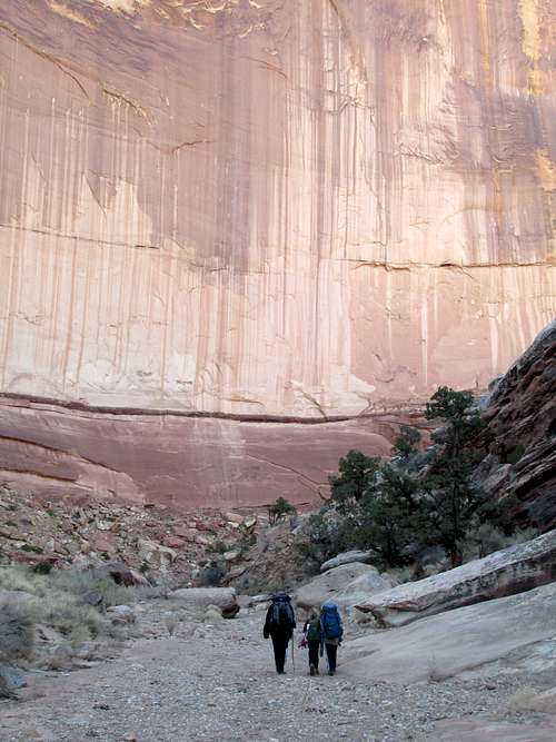
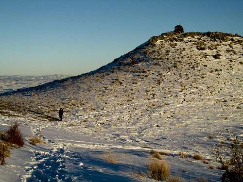
December 29: Monkey Business (Utah)
A group of us, including my son and I did Monkey Business during Freeze Fest. Malia knew the canyon well and took the lead.
Monkey Business was a really nice canyon, but not quite as good as Hog 1. There were some really interesting downclimbs, narrows, and potholes.
I was hoping that the canyon was going to be dry, but it was not. There were several waste deep pools of ice water. I was the one that busted a path through the ice in the first one. I tried to carry Kessler across the pool, but dropped him in while busting the ice.
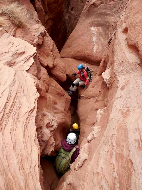
December 28: Hog 1 (Utah)
Kessler, me, and some others met at Sandthrax Camp for Freezefest. Hog 1 was the chosen adventure of the day. Hog 1 was a great canyon (I had last done it in 2002). Kessler really enjoyed it as well. There are some great slots and the hike out was nice too.
After enjoying the canyon, I showed some of the others some of the petroglyph and pictograph panels in the area.
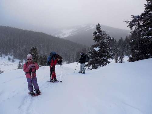
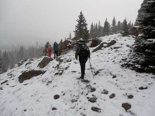
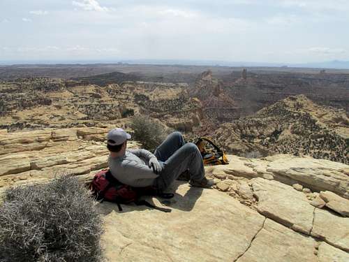
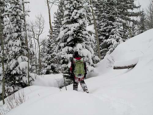
December 24-25: Taylor Hill (Colorado)
December 24
Christmas Eve we drove through a blizzard ( by far the worst part of the trip) to the trailhead for Vances Cabin. We snowshoed up through the snowstorm for 3.2 miles to the cabin reaching it right at dark. In the evening I cooked us all a dinner of chicken stew and we had some other treats. We also read some Christmas stories and other books.
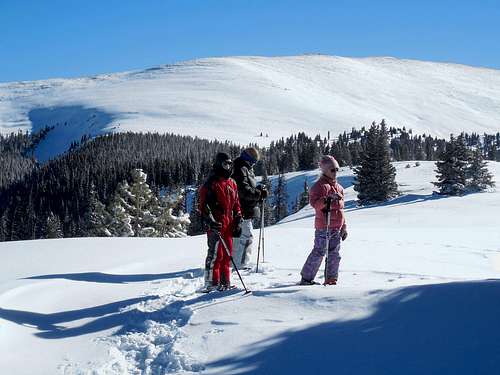
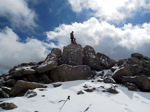
December 25
By around midnight, the sky was completely clear and full of stars. We awoke to cloudless skies, sunshine and -16F. All the trees were pre-decorated and looked just like Christmas trees! After a good breakfast we climbed up the Taylor ridge to the summit for the great views. It had warmed up to 7F, which believe it or not feels really warm in the sunshine when you are burning calories up a mountain. In fact, you can break a sweat at anything above zero when you're working hard!
The views of the Sawatch (including a really good view of Mount of the Holy Cross) and the Gore Range were really nice. After enjoying the summit at 11,725 feet elevation (it was a bit breezy so we didn't stick around too long), we headed for home. I had originally wanted to climb the Chicago Ridge, but it was quite windy and cold.
It was a beautiful Christmas Day.
December 21: Sandrocks (Colorado)
We were without a car today, so Kessler, Shaylee, and I snowshoed up the Sandrocks. We started on the east side and snowshoed over the top and to the west end of the ridge.
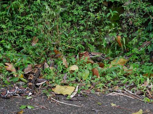
December 16: Flagstaff Hill/Speyside Nature Trails (Tobago)
Kim wanted a fairly easy hike today, so we headed for Flagstaff Hill. Most of the hike was on a seldom used road, but it was still a really good hike. The views from Flagstaff Hill are probably the best on the entire island since the rainforest has been cleared as it used to be an old lookout.
We also saw several birds and on the return trip saw a wild boa, my first that I’ve seen in the wild! It was a great hike and we walked all the way back to Speyside. We did some more walking on the beach before and then hiked all of the nature trails around the Blue Waters Inn. There were some interesting old ruins and many lizards.
In the late afternoon, it was time to start heading for the airport where we would fly back to Trinidad and then back home.
It was a really great trip.
December 15: Argyle Falls (Tobago)
This morning we took a boat ride out to Little Tobago where we planned on doing some snorkeling and hiking, but it the ocean was too rough to land. We instead went snorkeling off the coast of the island. It was really wavy though and despite the fact that I took Dramamine, I still got seasick.
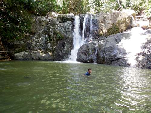
After the snorkeling adventure, we headed for Arglye Falls, one of the most spectacular sites in the country. We wanted to climb up to all four waterfalls. The hike to the highest falls has a reputation as being quite difficult, but after our previous hikes the past few days, we actually found it to be quite easy. There were some scrambling sections, but the steepest sections had fixed ropes, so it wasn’t bad, nor was it as slippery as some of our previous hikes.
The waterfalls were wonderful and we spent some time admiring in them and wading in the pools. I swam in the pools, but Kim didn’t want to. It was a very beautiful area and very enjoyable.
After spending much time at the pools and falls, we headed back to the trailhead and caught a ride back to Speyside. It was a good day.
December 14: Pigeon Peak/Man of War (Tobago)
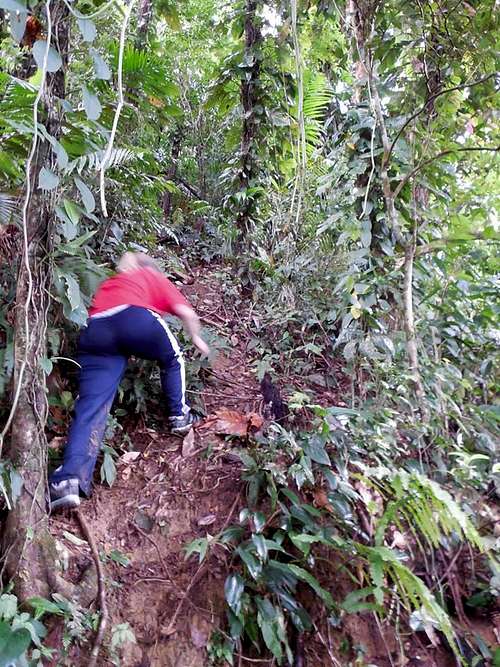
Today Kim and I decided to attempt Pigeon Peak and Man of War, two of the highest peaks on Tobago. We were weary of our experience on Mount Tabor the day before, so we weren’t quite as motivated to reach the summits this time, so we didn't get a really early start. In the morning we saw a very large and colorful caterpillar before a leisurely breakfast.
After catching a ride to the saddle between Pigeon Peak and Flagstaff Hill, we located the trail and headed towards the mountain. The trail was a bit overgrown, and we were startled by a huge frog and then a mountain crab. We saw a small snake as well. We made good progress to a big gully and then found the trail up towards the peaks. The “trail” to the saddle between the peaks was extremely steep and slippery. We had to find walking sticks in order to climb it. We also had a tight squeeze through a section of bamboo. Over all though, it was a fun and very exciting climb. It rained a bit as well.
Once we reached the saddle, we set off to climb Pigeon Peak first. Although the route to the peak wasn’t much of a trail, it was easier than the climb up to the saddle. We had to pay close attention to little blazes on the trees and eventually we found ourselves on the summit. There were some peekaboo views of the surrounding coast on both sides of the island.
We returned to the saddle and decided to climb Man of War as well. This route was harder to find than the route to Pigeon Peak. We left a water bottle behind at the saddle retrieved later) in order to mark the route for our return.
We carefully made our way to the summit of Man of War using very faint blazes on the trees. Along the way we passed under a huge fallen log with a very interesting bird’s nest. There was also a huge ants nest as well.
We returned to the saddle after climbing Man of War and were glad that we had left the water bottle behind in order to mark the route. After locating the trail it was a very steep and slippery descent down the mountain. We both took several spills and were very glad to have walking sticks.
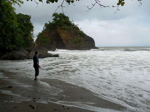
After arriving back at the trailhead e walked all the way back to Speyside where we were staying at the Blue Waters Inn. We had a well-deserved dinner before walking on the beach and retiring for the night.
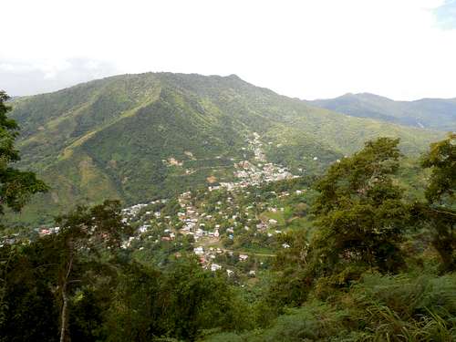
December 13: Mount Tabor (Trinidad)
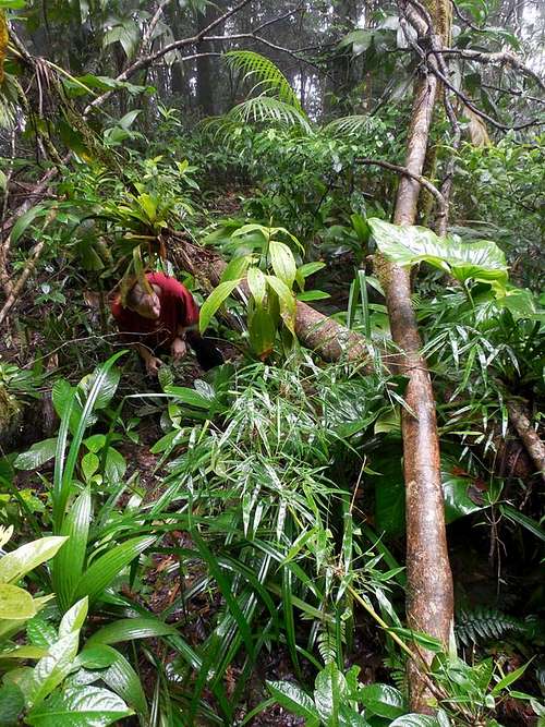
Today we climbed Mount Tabor since it was thought that it would be a good choice with the threat of rain. We caught a ride to the Saint Benedicts Monastery and took a little bit of time to wander around and locate the trail up Mount Tabor. We did find it and climbed up the steep trail past the old fire lookout and through the pine forest. The views were good and we saw several big vulture like birds. We also saw a gigantic grasshopper that was more than 6 inches (15 cms) long.
After reaching a small summit, the trail became less distinct. It actually got more difficult the higher we went. We also ran into a gigantic spider and after that a huge millipede. There were many razor sharp ferns (that would draw blood!)and some of the plants really stung like stinging nettle, but much worse. Thinking the trail would eventually improve, we continued up by bushwhacking. The route became more miserable as we climbed.
We eventually reached the top of the mountain, but couldn’t find the alternate route down, so we set off back the same way. It was a relief to get through all the sharp plants and the stinging ones as well. We had rain on and off, but as soon as we got down it really began to pour.
Mount Tabor was the only climb we did in Trinidad and Tobago that wasn’t that fun. It was fun climbing up to the first peak at the top of the pine forest, but beyond that it wasn’t very pleasant. I don’t think I’d repeat that part of the climb again!
After the climb, we head for the airport for our late evening flight to Tobago.
December 12: Nariva Swamp/Bush Bush (Trinidad)
Today we finally saw some sunshine! It was decided to go to Bush Bush (island) in Nariva Swamp in order to see the wildlife (which was Kim’s primary motivation in choosing Trinidad as a vacation destination.
After getting up very early, we headed for the East Coast and the Nariva Swamp. After arriving at the national park we arranged a boat ride through the mangrove swamp in order to reach Bush Bush. The first thing that was noticed was the mosquitoes, so we really put on the bug juice.
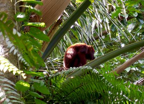
After riding a small motorboat through the mangrove swamps, we arrived at the island and set off to explore. The first things we saw were some gigantic snails and then red howler monkeys. We spent quite a bit of time hiking and looking for more monkeys. We never did see the Capuchins since because of the recent rains they were out in the swamp looking for more snails. I had really wanted to see and Anaconda as well (I still haven't seen one in the wild), but no we didn't see any.
We saw a lot of birdlife and some giant cicadas. We also saw different trees and plants, including the incense tree which has flammable (but good smelling) sap. After exploring the jungle on the island we returned to the water, but since the boat was not ready, Kim and I explored around and saw some more howler monkeys.
On the boat ride back, we also saw a caiman. Once out of the swamp, we headed to a nearby mud volcano to check it out before heading back to Arima.
That night the bed and breakfast threw us a surprise anniversary party since they knew we were there to celebrate our anniversary even though it was back in August (we celebrated it late this year). They made us a cake, other food, sparkling juice (since they knew we didn't drink alcohol), and played us some music on the steel drums. It was really nice.
December 11: North Coast/Paria Bay (Trinidad)
The original plan was to explore the Guanapo Gorge, but heavy rains but an end to those plans. Instead we decided to hike the North Coast to Paria Bay and Falls since it was thought that it would be safe in the rain.
The ride to the North Coast was longer than the original plan and several parts of the road were washed out. The trail was in mostly good condition, but some sections were washed out or had trees fallen across the path. Because of the heavy rain, there were also several river crossings as well.
The coast, beaches, forest, and waterfalls were really beautiful. There were actually three waterfalls that we found and I took a swim in one pool (though we were already soaked from the rain!).
The walk back was about the same as the walk in, though I got a big thorn caught between my eyebrow and eye lash from a low hanging branch. It stabbed be good and I was lucky that it didn’t get my eye.
We say several parrots, other birds, butterflies, and bats along the way. It was a beautiful, but long day, mostly in the pouring rain.
December 10: El Cerro del Aripo (Trinidad)
Today we set up to climb El Cerro del Aripo, the highest mountain in the country of Trinidad and Tobago. It sure was an exciting climb! Because the road was in poor condition, we had to walk a ways to the trailhead. It took us a while to find the correct trail, but once on it we made good progress through the rain forest and up to the saddle between Morne Bleu and Cerro Aripo, often while walking through the pouring rain. From here, the route would become much more challenging.
There was no real trail to Cerro Aripo after the saddle, and it was all through really thick rain forest and pouring rain. There were also several steep and significant subpeaks to climb along the way. The route was somewhat marked with the occasional piece of flagging tape on the trees. The steep sections were extremely slippery, especially with the pouring rain. We were also completely covered in mud.
Along the way to the summit we saw many strange plants and flowers. We were also startled by a mountain crab. When the rain briefly would taper off, there were plenty of butterflies and bats as well. I had one huge caterpillar on my shoulder, and only noticed that it had stinging spines after touching it to brush it off.
We reached the summit right at 1 pm. There were no views in the thick rain forest and rain, but it was still really beautiful. Because we were pressed for time, we had a very quick lunch and then descended the mountain.
The climb back was even more slippery than the climb up and we still had to reclimb all the subpeaks, still in the rain. We also got off track a few times in the thick jungle.
We got back to the trailhead and rushed along the road on foot in order to not miss the ridge that was supposed to pick us up. We were a little late, but it wasn't a problem. It sure was a good climb.
December 9: Asa Wright Nature Reserve (Trinidad)
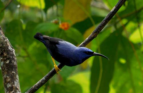
After a long day of travel, we awoke the next morning to head by taxi up to the Asa Wright Bird Sanctuary location in the Northern Range of Trinidad. Even before we started the guided hike (a guide is required for most of the trail) we saw countless birds, an agouti, and a big monitor lizard. We saw several lizards as well.
The guided hike was interesting and we were shown many other birds (hummingbirds, honey creeper, oriole, trush, etc.) and different kinds of plants and flowers (the monkey ladder plants were really neat). There were many small birds, and then some larger ones such as parrots. There was also the biggest ant colony that we had ever seen.
After returning back to the lodge for lunch, there was a big downpour. After lunch, Kim and I hiked to the freshwater pool where there was a large pool and a small waterfall. There were many small frogs around. I took a swim.
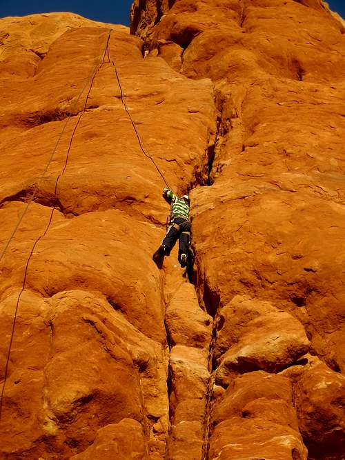
December 1: Wall Street (Utah)
Shaylee, Kessler, Kimberly, and I decided to do some climbing on Wall Street near Moab. The kids could out climb their parents and Kessler did some 5.9 routes and one 5.10 in the School Room Wall area. Shaylee climbed the 5.9 route at the School Room as well. We did several of the 5.5 to 5.7 routes.
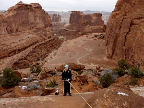
November 30: Windows/Un-named Butte/U Turn (Utah)
Our group (see below) hiked the Windows Loops in Arches National Park. After the loops, my brother’s family and my dad headed back home, but Kimberly, Kessler, Shaylee, and I stayed in order to do the technical U-Turn Route. Along the way we climbed an un-named mesa for some fine views.
The U Turn Route was a nice little adventure.
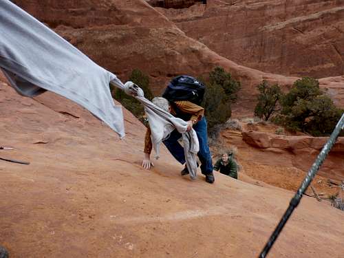
November 29: Delicate Arch/Un-named Butte/Devils Garden (Utah)
Our group (see below) hiked to Delicate Arch in the morning. Kessler and I climbed a nearby butte for some more excitement. After the Delicate Arch hike, Mark’s family had enough, but Kessler, Shaylee, Kimberly, my dad, and I headed to Devils Garden to complete the Primitive Loop.
Because much of the route was covered with snow and wet sand, the route was quite challenging. In a few places we had to tie jackets together in order to make a makeshift rope for people to get up.
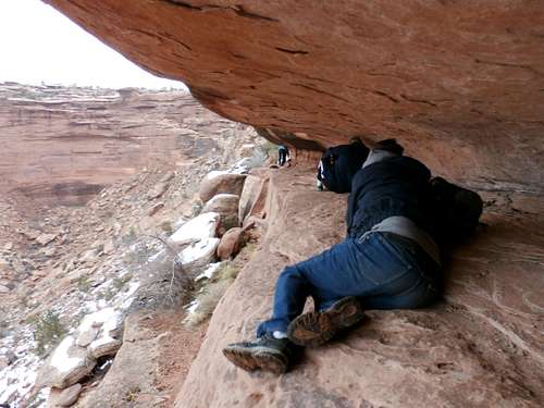
November 28: Hell Roaring Canyon (Utah)
Mark (my brother), Angie (sister in law), Matthew (nephew), Josh (nephew), my dad, Kimberly, Kessler, Shaylee and I all met in Moab for Thanksgiving.
On Thanksgiving Day we completed the Hell Roaring Loop. It is an exciting route and to get through the cliff bands, you have to crawl on your hands and knees along ledges. Along the way we also visited the big pictographs. We exited the old cattle trail in Debunki Wash.
It was a great loop hike, but was a bit rough on my brother’s family.
November 24: Sand Rocks (Colorado)
I hiked up the Sand Rocks Trail in the late evening. It was a bit muddy.
November 23: Cedar Mountain (Colorado)
The weather was bad today, so we stuck closer to home. Kessler, Shaylee, Kimberly and I hiked up Cedar Mountain, completing the short loop through the snow. It was snowing lightly and was a bit windy, but it was a nice climb.
November 16: Glenwood Caverns (Colorado)
Because of the weather, I took Kessler and Shaylee to Glenwood Caverns for the Fairy Caves and Kings Row Cave tours. It was thought that since the weather was going to be bad, we could spend the day mostly underground and indoors.
The night before however, we camped in the mountains above Glenwood Springs. It was a miserable night since while setting up the tent in high winds and pouring rain, we snapped a tent pole. We slept in a makeshift teepee that leaked a bit and it rained and snowed all night. We did get a bit wet.
The next morning we did the cave tours and the other activities at the caves. The caves were really nice, but we'll have to do the wild portion of the caves sometime.
November 15: Sand Rocks (Colorado)
Kimberly, Megan, and I took the Cub Scouts up and along the Sand Rocks Trail for their hike. It was cold, windy, and snowing, but everyone made it OK.
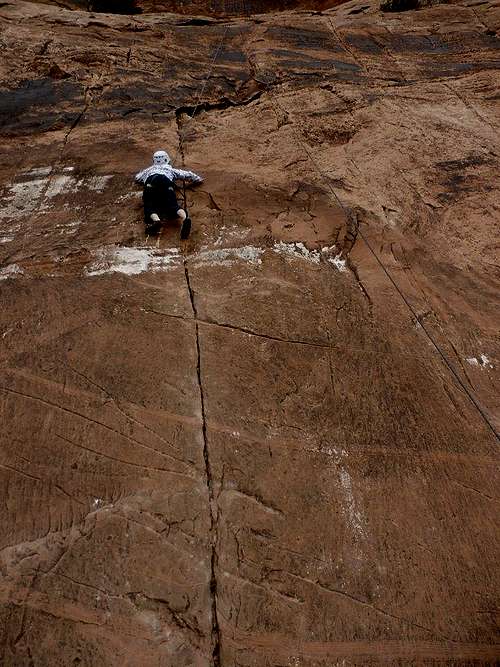
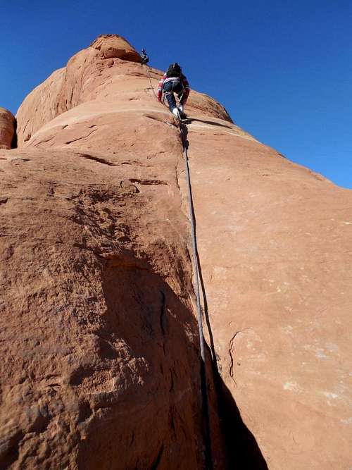
November 10: Looking Glass Rock (Utah)
Kessler, Charlie and I climbed Looking Glass Rock while Tess stayed below and photographed us (here wrist was hurting). It was a fantastic climb and very enjoyable. The weather was perfect.
Just as suspected, the sandy pitch was indeed sandy, but we all made it to the top without any problem. The exit rap is one of the most spectacular rappels anywhere. Kessler really enjoyed it.
November 9: Elephant Butte/Owl Rock (Utah)
A group of seven of us, including Kessler and I climbed Elephant Butte. As always, it didn't disappoint and provided one of the best views in the world.
Because the route was dry except for one pool to stem, it was an easier climb than last time.
All seven of us did the climb without any problems and we enjoyed the views for a long time before heading back down.
After descending Elephant Butte, we did an impromptu climb of Owl Rock. SP member Liba and her partner were climbing the rock and we asked if we could borrow their rope to climb to the top in order to set up a top rope with my rope (we did not bring a climbing rack).
Five of us climbed or attempted Owl Rock with varying degrees of success. Kessler made it to the crux.
It was a fun afternoon of playing around on the rocks before heading back to Moab.
November 3: Indian Cave (Colorado)
Kessler, Shaylee, Kimberly and I took a short afternoon hike (it was snowing) do Indian Cave and climbed to the top of the above it.
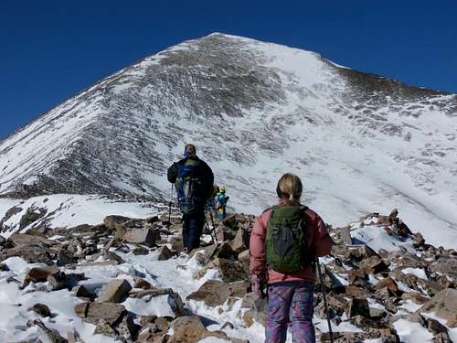
November 2: Quandary Peak (Colorado)
Kessler, Shaylee, Kimberly, and I climbed 14,270' Quandary Peak on Saturday with some 14ers.com members. We got a later start than most of the rest of the group.
Quandary Peak was much more difficult in November than it is in summer! The temperature was 11F degrees on top, but with the strong winds, the windchill was way below zero. It was a good and challenging day.
October 28: Sand Rocks (Colorado)
I did another hike to the top and along the ridge of the Sand Rocks.
October 27: Sand Rocks (Colorado)
I made an evening hike up and along the Sand Rocks. The trail starts not far from our house. I walked as far as I could along the route and returned.
October 26: Emerald Mountain (Colorado)
Kim had to work, so Kessler, Shaylee and I climbed Emerald Mountain. Because we went to a library presentation on Mt Everest and other peaks, we got a late start so we didn’t poke around much. We made the summit via the standard trail because all the side trails were officially closed because of mud. We took a break on the summit and returned the same way.
October 25: Cedar Mountain (Colorado)
Kessler went to a dance, so Kim, Shaylee and I climbed Cedar Mountain. We started just before sunset so we knew it would get dark on us. We completed the medium length loop and made the entire descent in the dark with flashlights, though headlamps would have been better.
October 20: Buck Canyon (Utah)
After a long night, our group drove to the head of Buck Canyon. I had wanted to do Buck Canyon since it is one of the few major canyons in the Roost that I haven’t done yet.
Marmotess stayed behind since her elbow was hurting. We set up the first rappel and had marmotess pull up the rope with her so we wouldn’t have to carry it through the canyon.
The canyon had a really nice slot (with lots of mud) and a few great downclimbs, but then it opened up all too soon and was a walk, though fairly pretty. We explored a narrow side slot before finding an exit out of the canyon. It was a long walk back to the vehicles.
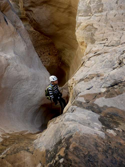
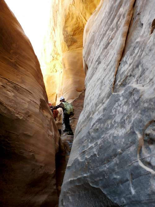
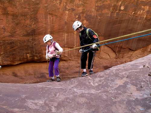
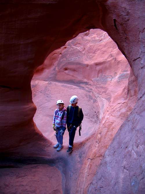
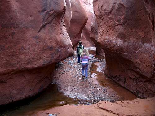
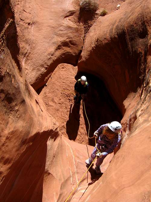
October 19: Bluejohn Canyon [East and West Fork] (Utah)
Kessler, Shaylee, and I met four other people (two from 14ers.com and two from Bogley) at Granary Springs in order to do some canyons. We chose the East Fork/West Fork of Blujohn loop, though we suspected there may be some water.
The route to the head of the canyon went without a hitch, but we suspected we may be in for some nice “surprises” after seeing some mud and pools before we even got to the narrows. The canyon was fun, but it was pretty wet, especially below the rappel. The pools were also slimy and hard to climb out of. The longest pool was an estimated 700 feet long! The adults could get by without swimming for most of the time, but the kids had to swim quite a bit. The water was quite cold.
As always, the narrows were really great, but since we were chilly, it was nice to get into the sunshine. After a nice lunch where we met another couple doing the canyon, we walked down canyon to the confluence of the East and West Forks. We climbed up the West Fork with no problems, though Kessler, Anya, and Dave took a more direct and challenging route up one of the falls.
After we got back to camp, we noticed the couple we met in the canyon were nowhere to be found. Where did they go? Long after dark, we saw them mosey into camp; apparently they took a wrong turn somewhere.
That night, the RV group next to us was extremely noisy and rude, so Anya, me, and the kids left at 10:30 PM and camped up the road a ways.
October 11-12: Twin Cones (Colorado)
October 11
Beautiful Kimberly wanted to go to a backcountry cabin for her birthday, so Kessler, Shaylee, Kimberly, and I hiked to the Broome Hut located at 11,350 feet in the Vasquez Mountains Friday evening. It was snowing on the drive and snowing on the hike, but we didn't have any real problems.
We cooked Kimberly a nice dinner while she relaxed and read.
October 12
In the morning, we cooked beautiful Kimberly a nice breakfast. She wanted some quiet reading time so she suggest that I take the kids up the mountain while she read.
The kids and I climbed both Twin Cones while she stayed behind with her books and relaxed. We saw some moose tracks early on and then many bunny tracks.
There were a few spots with deep snow, and some rock scrambling, so the climb took longer than expected.
After climbing the peaks, we returned and everyone had a late lunch before we all headed down.
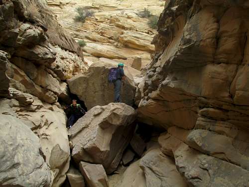
October 6: Dome Rocks/Hey Joe Canyon (Utah)
In the morning we climbed one of the Dome Rocks northwest of Hell Roaring because it looked like a great viewpoint. We enjoyed the class 3 scramble up and the view from the top. On top someone else started climbing the rock to and we met them on the way down.
After climbing the Dome Rock we drove towards Tenmile Point and to near the head of Hey Joe Canyon. We had heard of a route down the south wall and wanted to see if it existed and how the route was. The road to Tenmile Point is good, but the one to the south rim of Hey Joe Canyon was really rough.
We found the route without too much trouble, though we lost it a few times. The scramble down was actually fairly well marked with carins.
Once at the bottom of Hey Joe Canyon there was a mining camp, complete with old equipment and what was left of an old truck and bulldozer. We explored around and then headed down canyon to the Green River. We went to the muddy river and then hiked up to the bench with an old bulldozer before eating lunch.
After lunch we headed back up canyon and reclimbed the route up the south wall before heading home.
October 5: Dome Rocks/Hell Roaring Canyon
Kessler, Shaylee, and I headed for Utah because we could camp and hike while listening to our church conference. We left Saturday late morning and drove to Hell Roaring Canyon. We took the exciting Kachina Ledges route into the canyon. The route consisted of climbing through several cliff bands, including following one long ledge while crawling on your belly.
Once in the canyon we headed down canyon to the really nice pictograph panel. We visited it a while before heading quickly down canyon. We had to backtrack for about 20 minutes or so because Shaylee left her backpack on a rock.
After retrieving the backpack, we headed down canyon to Dubunki Wash and followed it to its head where we climbed to the canyon rim using an old and impressive cattle trail.
It was then a roadwalk back to the vehicle. We did the entire 7 mile route in 3 hours, which is pretty quick considering the terrain. It was a race to get back before dark. Late in the evening we also climbed one of the Dome Rocks.
September 28: Music Canyon (Utah)
Mike Kelsey, Kessler, and I did Music Canyon today. The canyon was filled with mud, making it much more difficult than usual. I’ve up and down climbed the canyon more than once, but this time it was too risky to do so and we used ropes in three places.
The rope did get stuck on the last rap and Kessler and I climbed back up to retrieve it. I had to do a partner assist, but a handhold broke loose when lifting Kessler up, so luckily I was holding onto his leg.
The Muddy Creek Gorge had lots of water, so was also slow going. It took us 8 hours to complete the entire route, but we were moving pretty quickly.
September 27: San Rafael Reef/Knotted Rope-Miners Hollow (Utah)
Matt Lemke, Mike Kelsey, Kessler and I met near Hidden Splendor the night before in order to do some technical canyons. It actually snowed around Ghost Rock that night, but the morning was clear.
In the morning, we hiked up to the top of the San Rafael Reef and then through Miners Hollow/Knotted Rope Canyon. We really enjoyed the views from the top of the San Rafael Reef and visited the old mining camp before heading down the canyon. Because of recent precipitation, most of the potholes were pretty full. We encountered a group of women early on, but we knew it was the annual Chick Fest gathering, which location and timing is usually kept under wraps, so we didn’t want to crash their party, and after a brief chat we went on our way.
The canyon was full of quite a bit of water, but it was fun. Because the potholes were full, the canyon was pretty easy and with only a few beached whale moves required. After completing the canyon, we hiked up the Muddy River Gorge and to Hidden Splendor. It took us about 6.5 hours to complete the trip. Matt Lemke went home after this, but the rest of us stayed.
September 21: Cross Mountain South (Colorado)
Matt Lemke called me the night before and wanted to do something since he was in Vernal. I suggested Cross Mountain since it was between us.
Kessler, Shaylee, Matt, and I met near the Cross Mountain South trailhead and did a car shuttle, parking one car at the Cross Mountain South trailhead and the other at the west end of the Cross Mountain Gorge. We climbed the peak, enjoyed the views and followed the rugged south rim of Cross Mountain Gorge down to the Yampa River.
September 20: Cedar Mountain (Colorado)
I climbed Cedar Mountain in the afternoon with Kessler, Shaylee, Kimberly and two other scouts. We completed the long loop. It was a nice hike.
September 14: "Forgotten Point" (Colorado)
Shaylee, Kessler, and I climbed "Forgotten Point" in the Elkhead Mountains. The original plan was to climb W Mountain in the Flat Tops, but it had been raining a lot, the weather forecast was calling for an 80% chance of rain, and is was (correctly) assumed that Forgotten Point would make a safe ascent in the rain.
This was my last of the 10,000+ feet peaks in the Elkhead Mountains that I climbed, basically because I forgot and failed to notice that it was a ranked peak. I thought I’d climbed them all, but after looking at the map, I noticed this one was also ranked.
We made our way up the Bears Ears Trail before setting off cross country to the peak. It was more of a navigational challenge through old growth forest than it was a typical mountain climb.
We were the first to sign the register in more than seven years.
September 13: Cedar Mountain (Colorado)
Shaylee, Kessler, Kimberly and I climbed Cedar Mountain, completing the long loop. Cedar Mountain was chosen because the trail usually doen't get muddy and it had been raining a lot.
September 12: Sand BM (Colorado)
I made an evening climb of the Sand BM. It gets dark earlier now, so much of it was in the dark!
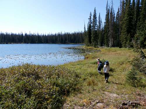
September 6-7: Long, Round, Percy, and Elmo Lakes (Colorado)
September 6
This weekend, Kimberly suggested that we do and easy and relaxing hiking trip, so Kessler, Shaylee, Kimberly, and I broke from our usually exciting excursions and instead did an easy 8 mile hike.
We all drove to the trailhead at Rabbit Ears Pass and found the road to be closed. We then drove all the way around to Buffalo Pass (where another trail accesses the same lakes), and lost an hour and a half.
Since daylight was then limited, he hurried and hit the trail and made it to Long Lake in 30 minutes (1.5 miles with backpacks). The daylight was fading, so we set up camp fast.
September 7
It rained for much of the night, but the next morning it was clear we hiked to Round Lake, Percy Lake, and Lake Elmo before heading back to long lake and then back to Steamboat. We then rode the alpine slide and went out to eat before heading back home. It was a good weekend.
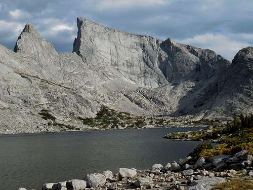
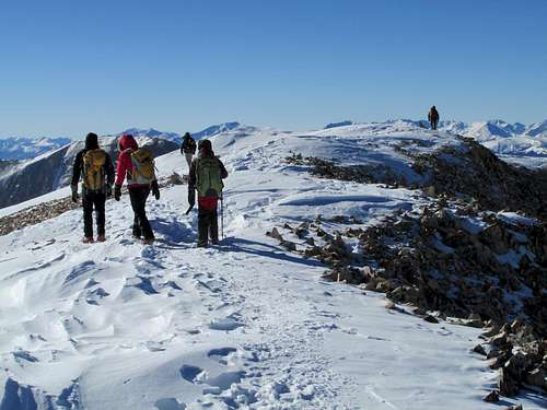
August 31-September 2: East Temple Peak (Wyoming)
September 1
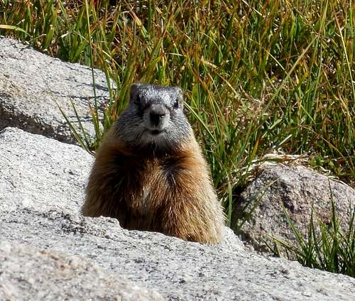
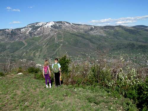
Today, Kessler, Shaylee, Kimberly and I set off to climb East Temple Peak. We slept in later than planned, but the sky was completely clear (and 30F/-1C) and we set off towards the mountain. Between Deep and Temple Lakes we found an old trail heading towards Temple Pass. Along the way we saw many pikas and a marmot that popped out and smiled for the camera.
The trail to Temple Pass was very steep, but not too bad and provided quick travel. Once at the pass we set off up the southwest ridge of East Temple. The climb was fairly easy, especially by Wind River Range standards, but we had a lot of boulderhopping on the ridge. We later found out that much of it could have been bypassed to the north.
Once at the summit, we had a really nice lunch and an incredible view. The kids really like to look straight off the "diving board" just below the summit.
After enjoying the summit we found a class 3 route north of the route we took up. It was easier than our ascent route.
It was a routine descent back to camp. It sure was a beautiful climb.
After dark we saw two headlamps near the top of Warbonnet Peak far to the south. They must have had an epic climb to the summit and had to descend in the dark. We watched them for a long time making slow progress down the mountain.
September 2
It rained the night before, so we woke up early and started packing up camp in the rain. The rain tapered off and luckily we didn't have to take the tent down until it stopped. We were sure if it would rain more and the sky was threatening, so we headed down the trail rather quickly.
We took two good rest, one at Big Sandy Lake to eat breakfast (because it was raining, we waited to eat breakfast) and one at the junction half way back from Big Sandy Lake. Other than that it was a routine hike, and the kids enjoyed watching the squirrels. We made it back to the vehicle right when it started to rain again.
August 31-September 2: East Temple Peak (Wyoming)
August 31
Kim had to work very late (12:20 AM) the night before, so we got a late start on the drive.
Once reaching the trailhead in the early afternoon, we quickly set off towards Deep Lake. The parking lot was very full, so we had to park fairly far away.
We had really beautiful weather and we had to walk quickly because of the late start. We made our way to Big Sandy Lake before heading towards Clear Lake. Luckily this late in the year, the stream crossing was quite easy.
Clear Lake had barking dogs, so we pushed on towards Clear Lake. It was actually a challenge to find a campsite that was both 100 feet from the steam and 200 feet from the lakes and trails, so Kessler and I set off to find one while Kim and Shaylee waited below.
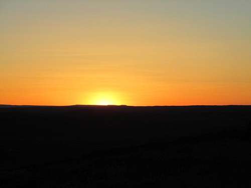
We ended up finding a beautiful campsite on a bench below Deep Lake. We had made the 8 miles in 4.5 hours, but still had to hurry with camp set up and dinner before dark. Camp was set up just as the mountains were being painted orange by the sun.
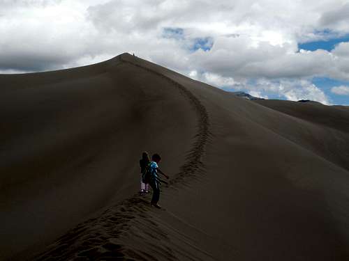
August 25: High Dune (Colorado)
The plan was to climb Ouray Peak today, but the kids had such a good time at the Sand Dunes that they wanted to stay there. We actually ended up climbing High Dune. It sure was a lot faster and easier to come down than it was to go up. After climbing the dune we quickly went down, but the kids wanted to climb another dune and run down, so I let them do so while I watched.
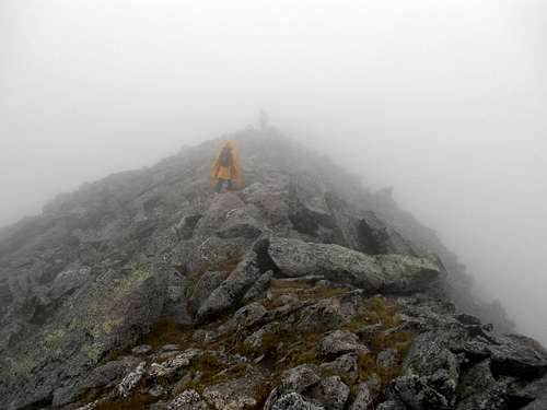
August 24: Culebra Peak/Great Sand Dunes (Colorado)
Darin, a 14ers.com member sent out an invitation for Culebra partners. Culebra Peak is a mountain that I once said for a long time that I would never climb, I decided to make the climb anyway since I am getting fairly close to finishing all the Colorado 14er. It is the only Colorado 14er that you have to pay a fee to climb.
At first the plan was just to take Kessler, but Shaylee wanted to go and when I found out that the fee was 1/2 price for children under 12, I decided to take her as well.
The morning of the the climb we met Darin, Tiffany, Steve, Carla, Britt, Uwe, and Susan at the trailhead and we all headed up the mountain.
It was very foggy and we could hardly see! It remained foggy the entire climb to the summit.
The kids and I started out last (they were still sleeping in the vehicle when we arrived at the trailhead), but we caught up with the rest of the group and more or less stayed with them until the summit ridge.
In the fog, we took a slightly longer route and climbed the big subpeak (unranked 13er) along the way before descending to a saddle.
About this time, Kessler, Shaylee, and I left the rest of the group and headed up the summit ridge in the thick fog. It was still foggy all the way to the summit.
Kessler, Shaylee, and I waited on the summit for the rest of the group and enjoyed a few brief breaks in the clouds where you could actually see something. The caretaker at the ranch said that if we chose to climb Red Mountain we could pay the fee on the way back, but since it was so foggy we thought it was pointless to climb Red Mountain.
After a while, the rest of the group reached the summit and we had a long rest before heading back down.
About halfway down the clouds started to break and I wished we had gone up Red Mountain. Five of us took a more direct route down and waited for the others on a hill. Once we saw the rest of the group, we hiked the rest of the way back to the vehicles.
On the climb we saw several pikas and one big fat marmot. It was a great climb and a lot of fun.
Since it was still early, we headed to the Great Sand Dunes National Park for some more hiking/exploring and where we would spend the night.
The kids and I hiked around and climbed some sand dunes. The kids liked to play on them for quite a while so we had a very late dinner.
August 18: Angel Creek (Colorado)
We met the group in the morning at the trailhead in order to complete Angel Creek, another beautiful canyon in the Ouray area.
The canyon is different from what we are used to because water flows over smooth limestone slickrock.
The canyon was a good one and the group was fun. After the canyon, we headed for home.
August 17: Portland Creek-Ivans Trail Canyon/Box Canyon Falls/Canyon Creek/Cascade Falls (Colorado)
Kim and I headed for Ouray in order to celebrate our 20th wedding anniversary, which was on August 11. We would also attend the 2013 Ouray Canyoneering Rendezvous while we were there.
Because we wanted to do something fairly relaxing, we chose Portland Creek-Ivans Trail Canyon. The canyon was a nice adventure and it was nice to rappel through the waterfalls. The downclimbs were also fun as well.
After completing the canyon, we headed to Box Canyon Falls and Canyon Creek and spent some time hiking there.
After lunch in Ouray we walked from downtown up to Cascade Falls and waited until another group descended it.
Later, at dinner, we met up with one of our old friends AJ and he suggested doing Portland Creek at night. We were a little tired, but decided to join the group anyway. It was a different experience doing the canyon in the dark, and we got wetter because we couldn’t see as well to avoid the water!
August 13: Cave (Colorado)
Shaylee and I did a quick hike to a local cave and climbed the hill above it.
August 9-11: Buck Mountain-North and South (Colorado)
Kimberly had to work the weekend, so Kessler, Shaylee and I decided to climb Buck Mountain. The main reason for climbing it was that it was thought to offer the best view of the Sawtooth Range.
August 9
In the early evening, we set off from the trailhead. The trail was confused by many sheep trails and we came upon a sheep herd. We went around the sheep as best we could and tried to stay away, but we could hear the sheep dogs barking from a distance. It sprinkled a little rain, but otherwise it was good weather. It must have rained hard earlier in the day though because there was lots of mud. There were lots of huge mushrooms along the way.
We made 4.8 miles along the Main Fork Trail. It was getting late and we found a marginal campsite. There weren’t too many good campsites in the area, but the kids wanted to camp before it got dark.
August 10
We awoke to a fairly mild 38F (3C) and clear skies. We made our way to Encampment Meadows on a good trail, but the trail became really wet and boggy for quite a distance. Our feet were soaked! We located the trail up to Gem Lake and followed it to the lake before taking a rest.
We expected a rough scramble to the pass south of Buck Mountain North, but upon reaching the steepest part we were surprise to find and old constructed trail. It must date to the peak sheep grazing days many decades ago. We followed the trail up to the pass and found that it was frequented by elk as well.
We scrambled up to the summit and found that the resister was signed by four parties (including a solo climber) in the past six years. After enjoying the summit and eating lunch, we followed the long ridge south and reached the summit of Buck Mountain South.
The weather was overcast, cold, and windy, and spit a few snow pellets and snowflakes, but there wasn’t a thunderstorm. We didn’t find a register on top, so we left one before quickly heading down the ridge. The weather quickly improved so we climbed and additional peak before descending to Lake Diana, seeing a marmot along the way
An old abandoned trail leads from Lake Diana back to the Continental Divide at Encampment Meadows, but we didn’t find it from the lake. We headed down the mountain without it, but eventually found it and followed it back down to the meadows.
From there we headed back to camp, meeting three other hikers and a dog, the only people we met along the hike.
The kids were tired by the time we reached camp and since we had enough food we spent another night.
August 11
In the morning, we ate a leisurely breakfast before packing up camp and heading back to the trailhead. We made the hike rather quickly and were glad that the sheep herd was gone.
August 6: South Castor Ridge (Colorado)
I made a climb of the South Castor Ridge today. It was warm, but not extremely hot. I saw one really big bull snake on the ascent and one rattlesnake on the descent. Unfortunately, I did not have my camera with me.
August 4: Millvue Peak (Utah)
Kessler, Shaylee, Kimberly, and I decided to make a climb of Millvue Peak. The Lambs Canyon Trailhead was only 1.5 miles each way out of our way travelling from SLC to Craig so it seemed like a natural choice. The trail was also north facing which would provide some shade. It had been many years since I last visited Lambs Canyon.
We started up the trail and at lunch at Lambs Canyon Pass. The trail has a reputation of being a steep one, but we actually found it to be quite pleasant, and with a nice forest, lots of flowers, butterflies, and a tiny gurgling stream.
After a nice lunch at the pass, we made our way up the ridge to Millvue Peak. The bushwhacking was rather minor, but we should have brought long pants for this one. There was quite a bit of stinging nettle too and Kessler got a fairly large rash, though it was short lived.
After enjoying the views from the summit, we headed back down the mountain. It was a warm day, but the shade was nice. It was a good climb.
July 31: Sand BM (Colorado)
I took and evening climb of the Sand BM. I saw two big bucks.
July 28: Sand BM (Colorado)
Shaylee, Kessler, and I did an evening hike up the Sand BM.
July 26-27: Sarvice Creek Wilderness (Colorado)
The original plan was for Shaylee and I to hike the Wyoming Trail, Buffalo Pass to Gold Creek, and climbing The Dome, Mount Ethel, and Lost Ranger Peak along the way (two days and one afternoon). Plan B was to do a slot canyon in the Escalante (Utah) region, but the weather forecast was quite bad for both areas.
We decided to hike across the Sarvice Creek Wilderness since we hadn’t done it and since even if it were to storm, it should be a safe trip. Kimberly could join us as well since she didn’t have to be to work until Saturday evening.
July 26
The car shuttle took longer than expected, so we (Shaylee, Kim, and I) got a fairly late start in the evening. We started from the upper trailhead. The trail was somewhat faded at first, but improved as it went on.
We hiked for 1.75 hours before camping at the second small creek crossing. Near camp we saw a deer and of course many squirrels and chipmunks.
July 27
In the morning we awoke to a rather refreshing 38F (3C) and climbed a somewhat small un-named mountain, but he views were mostly obscured by trees. After that we headed down the trail. There were several nice meadows and rock formations along the way. We did get wet at a few stream crossings and mud holes.
The route did take us a little longer than expected, but we made good time. There were wild strawberries, raspberries, and thimble berries to eat along the way (they ripened early this year). We also saw many wildflowers and butterflies as well. We saw moose and bear tracks, but no large animals, though we did see many small ones including a marmot.
As soon as we got back to the vehicles, it started pouring rain, so we were done just in time.
Overall it was a nice hike. The conclusion was that Sarvice Creek is a nice 12.2 mile hike with some pretty meadows, rock formations, and a pretty creek. It is pretty in its own way, but it lacks the spectacularly rugged mountains in some of the other wilderness areas. It’s a safe choice when the weather forecast is bad.
July 24: Sand BM (Colorado)
To avoid the hot temperatures, I did a late evening climb of the Sand BM.
July 22: Castor Ridge (Colorado)
I decided to take a late afternoon/evening hike to climb the Castor Ridge, near Hamilton Colorado. It was 96F/36C which is hot for this part of the country.
The cows made the trail up pretty dusty (it's been a very dry summer here) and it was hot, but I made due by taking extra water and dumping it on my head when I needed.
I climbed the peak and headed back down the ridge to the car.
July 21: Cedar Mountain (Colorado)
I made an evening climb of Cedar Mountain, completing the long loop. Met one mountain biker and a dog.
July 20: Mount Welba (Colorado)
Shaylee, Kessler, Kimberly and I climbed Mount Welba. It was a good climb and the mosquitoes have thinned out. Because Kim had to be to work at 4 PM and because we didn't get that early of a start, it was a pretty rushed climb. We didn't find the summit register on the big summit rolling summit this time, but if we had more time we probably could have located it.
July 15: Cedar Mountain (Colorado)
I climbed Cedar Mountain in the evening, alone, completing the long loop.
July 13: Pagoda Peak (Colorado)
Shaylee, Kessler, and I climbed Pagoda Peak in the Flat Tops. The trail was super muddied up and stinky form a huge herd of cows. Had we known, we would have chosen another hike.
We hiked along the trail (the mosquitoes were out), but left the trail too early so we had to do a lot of log hopping. We made our way to the easy cliff band on Pagoda Peak and had a bit of fun climbing it. There were still mosquitoes on the summit, but we still had a nice lunch.
It was noticed that some big clouds were headed our way, so we left the summit of the mountain and hurried down. About half way to the trail from the summit, the skies opened up and soaked us good. It was a really muddy walk the rest of the way back to Ripple Creek Pass.
July 12: Sand BM (Colorado)
Shaylee, Kessler and I went for an evening climb of the Sand BM.
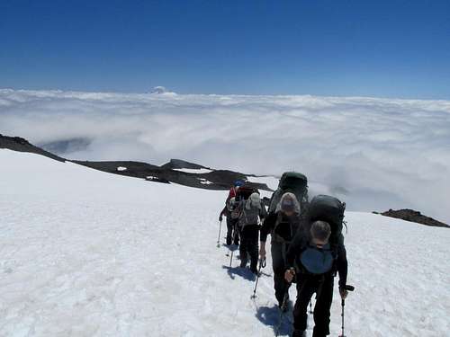
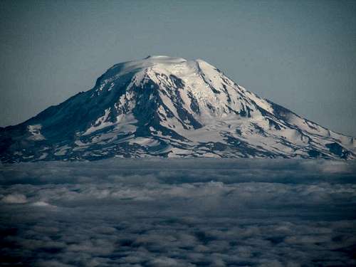
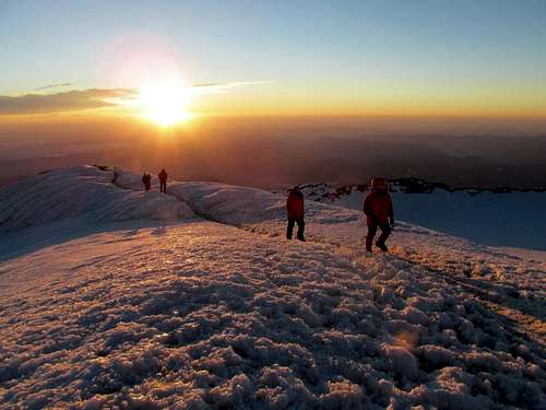
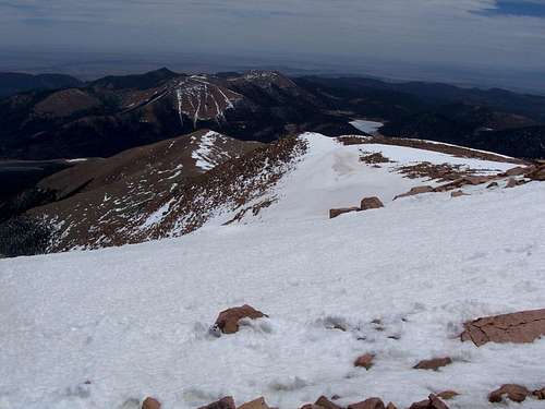
July 5-7: Mount Rainier (Washington)
July 5
July 6
July 7
It was chilly on the summit, but once the sun came out it was roasting. 22.8F at Ingram Glacier camp on summit day. Beautiful weather conditions, but with some haze down low.
The scree on the Disappointment Cleaver was the worst part, but the only disappointment was that I didn't get to climb it with one of my friends who was planning to climb it with me for a long time. I still got to meet some great people though.
See the trip album for more photographs:
Mount Rainier July 5-7
July 4: Coast Trail (Washington)
For part of the day, I hiked the bike/walking trail along the coast near Belltown. I have forgotten the official name of the trail.
June 30: Black Mountain (Colorado)
Kim, Kessler, Shaylee, and I climbed Black Mountain after church. It was a nice escape from the summer heat and we even had a snowball fight on top.
June 28: Cedar Mountain (Colorado)
It was too hot for a hike during the day, so I hiked the short loop on Cedar Mountain after sunset.
June 26: South Castor Peak (Colorado)
After work I climbed South Castor Peak. It was hot, at least for this part of the world. The area is getting pretty dusty as it hasn't rained in quite awhile.
June 21-22: Mount Massive (Colorado)
June 21
Shaylee, Kessler and I left for climbing Mount Massive. We wanted to get an earlier start, but after being too tired to pack the night before and after waiting for Pizza Hut in Leadville, we didn't get that early start. I thought it would be more pleasant to camp on the mountain than by the vehicles. We started the trail just after 7:30 PM and walked less than an hour before setting up camp. We camped at South Fork Willow Creek.
While I was filtering the water, Arthur and his dad walked up the trail. We were supposed to meet them at the campsite, so we all camped in the same place before heading to bed.
June 22
Our group of five woke up with a temperature of 33F. We quickly packed up and started up the mountain.
The trail up Massive is steady uphill, but never extremely steep. We made good progress up to the 13,900 foot saddle. After that there was some scrambling, but it was a straightforward climb to the summit.
It was Shaylee's (9 years old) highest summit to date.
Arthur and his dad when to climb the other 14er summits (unranked) of Mount Massive, but Shaylee, Kessler, and I only went to Massive Green as far as extra summits goes.
I was afraid that we would be beat if we tried them all in a day.
After climbing Massive Green, Shaylee, Kessler, and I went back over the summit of Massive and back down to camp. We took a nap while waiting for the other two.
When Arthur and his dad met us, they were beat. We hiked the short distance down the mountain and ate in Leadville. Because they were understandable tired, we cancelled the next day's climb and headed back home.
It was a great trip.
June 16: Left Fork North Creek [Subway] (Utah)
Kessler, Shaylee, Kimberly and I went through the Left Fork North Creek route today. It is one of my favorite routes.
Along the way I climbed a rock peak for some views, but maybe I should have since we had a 10 hour drive after completing the route!
The first half of the canyon when quickly. We swam through the upper sections with life jackets (rather than taking a wetsuit). The water was cool, but it was a hot day.
The route was beautiful (as always) and a lot of fun. The hike out dragged on since we were tired (not much sleep in the previous two days).
It was a long drive back, but a great trip.
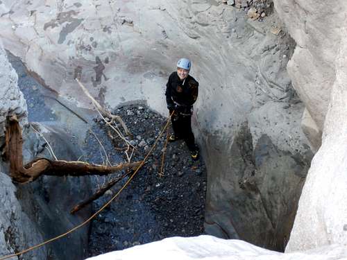
June 15: Spry Canyon (Utah)
I was unsuccessful in securing a permit for the four of us (Kim, Shaylee, Kessler and I), so only Kessler and I would do the canyon. Kim drove us to the trailhead (Shaylee and Kim went to go hike the Narrows) and at the trailhead we met another group. One person said we could tag along with them while the others said they wanted to move faster, so Kessler and I let them go ahead and took 15 minutes or so to get ready. Even so, we caught up with them on the approach.
Luckily the first part of the approach was shaded, but the steepest parts were in full sun. Still, it wasn’t that bad and the approach is actually pretty scenic.
At the first rappel, the other group wanted to set it up so we let them and they let us go down first (they were going to be moving slower than Kessler and I). We rapped down and left them behind.
In order to return the favor we set up one of the tricky rappels and waited for the other group while we ate lunch, but it took them almost an hour to catch them. After that we didn’t see them again.
The canyon was really nice. At the “Hidden Slot Chamber” though, Kessler didn’t want to swim with a pack through the dark slot, so after he went down I walked to the ledge rappel and lowered the pack off. Unfortunately the Pelican case caught a ledge up top (I should have put it inside the pack and popped open so the camera freefell 100 feet into the slot below. We got no photographs after that, but the memory card was still good.
Other than that it was a routine descent. The exit chute is actually fairly long, but not bad. When we reached Pine Creek we hiked down to the highway and then down the highway to the first shuttle stop where we rode the shuttle to the visitor center where Kim and Shaylee were waiting for us.
June 12: Cedar Mountain (Colorado)
The scouts climbed Cedar Mountain this evening and I joined them. Kessler is now a scout as well and this was his first scout meeting. We all climbed Cedar Mountain and did a few side trips so the scouts could count a five mile hike.
June 11: Sand BM (Colorado)
Alone, I climbed the Sand Bm in the evening. I saw several deer.
June 9: Cedar Mountain (Colorado)
Kimberly and I went for an evening climb of Cedar Mountain. The caterpillars and cicadas were really out, in fact the cicadas kept flying into our faces! We saw one deer as well. We completed the long loop.
June 8: Fish Creek Falls/Long Lake (Colorado)
Justin Kuhn, Shaylee, and I went to hike Upper Fish Creek Falls. We made the falls quicker than expected (there was no snow on the trail up to the Upper Falls) and ate lunch at the falls. Shaylee spotted a marmot and showed it to us.
After lunch we decided to push on towards Long Lake. We passed many other small waterfalls, but decided to turn back after hitting quite a bit of snow at 9500 feet.
June 5: Cedar Mountain (Colorado)
Today after work, Kessler and Shaylee joined me for a climb of Cedar Mountain. We watched the cicadas which were out and all over the bushes. There were also several caterpillars all over the place as well. Lots of wildflowers were out as well. We completed the long loop finishing not long after sunset.
June 2: Emerald Mountain (Colorado)
Shaylee, Kessler and I went for a climb of Emerald Mountain. We got a fairly late start so moved fairly quickly. We took the main trail up before switching to the Blair Witch Trail. We followed this a short distance and then turned onto the longer Quarry Mountain Trail which we followed to the top of the ridge. From the ridge we followed it south and west over the summit and then descended to the old quarry via an indistinct trail.
It was a good climb.
June 1: Sand BM (Colorado)
Alone, I did an evening climb of the Sand BM.
May 31: Cedar Mountain (Colorado)
Shaylee, Kessler, and I made an afternoon climb of Cedar Mountain.
May 25-27: Pikes Peak (Colorado)
May 25
Today Kessler, Shaylee, Kimberly and I hiked up to Barr Camp. The worst part was finding a place to park! The parking lots in Manitou Springs where they have a free shuttle don’t allow overnight parking. All the lots near the trailhead were full. We ended up parking at the Rodeway Inn at the east side of town and walking all the way to the nearest shuttle stop.
The trail was in good conditions, but with lots of runners to dodge. The crowds thinned out after the junction with the top of the Incline.
Along the way to Barr Camp, there was a nice looking rock peak that I just had to climb. The rest of the family waited behind while I climbed it. After the short side climb, it wasn’t far to Barr Camp.
We spent the rest of the afternoon playing horseshoes and other games.
May 26
The plan was for us all to climb Pikes Peak and have a nice lunch on top, but Kessler said that he didn't feel well in the morning. Because her brother wasn't going to go Shaylee didn't either.
I would climb the peak alone. Unfortunately, I hung around for breakfast at Barr Camp which would make the snow softer without an early start.
I climbed up the mountain and there wasn't much snow until timberline. After that there was a lot of snow and some postholing. Because the night before was a warm 46F, the snow was really soft and wet. Most people on the mountain turned back, but several made it including a 7 year old girl.
On top I had a nice lunch bought some presents for the rest of the family whom were waiting down at Barr Camp. After that it was soon good glissading down the mountain and a routine walk back. We all played games and cards in the afternoon and evening.
May 27
Today we packed up and headed down the mountain. We climbed a minor subpeak on the way down in order to have a good view of Pikes, but it was just a short side trip and an unranked peak.
Again, once we got to the top of the Incline, there were many joggers to dodge. Near the end we witnessed a rescue on the Incline.
At the bottom we walked to the shuttle stop and took the shuttle into town. The walk to the Rodeway Inn seemed a lot longer going back than it did on the way up.
May 21: Castor Ridge (Colorado)
I took an afternoon and evening hike alone to the peak on the Castor Ridge. It was a beautiful spring hike and wildflowers were all over the place. I wished I had brought my camera.
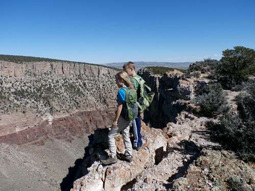
May 19: Devils Canyon Overlook (Colorado)
Kessler, Shaylee, Kimberly and I took a hike in the Devils Canyon area. We hiked to a high point above the canyon in order to look into it, passing Cowboy Hat Tower along the way.
After that, we gave Kessler the map so he could navigate back to the trail for us, using a different route. He did fine and it was a good hike.
May 18: Dinosaur Hill (Colorado)
Kessler, Shaylee, Kimberly and I took a hike to the top of Dinosaur Hill in the dark. We had spent the day at Mike the Headless Chicken Days.
May 16: Yampa River Trail (Colorado)
Shaylee and I did a hike along the Yampa River Trail in order to look for beavers. We saw some old chewed trees, but no really fresh sign of beavers. We did see lots of birds though.
May 15: Sand BM (Colorado)
Alone, I made an evening climb of the Sand BM.
May 11: Nohog (Utah)
Julie, Kessler and I went for an attempt of Hog Canyon in Dinosaur National Monument. I had wanted to complete the canyon since we only did the left fork last year due to being cliffed out on the approach.
With high hopes we set off up the south face of South Split Mountain for our 2000 feet/700 meters) approach climb. At first the going was easier than last year's route. The route was solid class 3, then class 4 and then had two hairy, but short 5th class pitches thrown in. We were stopped at a lateral crack that we could cross.
We were probably 2/3 up the mountain, but we decided to bail on this approach. We came down the canyon to the east and named it Nohog.
We also found a very dark slot that was so narrow that you needed a headlamp to get through. We also discovered a fine double arch and one other huge arch (the longest I know of in northern Utah.
The canyon had several tricky downclimbs, but we were able to get through and only did one big rappel.
In the late afternoon we explored Hog Canyon from the bottom in order to view the final rappel.
We weren't successful in reaching our intended goal, but it was still a good trip.
May 5: Riggs Hill (Colorado)
Shaylee picked Riggs Hill as the place to go today because she wanted to see where a Brachiosaurus was once found because it is one of her favorite dinosaurs. The Brachiosaurus is long gone, but there were some nice views from up there.
May 4: Shaylee’s Birthday Canyon/Hippo Frog (Colorado)
Shaylee wanted to spend her 9th birthday in Grand Junction. We went to places such as Bananas Fun Park (miniature golf, laser tag, etc.), birthday shopping, etc, but we also did some technical canyons so Shaylee would be able to name them on her birthday.
Several years ago (before Shaylee was even born), I had found some slot canyons around Grand Junction, but they were pretty short. There were a few hidden side canyons in the Rough Canyon Complex that looked promising and Shaylee, Kessler, Kimberly and I went to check them out.
The first canyon we completed was what Shaylee wanted to name Shaylee’s Birthday Canyon. It's well hidden an not obvious from anywhere in the main canyon. It was definitely technical and had a nice slot. It had some good downclimbing too. Shaylee named the first drop the lizard drop because there were lizards climbing the wall all over the place. We weren’t quite lizards, so we had to resort to rappelling to access the canyon.
The canyon soon slotted up and had a spring at the top, which made the slot slippery in places. We made our way downcanyon and through the slot, using a rope in some sections.
After Shaylee’s Birthday Canyon, we did another slot canyon and Shaylee named it Hippo Frog. There were some frogs in some of the pools and we enjoyed going through the canyon. It was a nice little slot, but too short.
After completing the slots, we walked back up Rough Canyon and left for some birthday shopping!
April 30: Sand BM (Colorado)
I did a quick climb of the Sand BM in the evening.
April 26-29: Mt Helen/Crystal Lakes (Colorado)
April 26
Kessler, Shaylee, Kimberly and I set off for Francies Cabin (11,360 feet) along Crystal Creek in the Tenmile Range. We got a later start than hoped for and didn’t leave until 8:10 PM, which is after sunset. Because it was after sunset and because we thought that we had forgotten our lights, we quickly snowshoed up the trail as quickly as possible.
We chose to take the shorter, but much steeper route. The second half of the route was completed by starlight. We were afraid that finding the cabin would be difficult, but luckily we found it without any problems. We had made the route in one hour, half of what the guidebook said it would take.
After getting to the cabin, we found out that we had actually had our lights stashed in Kessler’s backpack all along! There were several other people in the cabin as well.
April 27
We awoke to 14F (-10C) outside, which made for good climbing conditions. No one else wanted to climb a peak, so I set off alone towards Mt Helen (13,164 feet). With the recent storms, I chose Mt Helen because I thought Peak 10 (which was the original plan) would carry more risk. The snow was now the deepest of the season and much deeper than it was in the mostly dry winter.
I chose to climb up the rock ribs in order to reach the ridge because I thought the snow would be shallow and not risky. The rock ribs actually turned out to be quite difficult and I had to use my iceaxe on the slope between the rocks. I probably should have taken the standard route. There was a little unstable snow, but most of it was more stable than expected.
Once on the ridge, the snow was stable and it was a direct climb straight to the summit. It was a bit windy, but otherwise the weather was great.
I took a rest on the summit in order to take several photographs. I was the first to sign the summit register since November 8 2012, but wondering how many ascents of the peak there were over the past winter season. Probably not too many.
I took the about the same route down, but had a nice glissade next to the trees. Because it was still fairly early, the snow was pretty stable, but I wouldn’t want to do it in the afternoon. The climb had taken 2 hours 20 minutes up and 40 minutes down.
After some games and other fun in the cabin, I explored some of the upper basin in the evening.
April 28
In the morning, Kessler, Shaylee, Kimberly and I went to go snowshoe up to Lower Crystal Lake. It was a beautiful and sunny day and we had a nice break at the cabin ruins located at 12,020 feet. After enjoying the views, we returned to Francies Cabin, packed up and headed down the trail. It took us 35 minutes after leaving the cabin to reach the cabin, again about half of what the guidebook said it would take.
It was a really great trip.
See the trip report for more photos and details:
Mount Helen/Crystal Lakes
April 21: Cedar Mountain (Colorado)
I did an evening climb of Cedar Mountain. There was more (wet) snow than expected up there and it was pretty mushy. Some areas had mud. I completed the short loop.
April 20: Sand BM (Colorado)
The weather was stormy today, the lower elevations were saturated, and the higher elevations had extreme avalanche danger. Because of this I just did an evening climb of the Sand BM.
April 13-14: Little Death Hollow/Horse Canyon/Wolverine Canyon (Utah)
The original plan was for all of us (Kim, Kessler, Shaylee and me) to go and do the Little Death Hollow Loop, but Kim had to stay home since one of our guinea pigs needed some medicine. I had been through much of Little Death Hollow several years ago, but it was full of water and we stopped short of much of the best parts, so it was time to complete the loop.
Rather than doing the entire loop in one day, which is what most people do, we were to take two days in order to explore all the side canyons and to hike all the way down to the Escalante River.
April 13
From the trailhead, we hiked down Little Death Hollow. In the Hollow, we met SP member gjagiels who was running the canyon. He recognized my name in the summit register. We chatted for a bit until we reached a side canyon, but the kids and I set off to explore the side canyon.
We explored another technical side canyon farther down Little Death Hollow as well. This one had some technical scrambling up the slot and around potholes.
Once the side canyons were explored, we continued down Little Death Hollow. Little Death Hollow certainly lived up to its name as there were many bones scattered throughout the canyon, one dead cow and a fresh dead deer.
The rumored obstacles in the canyon have either changed or have been highly exaggerated because it was more or less a stroll through. There were several chockstones to scramble over and under, but it was easy as slot canyons go. We could keep our feet dry as well. We found ourselves out of the canyon faster than expected and we kept expecting it to get more difficult.
We made it through Little Death Hollow in four hours, even with exploring all the side canyons. From there we dropped our packs and headed down Horse Canyon to the Escalante River. It was a pretty walk and the kids like to play in the cold river, which was running clear (rather unusual for this time of year).
After enjoying the river, we headed back up to the confluence of Little Death Hollow/Horse Canyon, but there was a group camped there with six big dogs. We decided to hike farther up Horse Canyon to camp and camped near the line camp.
After camp was set up we hiked up to the spring high on the canyon wall for good water. We thought about sleeping in the Line Cabin (it was windy), but some ranchers came down and were going to sleep in the cabin. They were looking for a lost cow and we told them we only saw a herd of cows farther down canyon. When we described the herd, they quickly went down canyon with their horses because it was a cow herd that was lost for quite a while now.
The evening was quite windy, but later that night the stars came out and it became calmer. We had hiked 12.5 miles (~20 kms) today.
April 14
Today we hiked up Horse Canyon and out Wolverine. It was a pretty walk, but quite easy although there were some boulders to pass. At the upper end of Wolverine, there are some huge petrified logs and we spent some time observing and exploring them. After that it was a walk across the colorful hills to the vehicle. It was a good trip, but since it was a long drive, I wished that we could have stayed longer.
See the trip report for more photos and details:
Little Death Hollow/Horse Canyon/Wolverine Canyon
April 7: San Rafael Knob (Utah)
Fred Genske joined me for a climb of the San Rafael Knob. We didn’t drive all the way to the standard trailhead so road walked to the ATV track which we hiked. We started off on the wrong track, so we had to do some backtracking and traversing, but once on the right track, we quickly made our way to the Knob.
The San Rafael Knob was a beautiful scramble to the top of a spectacular summit. Interestingly, there was still some snow on the north side. I was going to climb the Northeast Ridge directly, but Fred found an easier way up on the south side.
After enjoying the great views, we descended the knob and made our way quickly back to the vehicle. It was a good climb.
April 6: Eagle Canyon/Forgotten (Secret Mesa) Canyon (Utah)
Fred Genske, Justin Kuhn, Kessler and I went for a big loop between Eagle and Forgotten Canyons. Forgotten has been in the back of my mind for a long time and I hadn’t been there yet.
We started near the bridge and hiked down the wide section of Eagle Canyon to the Kayenta Narrows. Slots in the Kayenta formation are rare, but Eagle Canyon has a pretty good one.
After noticing that the pool at the end was dry except for ice, we dropped into the slot. We traversed the slot with minimal problems. It was a good slot, but it would have been nice if it were a lot longer.
After two rappels and some downclimbs, we headed down canyon. We met another couple at the falls and they were traversing around it. It was the last we saw of them.
Just down canyon was another nice slot. Not far below that, we ascended Forgotten Canyon (a.k.a. Secret Mesa Canyon). It was better than expected and was actually quite nice. There were several nice climbing obstacles to negotiate as well. We also explored several really good side slots with some great 5th class climbing and also found the large arch in a side canyon.
Interestingly, there was a little snow in the canyon (It was quite warm outside) and the pool in the final slot probably had ice one foot thick.
After doing an exciting ledge traverse on the north side of the slot (later we found that the standard route is on the south side) we reentered the canyon before it faded away onto the mesa. From there it was a nice and scenic walk past some impressive rock buttes and towers back to the trailhead.
It was a pretty long day, but only because we spent much time exploring all the side slots and some other side trips.
See the trip report for more photos and details:
A Swell Weekend
March 31: Iowa Gulch (Colorado)
I had originally planned to climb Dyer and West Dyer Mountains, but did not make the summits. After snowshoeing up Iowa Gulch and having climbed two 13ers on two consecutive days, breaking trail alone up the Dyer Amphitheater just wasn’t appealing, especially since I missed the family who was back home.
After taking photos from upper Iowa Gulch, I turned around and snowshoed back to the trailhead.
March 30: Lackawanna Peak (Colorado)
Five 14ers.com members and I climbed Lackawanna Peak today. We climbed the south couloir.
With the current conditions, Lackawanna was much, much easier than Bull Hill (which was climbed the day before). After ~100 yards of postholing with snowshoes, the couloir was in perfect condition. The route was pretty fast, very direct, and fairly easy.
We had some pretty good conditions for glissading, but we would punch through in places, so you couldn't do a continuous glissade. Still, it was a quick trip down.
It was a good climb.
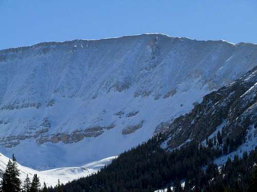
March 29: Bull Hill (Colorado)
At 13,761 feet (4195 meters), Bull Hill is the highest named “hill” in the United States. It is still one of the higher mountains in the lower 48 States and much bigger than many mountains.
I met Ben, Bethany, Brian and two dogs at the trailhead and we headed up the mountain. There was some confusion about finding the beginning of the route and once we did, the going wasn’t that easy. There was lots of postholing, even with snowshoes and lots of tricky side stepping. It was a bit of a struggle to reach timberline.
One we hit the timberline, the climbing was faster, but it was windy and cold. The weather really had an identity crisis today and the weather would turn anywhere from breaks of sunshine to blizzard in a matter of less than a minute. We had a mix of views and clouds, but got some peekaboo views of some of the surrounding mountains.
After enjoying the summit, we headed back down the mountain. It was a much faster trip down than it was up.
March 24: Cedar Mountain (Utah)
I ran up Cedar Mountain starting at sunset so I could see the sunset and the nearly full moon. Since the sun was the opposite direction as the moon, and since cloud cover was sporadic, it made for some beautiful scenes. I completed the short loop.
March 16-17: Lower Muley Twist Canyon (Utah)
March 16
After a fairly late start, Kimberly, Kessler, Shaylee and I started up the Cutoff Trail on our way to Muley Twist Canyon. We found some descriptions of the Cutoff Trail to be over exaggerated as far as difficulty goes. It was a beautiful route.
Near where the trail traverses over to the saddle, Kessler, Shaylee and I decided to take a detour and to climb one of the high fins for the views and for a little fun. We found a challenging route up one of the big fins, but Shaylee stopped about seven feet from the summit.
After climbing the big fin, we made our way back to the standard route and then it was up and over the saddle and down into Muley Twist Canyon. We found water at the junction of the Cutoff Trail and Muley Twist Canyon, which was a good sign.
We continued down canyon enjoying the scenery and overhangs. It was mostly cloudy and rained a bit, but began to clear late afternoon.
We reached Cowboy Camp at around 4:30 pm and since there was some clear water available there, we decided to set up camp and explore around. We saw many old signatures including one we found, which was possibly from 1895 (it was hard to read). We found two others from 1896 and the others were mostly from the 1920’s, but some were from 1914 and some others were from 1936.
March 17
The next morning, after packing up camp, we headed down Muley Twist through the Fold and back up Halls Creek to the trailhead. We didn’t stop or poke around too much so we completed the 7 miles in three hours.
Overall, Lower Muley Twist is pretty average scenery wise, when in comparison to the nearby canyons, but with the big undercuts and signatures, it’s pleasant enough.
The weather was really good and nearly idea, temperature wise, but the drive home was windy and with dust storms. We were glad that we completed the hike before the wind hit.
March 9-10: New York Mountain (Colorado)
March 9
After debating whether or not we should go or not, Kessler and I finally decided to head off towards the trailhead for the Polar Star Hut and New York Mountain. It was already snowing hard and winter storm warnings were out.
We had a reservation for the hut, but I wasn’t sure if I wanted to make the drive through the snowstorm. We decided to try it, but to turn back if things got bad. I also loaded up the vehicle with lots of emergency supplies before heading off.
The drive down to the trailhead was indeed dicey and unpleasant, but we made it. We set off towards the cabin in the snowstorm. Because it was snowing hard and much of the trail was covered, we had to pay close attention as to where the trail was.
We actually made pretty good time to the cabin (especially considering that we had to break trail part of the way), reaching it in four and a half hours. We didn’t want to risk getting caught in the dark during the storm, so we really booked it. We didn’t even break for lunch, though we did stop briefly to wolf down some donuts.
March 10
We awoke to cloudy skies and -2F. It was snowing lightly, but we set off for New York Mountain and as we climbed higher, the sky began to clear. Once we hit timberline, the sky was mostly clear except for some beautiful swirling clouds on the mountains. The chill factor was way below zero on the ridge, but it was very beautiful.
Kessler wasn’t feeling well the night before and wasn’t feeling well today, so we decided to turn back before reaching the top. We took a break to take some photographs and enjoy the spectacular views, but we didn’t stay that long because it was cold.
We headed back down the mountain before taking a long rest and heading back to the trailhead. It was a good trip, but was the first failure of the year. We’ll be back to finish the climb of New York Mountain!
March 2-3: Confluence Overlook/Powell Route/Red Lake Canyon (Utah)
March 2
Kessler, Shaylee, Kimberly and I set off to do a loop in the Needles of Canyonlands National Park. We were to attempt the difficult Powell Route down to the Colorado River; which was the main objective. We then planned on exiting Red Lake Canyon.
At first we had a little trouble obtaining a permit because the park rangers said that our route was impossible. After some explaining that I had scouted the route, they gave us a permit, but told us to report back when we completed (or failed on) the route.
From Elephant Hill we hiked (the road wasn’t open for the season until right when we began the hike) rather quickly to the Confluence Overlook. After enjoying the fine views, we descended the canyon that led to the Powell Route. Although much of it was dry, there were some icy spots and the going was very slow.
We found the correct benches and ledges along the Powell Route, but it was very steep, difficult and exposed and some areas were loose. It took several hours to reach the Colorado River. The final portion to the river was the worst and I don’t know if we were on route or not.
We had hoped to make it down to Red Lake Canyon, but we only made 0.6 miles along the Colorado River before it was getting dark. We found a place to camp and had a good dinner before heading off to bed. We had completed 11 miles this day, which was actually very god considering that the route was so rugged.
March 3
Because we had a 12 mile hike, and a long drive home, we woke up early and started hiking down river. The route was fairly easy for the 3.0 miles along the river, but there were some areas that were brushy and a few areas where scrambling over boulders was required.
Once we were at Red Lake Canyon, we took the Red Lake Route back to Elephant Hill. The route has a reputation of being very strenuous, but it was actually a welcome relief from the route we did the day before. It went rather smoothly except for the upper portion of Lower Red Lake Canyon where the route was covered in ice and snow. Other than this, the route was pretty well marked.
We were all glad to complete the route, but we were very tired. We should have taken three days for the trip Because of the ruggedness, 23 miles made a really long two day trip.
Unfortunately, the camera was left home for this trip. This was very sad because I don’t think I’d do the route again. It was an interesting route, but once is enough.
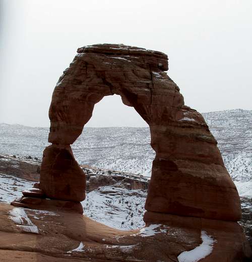
February 24 Delicate Arch/Un-named Butte (Utah)
While the rest of the group went off to explore Sevenmile Canyon, Justin Kuhn, Shaylee, Kessler, Kimberly and I hiked to Delicate Arch. It had snowed the night before, so I wanted to get photos of arches in the snow. The route was a bit slippery and the photos didn't turn out quite as well as hoped because of the lighting.
We also climbed the highest butte around Delicate Arch. It was a really fun scramble.
February 23 Rock of Ages (Utah)
A group of us, led by Shane Burrows, completed the Rock of Ages Scrambling/Canyoneering Route. Kessler, Shaylee, Kimberly and I had fun and the route went smoothly. It was actually easier than expected because the slot was not filled with water as it usually is.
At the end of the route, Justin, Kimberly, the kids, I and others did an alternate route around the big drop.
February 18: Morocco Canyon (Utah)
February 10: Cedar Mountain (Colorado)
Bad weather kept us close to home all weekend, so I did an afternoon climb of Cedar Mountain. I saw many deer on Cedar Mountain and many elk on the drive back.
February 3: Cedar Mountain (Colorado)
Shaylee, Kessler, and I made an afternoon and evening climb of Cedar Mountain. We completed the short loop. Snow conditions were really good.
February 1-2: Fletcher's Cabin and Un-named Peak (Colorado)
February 1
I went with the scouts to snowshoe to a cabin north of Steamboat Lake. We started north and on track, but soon it began to snow hard and visibility dropped. Trail-breaking was really difficult and strenuous. It got dark as well. Once we hit the forest, we veered off track and it took a while to find the cabin in the dark and in the snow. After about five hours from leaving the car we found the cabin. I slept outside so I wouldn't be bothered by the snoring.
February 2
It cleared last night, so the temperature really dropped. My thermometer indicated that the low was -12.6F.
In the morning, several of us hiked to a small peak in order to go sledding and snowboarding. I climbed up to the summit while everyone else played on the slopes. The views were really great and it was a nice day.
The trip back was much easier and less strenuous than the trip in.
Highest Elevation Reached
14,428 feet (4398 meters) on Mount Massive (Colorado); June 22.
Highest Elevation Reached in USA
14,428 feet (4398 meters) on Mount Massive (Colorado); June 22.
Highest Sleeping Altitude
12,000 feet (3658 meters) at Fourmile Creek (Colorado); January 18-19.
Highest Sleeping Altitude in USA
12,000 feet (3658 meters) at Fourmile Creek (Colorado); January 18-19.
Highest Elevation Climbed To By Month
| Month | Feet | Meters |
| JAN | 14,040 | 4279 |
| FEB | 8260 | 2518 |
| MAR | 13,823 | 4213 |
| APR | 13,164 | 4012 |
| MAY | 14,115 | 4302 |
| JUN | 14,428 | 4398 |
| JUL | 14,411 | 4393 |
| AUG | 14,051 | 4283 |
| SEP | 12,620 | 3847 |
| OCT | 12,060 | 3676 |
| NOV | 14,270 | 4350 |
| DEC | 11,725 | 3574 |
Highest Outdoors Sleeping Altitude by Month
| Month | Feet | Meters |
| JAN | 12,000 | 3658 |
| FEB | 8100 | 2469 |
| MAR | 11,040 | 3365 |
| APR | 11,360 | 3463 |
| MAY | 10,160 | 3097 |
| JUN | 10,800 | 3292 |
| JUL | 11,100 | 3383 |
| AUG | 10,300 | 3139 |
| SEP | 10,300 | 3139 |
| OCT | 11,350 | 3460 |
| NOV | 5800 | 1768 |
| DEC | 10,980 | 3347 |
December 10
Highest ascent in Trinidad and Tobago 3087 feet (941 meters).
July 7
Highest July ascent; 14,411 feet (4393 meters) on Mount Rainier. Previous July record was 14,291 feet (4356 meters) on Mount Lincoln on July 4 2009.
The July 7 ascent of Mount Rainier was also my highest Washington ascent. Pervious Washington record was 12,276 feet (3742 meters) on Mount Adams on July 15 1999.
July 6-7
Highest camp/sleeping altitude in Washington; 11,100 feet (3383 meters) at Ingraham Glacier. Previous July record was 9250 feet (2819 meters) at Lunch Counter (Mount Adams) on July 14-15 1999.
June 22
Highest June ascent; 14,428 feet (4398 meters) on Mount Massive. Previous June record was 14,276 feet (4351 meters) on Mount Antero on June 2 2012.
May 16
Highest May ascent; 14,115 feet (4302 meters) on Pikes Peak. Previous May record was 13,820 feet (4288 meters) on a false summit of Mount Antero at 13,820 feet (3926 meters) on May 22 2010.
January 18-19
Highest January camp/sleeping altitude in Colorado; 12,000 feet (3658 meters) at Fourmile Creek. Previous January record was 11,750 feet (3581 meters) at Pacific Creek on January 7-8 2011.