Toggle navigation
Mountains
Routes
Images
Trip Reports
Forum
What's New
People
Areas & Ranges
Articles
Trailheads
Canyons
Huts & Campgrounds
Albums
Logistical Centers
Fact Sheets
Lists
Custom Objects
Gear
Plans & Partners
WELCOME TO SUMMITPOST
SIGN IN
REGISTER
East Fork Blacks Fork - East Ridge
Additional Parents
Image
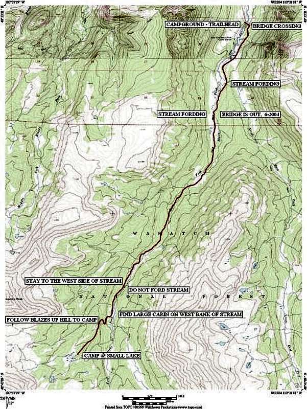
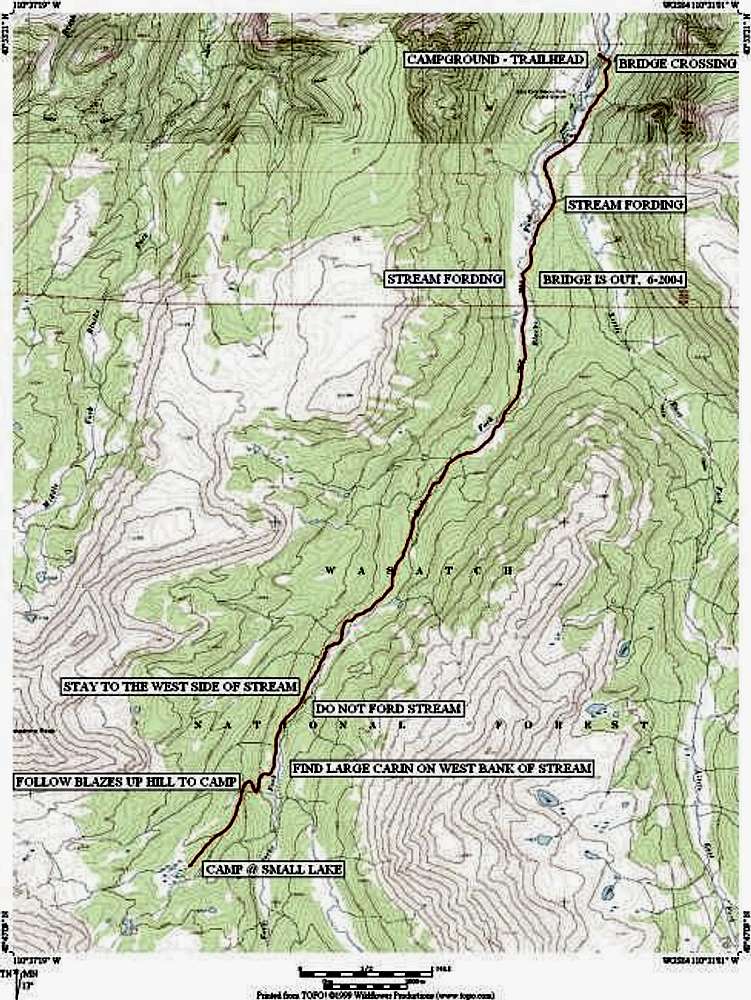
24K quad based route map from...
View High-Resolution Image
24K quad based route map from...
24K quad based route map from trailhead on the north to the camp @ small lake on the south.
« PREV
NEXT »
grandwazoo
on
Jul 7, 2004 7:51 pm
Comments & voting
Other parents
Lat/Lon:
40.78340°N / 110.6232°W
Image ID:
59744
2562 Hits
73.06
% Score
3
Votes
Log in to vote
Comments
No comments posted yet.
to post!
Don't have an account?
East Fork Blacks Fork - East Ridge
(Route)
« PREV
Viewing
#8 of 9
GALLERY
NEXT »
grandwazoo's Image Gallery
« PREV
Viewing
#340 of 468
GALLERY
NEXT »
Wasatch BM
(Mountain/Rock)
Loading....
×
You need to login in order to vote!
User Name
Password
Remember me
Forgot your password?
Log me out when I close my browser.
Keep me logged in all the time.
sign in as a user
Don't have an account?
Register now for FREE
Rating available
Suggested routes for you
People who climb the same things as you
Comments Available
Create Albums
Register Here


