
Viewing: 1-4 of 4

emunsing - Dec 10, 2013 2:11 pm - Voted 10/10
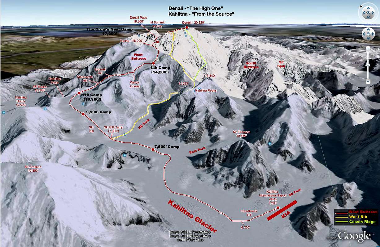
GPX or KMZ files?Nice job with the route trace and image; I'd love to have a copy of this for an upcoming Denali trip. Do you have a gpx or kmz file from this?
emunsing - Dec 10, 2013 2:11 pm - Voted 10/10
GPX or KMZ files?Nice job with the route trace and image; I'd love to have a copy of this for an upcoming Denali trip. Do you have a gpx or kmz file from this?

PellucidWombat - Dec 10, 2013 7:19 pm - Hasn't voted
Re: GPX or KMZ files?I don't, but it has been casually on my 'to do' list to go back and do. I won't have access to my Alaska Topo! CD for making GPX files for about a week, but I can whip together a Google Earth KMZ file in the mean time and send it your way.
Cheers,
Mark

RobertDangerByrd - May 23, 2015 12:18 pm - Hasn't voted
Re: GPX or KMZ files?I too would like a copy of the KML if you have it. I leave for Denali in 9 days. http://www.robertdangerbyrd.com
Viewing: 1-4 of 4


Comments
Post a Comment