Toggle navigation
Mountains
Routes
Images
Trip Reports
Forum
What's New
People
Areas & Ranges
Articles
Trailheads
Canyons
Huts & Campgrounds
Albums
Logistical Centers
Fact Sheets
Lists
Custom Objects
Gear
Plans & Partners
WELCOME TO SUMMITPOST
SIGN IN
REGISTER
East Face Gully
Additional Parents
Image
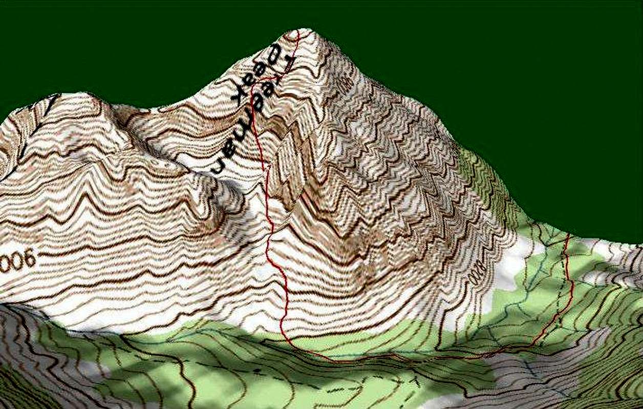
3D Topo of Climbers' Route
View High-Resolution Image
3D Topo of Climbers' Route
This Topo shows the climbers' route as it ascends through the cirque, up the gully, and onto the face, on its way to the summit of Freeman Peak, GPS recorded 3sep06.
« PREV
NEXT »
Michael Hoyt
on
Sep 5, 2006 9:09 pm
Comments & voting
Other parents
Lat/Lon:
45.27450°N / 113.7001°W
Image Type(s):
Topo/Diagram
Image ID:
223057
1769 Hits
71.06
% Score
1
Votes
Log in to vote
Comments
No comments posted yet.
to post!
Don't have an account?
East Face Gully
(Route)
« PREV
Viewing
#10 of 11
GALLERY
NEXT »
Michael Hoyt's Image Gallery
« PREV
Viewing
#1511 of 1801
GALLERY
NEXT »
×
You need to login in order to vote!
User Name
Password
Remember me
Forgot your password?
Log me out when I close my browser.
Keep me logged in all the time.
sign in as a user
Don't have an account?
Register now for FREE
Rating available
Suggested routes for you
People who climb the same things as you
Comments Available
Create Albums
Register Here


