Toggle navigation
Mountains
Routes
Images
Trip Reports
Forum
What's New
People
Areas & Ranges
Articles
Trailheads
Canyons
Huts & Campgrounds
Albums
Logistical Centers
Fact Sheets
Lists
Custom Objects
Gear
Plans & Partners
WELCOME TO SUMMITPOST
SIGN IN
REGISTER
Stewart Peak
Additional Parents
Image
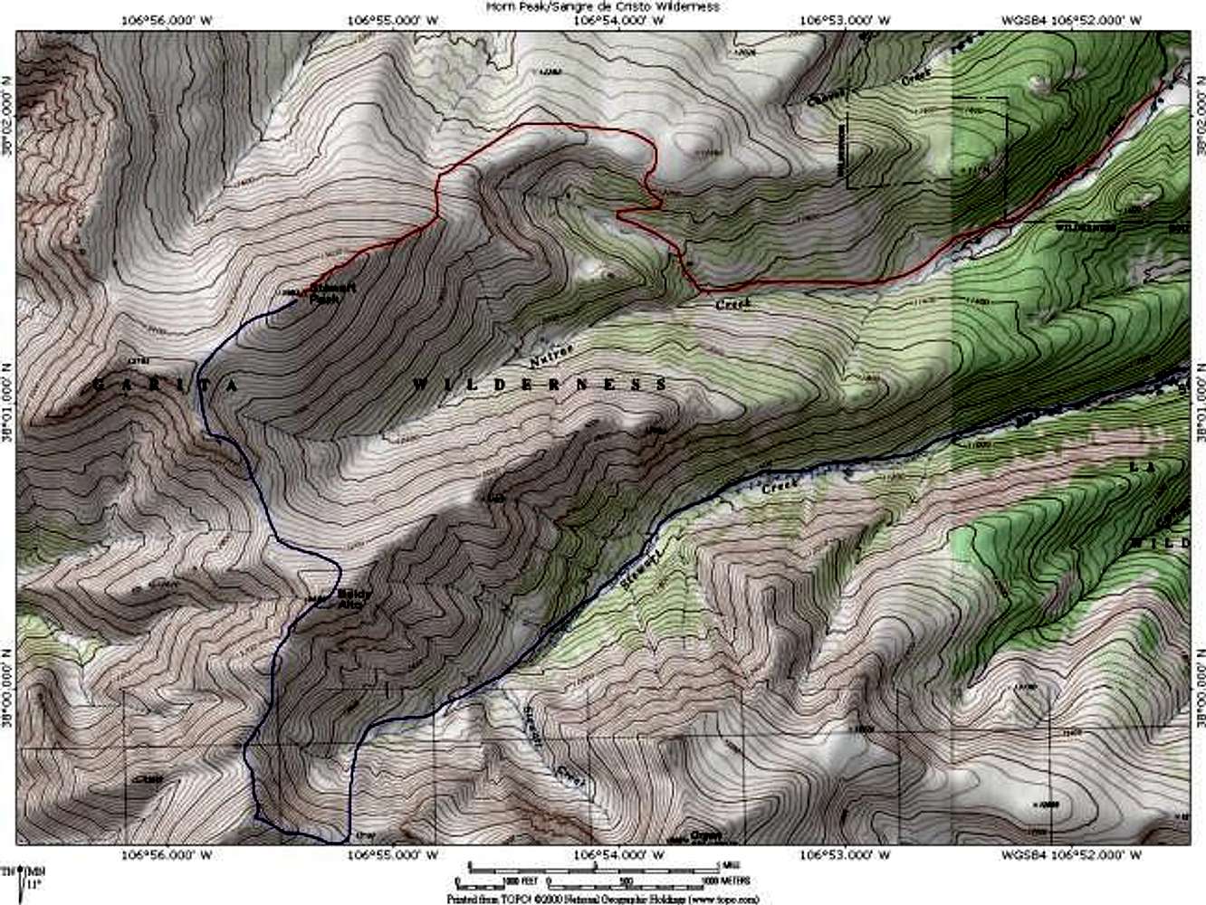
A topo map depicting eastern...
View High-Resolution Image
A topo map depicting eastern...
A topo map depicting eastern routes on Stewart Peak. The route in red is the Nutras Creek Route. The route in blue is the Stewart Creek Route (that can be combined with San Luis Peak). Created with National Geographics Topo! software. Jon Bradford
« PREV
NEXT »
JonBradford
on
Oct 30, 2003 11:08 pm
Comments & voting
Other parents
Lat/Lon:
38.02300°N / 106.923°W
Image ID:
31942
3802 Hits
74.92
% Score
5
Votes
Log in to vote
Comments
No comments posted yet.
to post!
Don't have an account?
Stewart Peak
(Mountain/Rock)
« PREV
Viewing
#18 of 32
GALLERY
NEXT »
JonBradford's Image Gallery
« PREV
Viewing
#581 of 1444
GALLERY
NEXT »
×
You need to login in order to vote!
User Name
Password
Remember me
Forgot your password?
Log me out when I close my browser.
Keep me logged in all the time.
sign in as a user
Don't have an account?
Register now for FREE
Rating available
Suggested routes for you
People who climb the same things as you
Comments Available
Create Albums
Register Here


