
-
 30403 Hits
-
 86.85% Score
-
 23 Votes
|
|
Mountain/Rock |
|---|---|
|
|
38.02300°N / 106.923°W |
|
|
13983 ft / 4262 m |
|
|
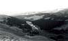
La Garita Mountains Overview
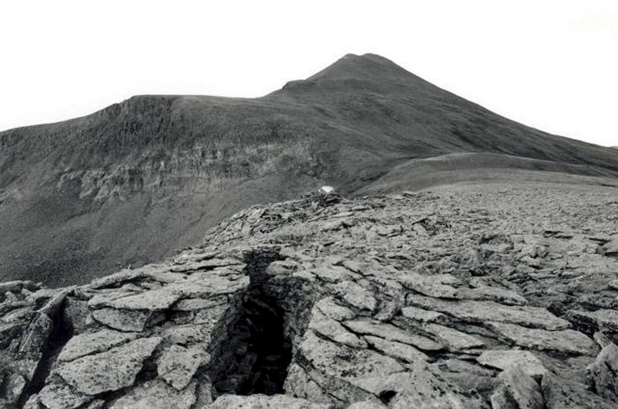
Above is a somber Stewart Peak above a field of felsenmeers. Black and White Photo taken July 2002.
 The La Garita Mountains are a gentle subsection of the San Juans located north of Creede and south of Gunnison. They are a remote series summits that guard the northeastern corner of the mighty San Juans. The main body of these mountains lies within the La Garita Wilderness. This large (126,626 acres) wilderness area offers excellent camping and hiking in a locale well removed from civilization.
Prominent summits of the La Garita Mountains are Stewart Peak, San Luis Peak, Organ Mountain, Creede Crest (a.k.a Phoenix Peak), and the suprising Twin Peaks. These summits are generaly quite gentle, offering pleasant strolls up grass and wildflower covered slopes. There are exceptions to this rule however; the ridge connecting San Luis Peak and Organ Mountain has a ghoulish gash in it, Organ Mountain's south face is a steep sequence of chimmneys and towers, and Twin Peaks vies with Turret Ridge as the most difficult summit in Colorado. Bob Martin and Mike Garret described climbing this mushroom capped summit akin to "ascending a verticle mud pile" The geology of this region is probably responsible for this characterization.
The rocks of the La Garitas are primarily 25 million year old volcanics produced by some exceedingly violent eruptions. Sections consist of horizontal layers of resistent basalt (responsible for the columnar jointing on Stewart Peaks Columnar Ridge and the "cap" on Twin Peaks) and the weirdly eroded layers of volcanic Tuff that make up the pinacles of the Wheeler Geologic Area. Ash from the eruptions in this area of the San Juans is responsible for the layers of bentonite west of Denver. Such an outpouring of volcanic material dwarfed the Mount Saint Helens eruption. As you wander this gentle region think back to what it was like when the earth heaved and vomited forth thousands of metric tons of glowing ash 25 million years ago.
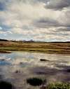
In addition to the high summits, the La Garitas boast some extensive alpine mesas. Willow Mesa boarders Stewart Peak on the east while the majestic Snow Mesa sits of to the west of San Luis Peak. Snow Mesa represents one of the largest pieces of alpine tundra in the lower 48 states.
 |  |  |  |  |
Stewart Peak Overview
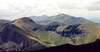
Stewart Peak is a prominent and beautiful summit on the north end of the La Garita Mountains. Seen from near Dome Lake it is much more prominent then the nearby fourteener San Luis Peak. Once considered a fourteener until decommissioned by a subsequent survey it now stands as one of the more neglected of Colorado's Centenial Peaks (as well as the second highest thirteener in the state). Indeed this mountain offers a place to get away from it all; a perfect place for escapists wanting to relax. Few people come here.
The volcanic rock that composes this region has weathered into lush gentle slopes that support outragous displays of wildflowers. The slopes of Stewart are easy to ascend offering pleasant strolling terrain. The west ridge of Stewart Peak sports some columnar jointed basalt akin to Devils Tower in Wyoming.
Wildlife viewing opportunities abound on Stewart Peak. The valleys below the summits have some extravagant beaver tenements (Nutras Creek especially). In addition, the La Garitas have immense herds of elk and recently reintroduced moose (Stewart Creek was the original site of the reintoduction but nearby draineges have been colonized).
 |  |  |  |  |
Getting There
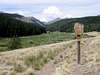
The La Garitas are about as close to "the middle of nowhere" as you can get in Colorado. Starting from the US 50-Colorado 114 junction (7.5 miles east of Gunnison) go south 20 miles on Colorado 114. Turn right on Saguache County Road NN14. Follow Saguache County Road NN14 7 miles to Upper Dome Reservoir's south end (an excellent view of the La Garitas can be had from here) and then turn right on Saguache County Road 2166. Continue on this road as it becomes Forest Service Road 794. You will pass signs pointing toward the Stewart Creek Trailhead (famous for being the starting point for the fourteener San Luis Peak). Stay on this road for 18.6 miles from the junction of Saguache County Road NN14 and Saguache County Road 2166. The stream crossing at this point is Nutras Creek. This can be considered the Trailhead for the Nutras Creek Route (although it is unsigned and doesn't have an official trail). As Stewart can be combined with Organ Mountain or San Luis Peak one can also continue on another mile to the Stewart Creek Trailhead, which is signed.
 |  |  |
Red Tape
The La Garitas are free and easy even by Colorado Wilderness standards. No permits are required. Please behave in manner consitent with wilderness regulations.
When To Climb
The exceptionally long dirt road approaches to Stewart Peak allow practical ascents only to be made from about mid June through October. Just getting close to this mountain would be an ardous winter endeavor.
 |  |
Camping
The gentle rolling terrain of the La Garitas provides ample camping both near the Trailheads and within the wilderness boundaries.
 |  |
Mountain Conditions
Contact Info:
Saguache Ranger District (USFS)
46525 State Highway 114, Box 67
Saguache, CO 81149
719-655-2547
Weather Forecast:
