Toggle navigation
Mountains
Routes
Images
Trip Reports
Forum
What's New
People
Areas & Ranges
Articles
Trailheads
Canyons
Huts & Campgrounds
Albums
Logistical Centers
Fact Sheets
Lists
Custom Objects
Gear
Plans & Partners
WELCOME TO SUMMITPOST
SIGN IN
REGISTER
Alaska Range
Additional Parents
101 Ways to Pass Time at Camp (On the Ruth Glacier)
Image
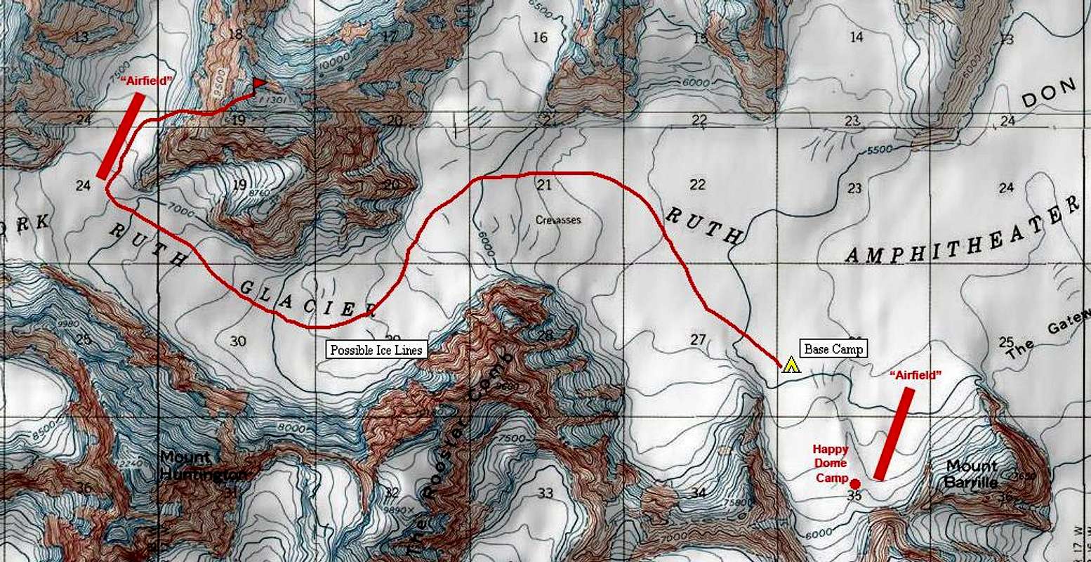
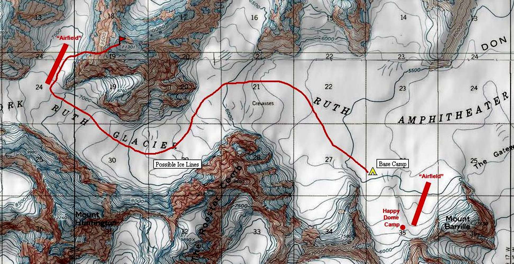
A Topographic Map of the Ruth Gorge
View High-Resolution Image
A Topographic Map of the Ruth Gorge
June 2006 - This is a topographic map of the West Fork of the Ruth Glacier, with our proposed new route ascending Pk 11,300 via a direct line on the NW Face. We had expected that later days could entail ice climbing new routes on the Rooster Comb.
« PREV
NEXT »
PellucidWombat
on
May 28, 2006 8:41 am
Comments & voting
Other parents
Image Type(s):
Alpine Climbing
,
Topo/Diagram
,
Informational
Image ID:
196585
11462 Hits
74.01
% Score
4
Votes
Log in to vote
Comments
No comments posted yet.
to post!
Don't have an account?
Alaska Range
(Area/Range)
« PREV
Viewing
#93 of 146
GALLERY
NEXT »
PellucidWombat's Image Gallery
« PREV
Viewing
#980 of 2324
GALLERY
NEXT »
101 Ways to Pass Time at Camp (On the Ruth Glacier)
(Trip Report)
Loading....
×
You need to login in order to vote!
User Name
Password
Remember me
Forgot your password?
Log me out when I close my browser.
Keep me logged in all the time.
sign in as a user
Don't have an account?
Register now for FREE
Rating available
Suggested routes for you
People who climb the same things as you
Comments Available
Create Albums
Register Here


