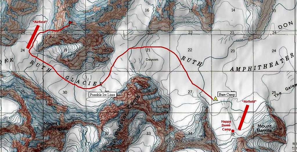
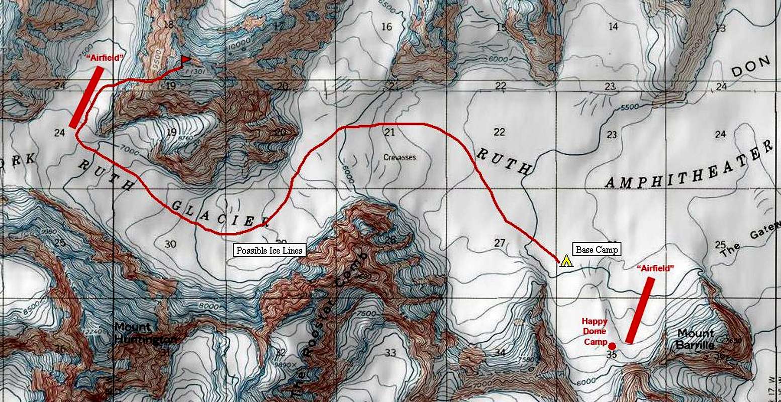
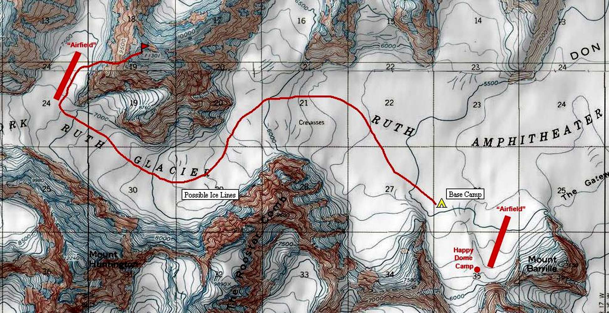
A Topographic Map of the Ruth Gorge
June 2006 - This is a topographic map of the West Fork of the Ruth Glacier, with our proposed new route ascending Pk 11,300 via a direct line on the NW Face. We had expected that later days could entail ice climbing new routes on the Rooster Comb.


