Welcome to SP!  -   
 
 New features are here! - Read More... 
Areas & Ranges·Mountains & Rocks·Routes·Images·Articles·Trip Reports·Gear·Other·People·Plans & Partners·What's New·Forum

A view looking down from the...

 
[ Sizes: Orig | Med | Small | Thumb ]
A view looking down from the...
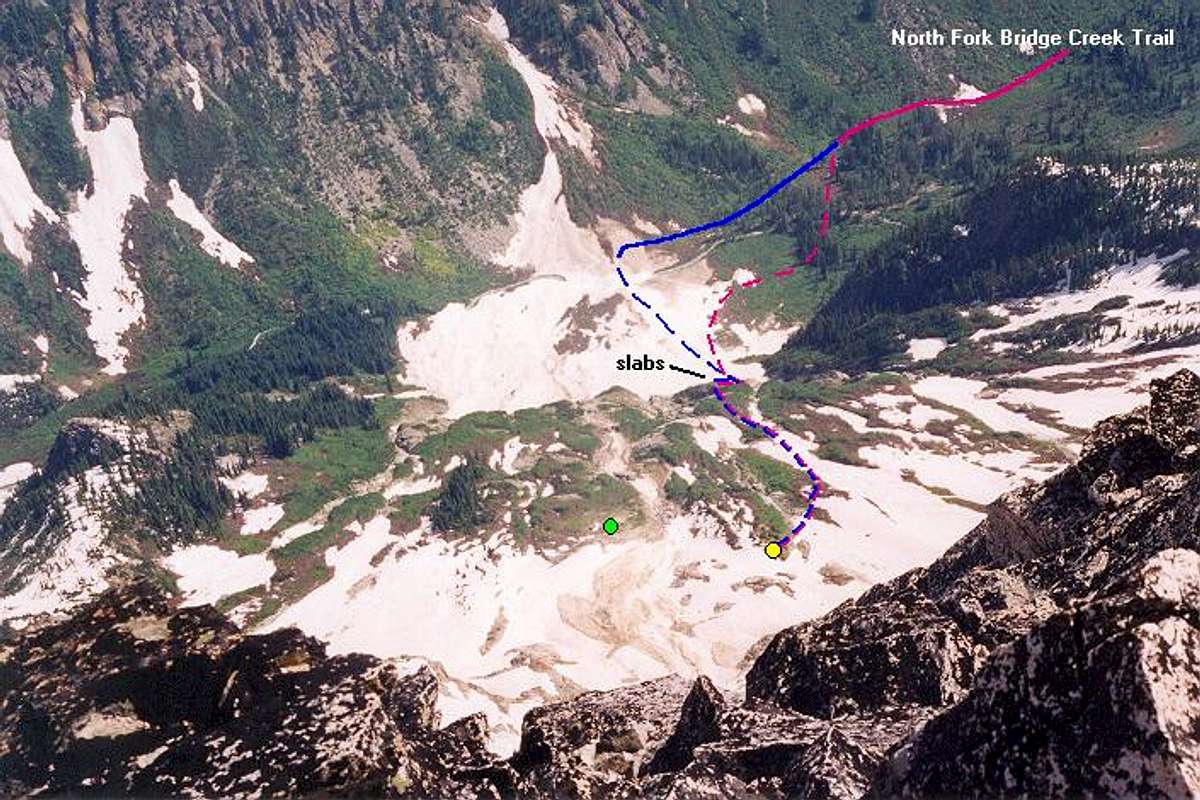
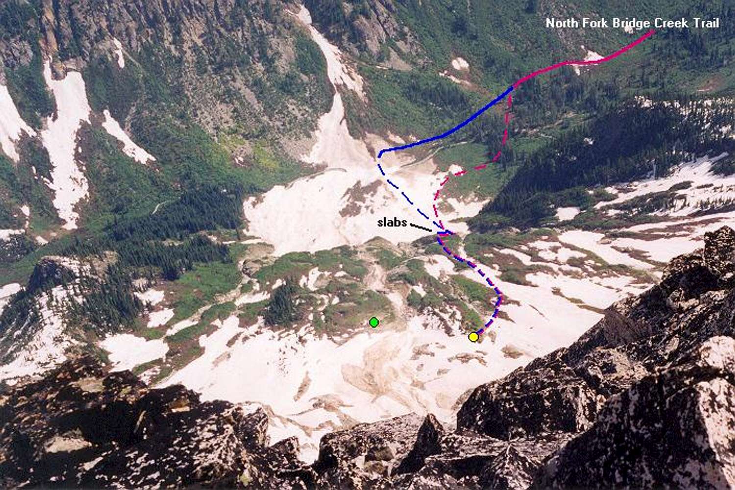
A view looking down from the Northeast Buttress toward North Fork Bridge Creek. The solid red and blue lines designate the trail. In early season, it may be possible to cross the creek over avalanched snow (dashed blue line), else make a crossing in the trees (dashed red line). For a picture of the slab area, click here. Our bivy site was at the yellow dot. Another party camped at the green dot. July 5, 2002.


Comments

No comments posted yet.


Sign in to post!

Don't have an account? Register now.


Rate This Image
Current Score: 86.24

Log In To Vote
 Goode Mountain (Mountain/Rock)

Mt. Goode from the west on...
« PREV

Viewing
#45 of 68
GALLERY
The approach to the NE...
NEXT »

 Klenke's Image Gallery

A beautiful florescence along...
« PREV

Viewing
#2588 of 5079
GALLERY
The approach to the NE...
NEXT »


 Northeast Buttress (Route)


Image Data

KlenkeSubmitted by Klenke
on Nov 18, 2003 8:37 pm

Image ID: 33494
Hits: 1413 

Lat/Lon: 48.48000°N / 120.91°W


"Thank goodness. This reinforces my simplistic world view."   --The Tick   

© 2006-2012 SummitPost.org. All Rights Reserved.