
-
 31757 Hits
-
 86.37% Score
-
 22 Votes
|
|
Area/Range |
|---|---|
|
|
41.27781°N / 108.25104°W |
|
|
Hiking, Scrambling |
|
|
Spring, Summer, Fall, Winter |
|
|
7000 ft / 2134 m |
|
|
Overview
 |
 |
|---|
 |
 |
|---|
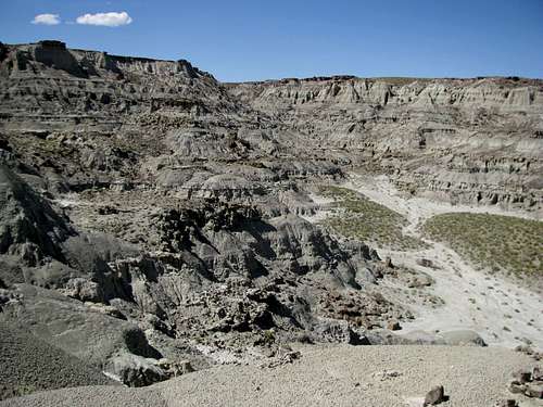
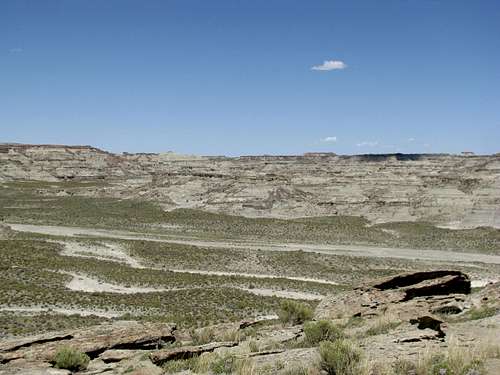
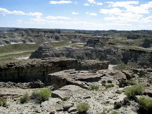
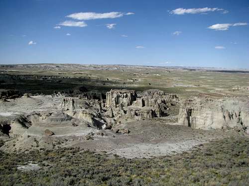
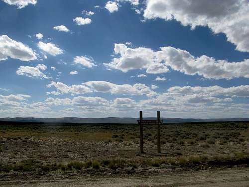
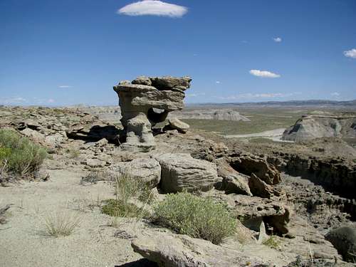
Somewhere, in the middle of nowhere, there is a place they call Adobe Town. Located incongruously near the border of Colorado and Wyoming, one follows unmarked and unpaved roads for hours through the high plains on the fringes of Wyoming’s Red Desert, de facto the Outback of the Rockies. Tumbleweeds blow past, and sparse pockets of sagebrush line the grey landscape towards unnamed buttes on the far horizons.
 |
|---|
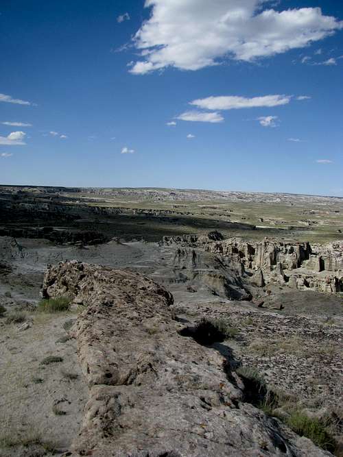
So here you stand on this barren soil, perhaps wondering at the sanity of your choice in destination. All around you, beyond your line of vision, lie unseen greatness. Somewhere to the north, beyond the Great Divide Basin, lie the Wind Rivers, the Absarokas, the Tetons. To the southwest flank the remote and puzzling East-West slopes of the Uintas. Past the southeast horizon the Colorado Rockies rise to cloud defying heights. Yet here, the sun bears down on you, there is little water to spare, and you trudge on through blandness.
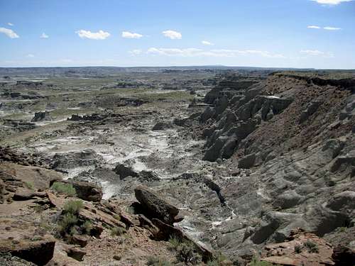
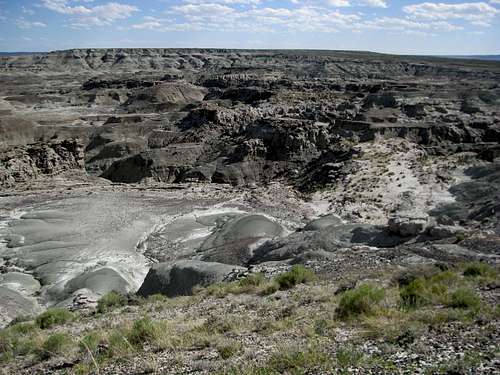
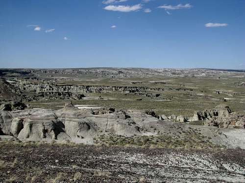
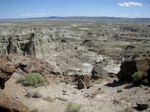
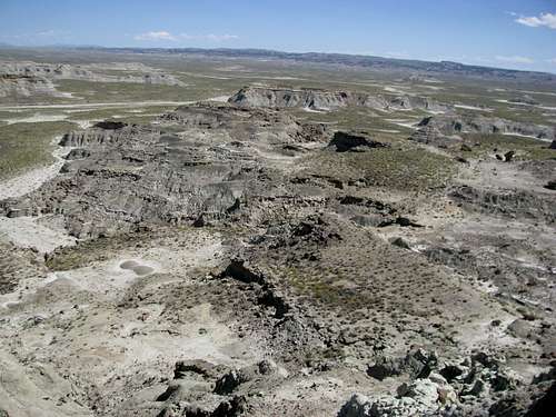
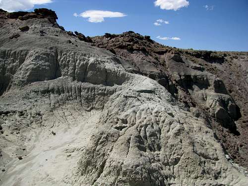
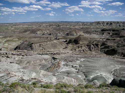
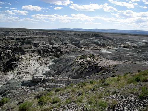
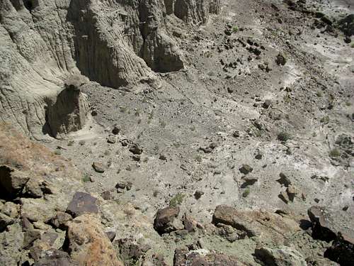
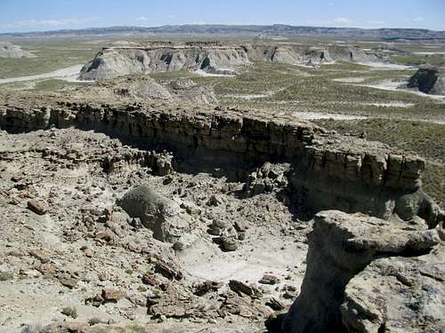
But though the gems of the American west tease you with their distant and ephemeral presence, there is a wonder here too, as rich, dazzling, and awe-inspiring as any tableau on the Contintent, and likewise, hidden from you. Unlike the others however, this wonder is but separated from you by only the immediate horizon. Push your Jeep a little further down the dirt path, up the gentle prairie slope of the desert, past a few more horizons, and suddenly the immediate landscape ends, morphing into a dizzying array of badlands, ravines and gulches.
 |
 |
|---|
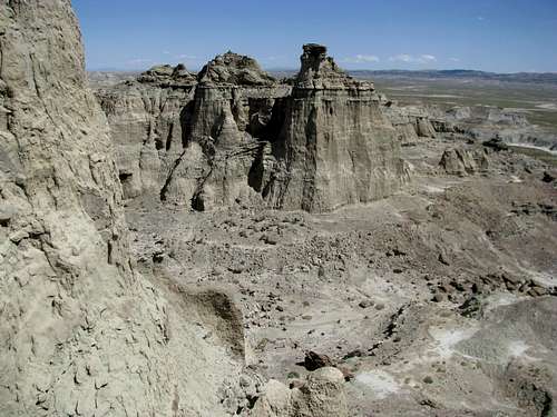
The few who have seen this place compare it to the Badlands of the Dakotas, or to Bryce Canyon in Utah. While bearing some similarities to its more famous cousins, to label Adobe Town one or the other would be doing justice to neither them nor itself. It is its own entity, an individual place for the individualist. Located in any other place the geography, geology, and history of Adobe Town will merit it a coveted spot in the National Park System and the pantheons of American Pride and Glory. Here in Wyoming, adjacent to rich oil fields and natural gas reservoirs, Adobe Town is unsigned, untrailed, and unadvertised.
To find it will require you to take your own initiative through a maze of back roads miles from the highway and any other vehicular traffic. And while its proximity to such exploitable wealth has conjured up its fair share of environmental controversy, one side effect of it all, a benefit for some, is that the lack of any official designation has and continues to keep the crowds away.
As you stand and admire by yourself this truly primeval landscape and amble lonesomely along its narrow defiles, twists, and turns, take a moment to gather some perspective, to imagine seeing those other American wonders such as Zion, or the Sierras, or the Grand Canyon, as they were hundreds of years ago: virgin, unknown, and seldom touched. While the future of Adobe Town remains in flux and the BLM ponders the pros and cons of development (refineries, wells, smokestacks) versus “preservation” (visitor centers, paved trails, yuppies), one can still savor the place as it presently is: wild, untamed, and free.
 |
 |
|---|
Bring your own food and water here. Better to bring more than what you'd expect to be necessary. If backpacking setting up caches might be helpful. Carry at least a full tank of gas. A spare tire too. You probably won't have cell phone reception.
 |
|---|
If you plan on venturing further beyond the immediate overlooks along the rim and descending into the labyrinth below you should bring a map and compass. Make good mental notes of landmarks, and remember the way you came. This is a wild and desolate land, hot and dry in the daytime, cold and dry at night. Respect the desert, and observe all Leave No Trace guidelines.
 |
 |
|---|
 |
 |
|---|
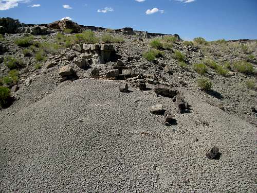
Also, careful not to step on these giant anthills:
 |
|---|
The Areas, and Getting There
This website has pretty good directions for getting to Adobe Town. I'll add and supplement what I can base on road conditions from August 2010.
Adobe Town Rim
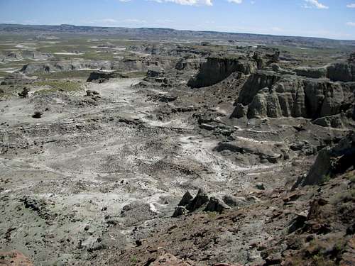
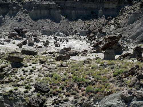
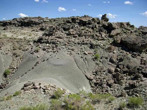
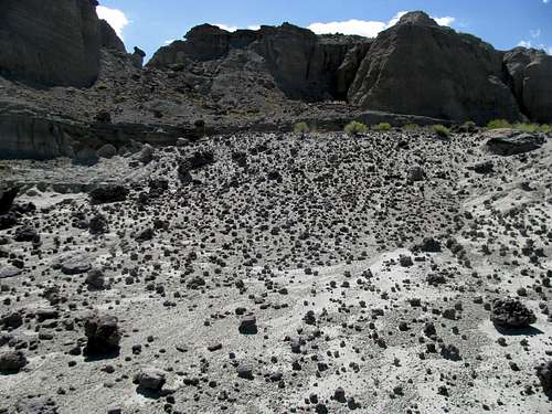
Of the two main access areas the Adobe Creek Rim is closer to major roads. The terrain here is gentler and makes for an easy trail-less descent into the badlands below.
 |
 |
|---|
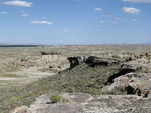
One area to note here is Monument Valley, a miniature version of the famous Arizona landmarks. Look for the signature rock formations.
 Monument Valley
From the North: On I-80 take the Bitter Creek Exit (Exit 142) and follow County Road 19 (S) south a few miles to the town of Bitter Creek. Continue past the town as the road turns to gravel, bearing left at the junction with County Road 24. Around 27 miles from I-80 pass the Eversole Ranch. Bear left at a minor junction at the Eversole Ranch. 1.8 miles south of the ranch CR-19 bears right. Here, bear left and leave CR-19 on a wide, well-graded, and unnamed BLM road (BLM 4412 on some maps). 3.4 miles on reach an unsigned T Junction. Staying straight will take you towards the Skull Creek Rim Access Road and eventually Colorado. Take a left for the Adobe Creek Rim.
From the South: On CO-13 just south of the WY Border and Baggs, WY travel west at the junction with County Road 4. Continue down this road (sometimes paved, sometimes gravel) around twenty miles to the town of Powder Wash, consisting mostly of drilling facilities. Take a right onto County Road 62.
The link above tells you to bear left on any intersection from this point. For the most part this is true, but to avoid getting lost in the various wells and stations of Powder Wash make sure you bear right at the first major intersection after turning on CR-62, less than a mile from CR-4. You should see the one mile mile-marker fairly quickly. If you don’t, you’re not on the right road. After about 3-4 miles you reach the Wyoming border. It is labeled. The road is unnamed, but it is clearly the only major road in the area and I didn’t notice any confusing intersections between the border and Cow Creek Ranch. The road veers west after you’re in Utah and slowly contours NW before pursuing a direct northern course. You get a few sneak peeks at the badlands a few miles before Cow Creek Ranch:
 Cow Creek Ranch |
|---|
It is around 13-14 miles to Cow Creek Ranch from Powder Wash, consisting of a few seemingly abandoned buildings on the left side of the road. Another 8 miles from here look for a fairly wide road branching off on your right. This unmarked, unsigned road will take you to the Adobe Town Rim.
As for the Adobe Creek Rim access road itself, drive east along the road for about 3 miles from the junction. You get your first views of the rim near a drilling facility/building on the left side of the road. On the right, the rim overlooks some badlands. Bear left on the road and you can continue further a little more for some overlooks. Reach an open area where another road bears left (north). I parked here and walked to various points along the rim. According to the maps, this road continues down into the badlands. I didn’t follow it that far. The road going north from here appears to be closed due to the WSA. A passenger car might be able to reach the rim, but 4WD is recommended.
There are signs in this area marking the boundaries of the BLM's Adobe Creek Wilderness Study Area and prohibiting vehicles (including motorbikes and ATV's) from continuing further.
Skull Creek Rim
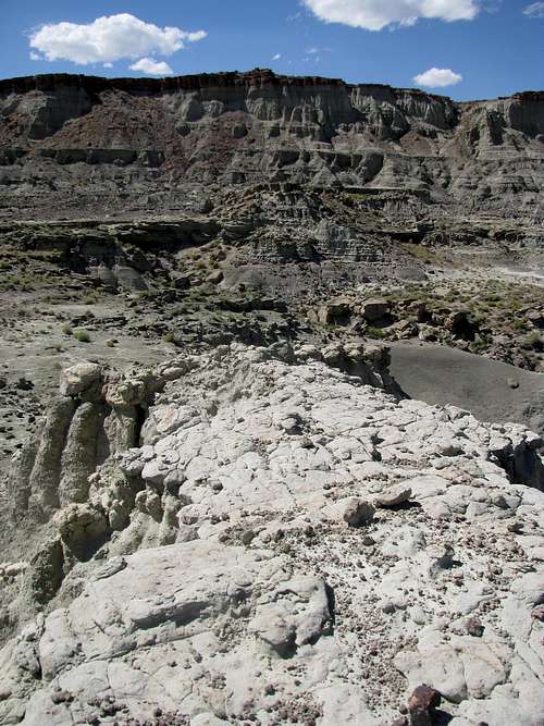
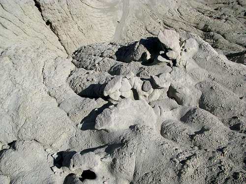
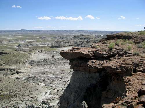
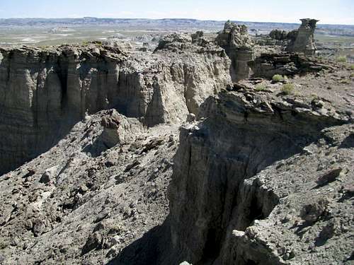
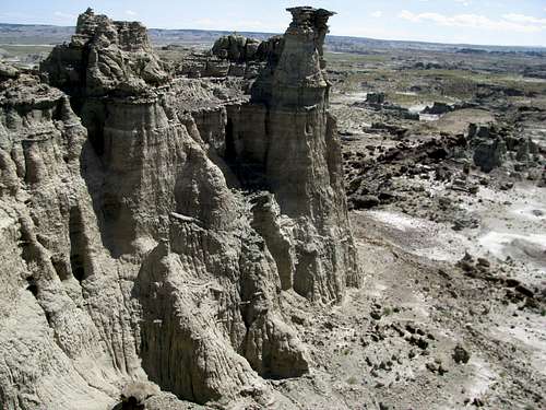
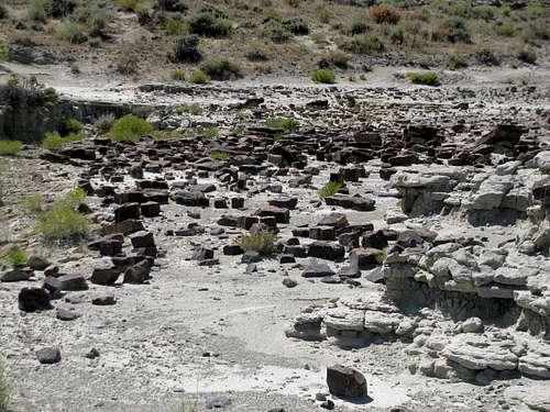
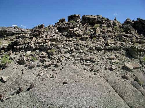
South of Adobe Creek Rim is its more rugged cousin, the Skull Creek Rim. The 200 feet drop-offs here from the rim are steeper, the footing more precarious. Choose your route wisely if descending into the badlands, and don't take any step for granted. Some of the white, dusty-looking fins are quite solid; others are slippery and treacherous.
 |
 |
|---|
 |
 |
|---|
From the North, the junction of the Skull Creek Rim access road is approximately seven miles south of the Adobe Creek Rim road junction. Take a left when you see this sign:
 |
|---|
From the South continue past the Cow Creek Ranch for about a mile, taking a right at the above sign.
It is about 4.2 miles to the end of the road. A passenger car can make it 1.5 miles past the junction. 4WD is recommended for the last 3 miles or so, and definitely required for the last .7 miles.
Most of these roads, especially the 4WD sections, would probably be undrivable immediately after the rare rainstorm.
The Past; The Present
Native Americans have come and gone in this area for centuries. It is sacred to some tribes. Various cowboys and outlaws roamed this area in the 19th century. A popular story claims that Butch Cassidy once hid in the Haystacks area following one of his train robberies.
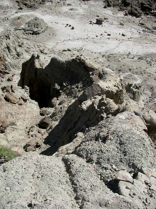
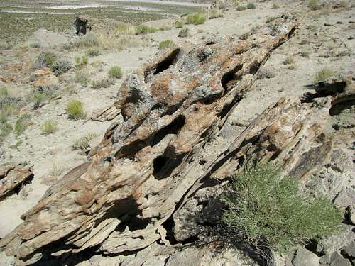
The Yellowstone Super Volcano eruption 55 million years ago spread tons and tons of ash into the surrounding landscape, including over 150 miles southeast of the caldera where Adobe Town is today. Once covered by dense jungle, swampland, and even an extinct lake, millions of years of build-up and subsequent erosion have resulted in the spectacular formations we see today.
 |
 |
|---|
 |
 |
|---|
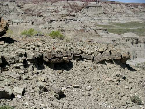
Remnants of these former worlds are continuously rediscovered at Adobe Town in the form of fossils. Erosion has left behind many odd feats of architecture; I noticed several places where the rocks aligned neatly and squarely to resemble foundations laid by master stonemasons and left unfinished in the blistering heat. Explorers and surveyors in the 19th century commented on this as well:
Along the walls of these ravines, the same picturesque architectural forms occur, so that a view of the whole front of the escarpment, with its salient and reentrant angles, reminds one of the ruins of a fortified city. Enormous masses project from the main wall, the stratification lines of creamy, gray, and green sands and marls are traced across their nearly vertical fronts like courses of immense masonry, and every face is scored by innumerable narrow, sharp cuts, which are worn into the soft material from top to bottom of the cliff, offering narrow galleries which give access for a considerable distance into this labyrinth of natural fortresses.
At a little distance, these sharp incisions seem like the spaces between a series of pillars, and the whole aspect of the region is that of a line of Egyptian structures. Among the most interesting bodies are those of the detached outliers, points of spurs, or isolated hills, which are mere relics of the beds that formerly covered the whole valley. These blocks, often reaching 100 feet in height, rise out of the smooth surface of a level plain of clay, and are sculptured into the most remarkable forms, surmounted by domes and ornamented by many buttresses and jutting pinnacles.
 |
 |
|---|
 |
 |
|---|
 |
 |
|---|
 |
 |
|---|
The current Adobe Town Wilderness Study Area, administered by the Bureau of Land Management, covers 85,710 acres. For the most part, it includes the lower badlands, reaching west only to cover the tip of the rims themselves. Many advocacy groups would prefer to see the WSA expanded (to 180,000 acres or so), and to include the Haystacks area northeast of Adobe Creek Rim, an area where private property still checkerboards with BLM owned lands (as well as other areas south of the WSA).
The area is rich in oil and natural gas, and the BLM often leases out parcels of land to private companies. Development has come close to the rim and the badlands themselves. This can be witnessed clearly in the Adobe Creek Rim area, complete with an electric generator type facility as well as signs warning of natural gas pipelines below. Several other projects in the works (Desolation Flats, Desolation Roads), if approved, would result in more drilling leases adjacent to the Rims as well as in the badlands and prairies southeast of and below the Skull Creek Rim. Some facilities located within the WSA predate the WSA itself.
Like the rest of the Red Desert, this area is known for its bands of wild horses. Over the years BLM estimates have ranged from hundreds to over 2,000. Current estimates have it pegged around 800 in an area encompassing Adobe Town and some parts west.
Bobcat sightings have been reported in the wooded ramparts of the Haystacks region.
External Links
BLM WSA Pamphlet
Biodiversity Conservation Alliance Website
Very informative BCA Brochure
Detailed Booklet from BCA (With Pictures)
A Note: I have only had one opportunity to experience this area on an almost cursory visit. I am sure that a lot more information (and pictures) can be added to this page. If you additional information (or corrections), especially about uncovered areas such as the Haystacks, please let me know and I will include them in this page.
geosean - Sep 19, 2011 9:05 am - Voted 10/10
GasIf you're planning on exploring much or driving through Adobe Town you better plan out your gas situation before hand; stations are few and far between. (Also 4wd uses quite a bit more gas than 2wd). The nearest stations would be Wamsutter and Rock Springs, WY and Baggs or Maybel, CO as far as I know. There is no gas on I-80 between Wamsutter and Rock Springs.
Castlereagh - Sep 20, 2011 11:52 pm - Hasn't voted
Re: GasGood point! I think I gassed up in Craig before, Wamsutter after. I'll take a look at the map in the next few days and add in some details about nearby gas.