I was in the area for work and had a couple of days off so I decided to check out Adobe Town (something I had been waiting for an opportunity to do for a while). I drove my stock 4X4 Toyota 4-runner from WY Hwy 430 south of Rock Springs along CR 19 through Kinney Rim after work one evening (after totally topping off my gas tank in Rock Springs). I camped the first night at the edge of Adobe Town Rim on BLM Rd 4412. It was cold at night in mid-September without a sleeping bag but I was fueled with a sense of adventure (and Old Crow).
You could probably drive a relatively high clearance car (if you are determined) at least this far in good weather.
The next morning I spent hiking the canyons and hoodoos of the rim to the north of Rd 4412. It is a really amazing place. If you are used to off-trail hiking it is pretty easy to hike up and down the small canyons individually. And if parked on the rim it is pretty hard to get lost, just head back up hill. I found it pretty easy to find a route from rim to floor in most places.
After a few hours of exploring I climbed aboard my 4wd steed and headed off the rim down the through road (BLM 4412). At the BLM office in Rock Springs they told me the last time anyone tried to patrol the road they couldn’t get across Sand Creek (barely 2 miles from the rim); they didn’t say how long ago that was. Fortunately – though bizarrely – somebody in a pickup came up out of the badlands from the east while I was having lunch on the rim, so I figured it was possible to drive all the way through. The road wasn’t bad at all, real gravel mostly. I didn’t need 4wd until you leave the improved road about 3.5 miles from the rim (except maybe to cross Sand Creek). The creek crossing was easy just a big ledge on the east side.
![1st Sand Creek Crossing]() no problem in 4WD and dry weather
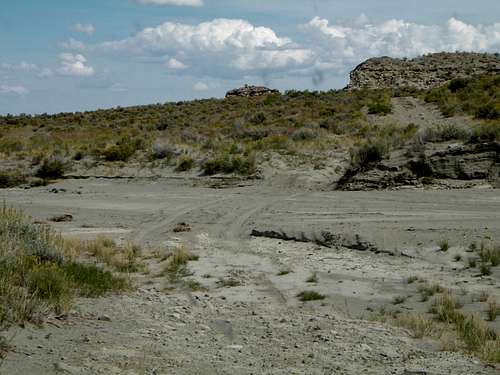
no problem in 4WD and dry weather![typical road in this area]() after you leave the improved road
after you leave the improved road
My intention was to make good the second crossing of Sand Creek that day in case of rain, then camp and finish the drive next day; however storms started to roll in while I was exploring Monument Valley and chasing wild horses on foot so I resolved to head out ‘till I hit the improved road on the east side.
I was navigating with only a DeLorme’s Gazetteer (don’t do this!) Get a real map from the BLM for $4. So I didn’t know there was a canyon you have to descend about 6 mile in from the rim. By the time I realized what was happening I was beginning to think I might be lost, but I was pretty sure I had passed the point of no return gas wise to make it back to Rock Springs. The tracks of the other truck came up the canyon so I knew at least that the road lead somewhere, though this wasn’t all that reassuring.
The road though the canyon was passable to most high clearance 4X4 SUVs, though I’m glad I was coming down and not up. It helped that I pretty much had to do it.
![2nd crossing of Sand Creek]() second crossing of Sand Creek
second crossing of Sand Creek
The worst part of the whole drive was crossing West Haystack Wash. The area was a maze of old “roads” and washouts. I muscled my way across the gully in a few places and did a lot of scouting on foot, only finding what seemed to be the way after resolving to turn back and risk running out of gas (hopefully on blacktop somewhere). I think the earliest you can get across the wash the better you will be. There is a small mesa on the east side; the road goes to the south of this heading easterly.
This was a scary moment… not knowing if my rig would go, not knowing for sure if I was even on the right road, with the sun setting and thunderstorms rolling in – thunder rumbling… not even knowing if the road behind me was even passable any longer.
When I saw the first litter and the road turned to gravel I felt like Columbus proverbially kissing the sand upon landing in the Bahamas. That night I slept the night in the back of the car in howling wind and lashing rain, lightning cracking all around… and it was a great relief knowing that I had reached the relative safety of gravel.
Both crossings of Sand Creek were a piece of cake with 4wd, I’m still not sure if West Haystack Wash can be crossed easily or not, but it is doable, maybe easier if you come from east to west, but then you would have to go up the canyon, also doable however. Surprisingly I had great cell service the whole time (with Verizon). Don’t count on it though, and if you are not from the area consider updating your roaming capabilities by dialing *228 (again for Verizon).
Comments
No comments posted yet.