
-
 12495 Hits
-
 86.85% Score
-
 23 Votes
|
|
Area/Range |
|---|---|
|
|
65.53907°N / 147.00653°W |
|
|
Hiking |
|
|
Overview
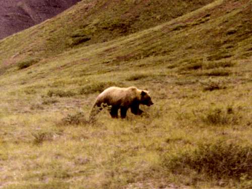
Alaskan Grizzly Bear
Many people who travel to the vast state of Alaska are content with a cruise to see the coastal glaciers or visit Denali and the Alaska Range, possibly even taking the famous Alaska Railroad to Denali National Park. Seeing and really experiencing Alaska takes time though, and no trip to Alaska is really complete without experiencing the Interior of Alaska. There is nothing quite like a trip to one of villages in the bush, going to the Tanana Valley State Fair, experiencing -65 degree temperatures in the dead of winter, watching a dog sled race, taking a float trip down the Yukon River, flying over vast areas that are free of roads and powerlines or getting a front-row seat to sensational displays of northern lights. While Denali and the Alaskan glaciers are stunning and magnificent, Interior Alaska is truly the “heart of Alaska” and the Yukon-Tanana Uplands are the heart of the Interior.
The Yukon-Tanana Uplands are a region of small mountains and hills in the east-central part of the state that is bounded on the east by Canada, on the north by the Yukon River and on the south by the Yukon’s greatest tributary, the Tanana River. About 20 % of this region is swampy lowland area, with the southern part of the Yukon Flats being the largest of the lowland areas. To the north of the Yukon River is the Brooks Range while to the south is the Alaska Range. From east to west, the Yukon-Tanana Uplands spans over 300 miles while the north to south distances vary from the point of the rivers confluence up to 170 miles from Fort Yukon to Big Delta. The total land area is around 30,000 square miles, making this region larger than the combined areas of New Hampshire, New Jersey, Connecticut, Delaware, Rhode Island and the District of Columbia.

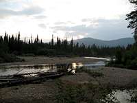
Tanana Valley Backroad
The Tintina Fault crosses the eastern upland on the north and is possibly the largest fault in the area. Permafrost is found throughout the region, in varying depths, drastically affecting tree growth in some places and making the building and maintenance of roadways very difficult. The highpoint of the Yukon – Tanana Uplands is 6,543-foot Mount Harper, about 50 miles north of Dot Lake. The region is full of mountains and ridges that generally rise 500 to 1500 feet above the flat valleys nearby. Forests cover much of the region, though timberline is quite low here, compared with latitudes much further south. Generally, the timberlines are in the 2,300 to 3,000-foot range. There are five common tree species found in this area, including black spruce, white spruce, balsam poplar, white birch and quaking aspen. The geology of the uplands includes loess-mantled bedrock hills. These hills and mountains are heavily-weathered Precambrian quartz-mica and quartzite schist of the Birch Creek formation. The White Mountains are the most noteworthy area of the uplands, with Mount Prindle being their highpoint at 5,286 feet. Three small mountain ranges lie just to the north of the White Mountains. The East Crazy Mountains and the West Crazy Mountains are bisected by the Upper Mouth Birch Creek, which also passes to the west of an even smaller range to the north, called the Little Crazy Mountains, before flowing into the Yukon Flats.
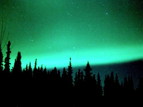
Tanana Valley Northern Lights
Wildlife abounds in the Yukon-Tanana Uplands, with mink, beaver, river otter, muskrat, lynx and marten commonly found here. There is a grizzly bear population here, but black bears are far more common. Moose and wolves are common throughout the region, while caribou and Dall sheep are normally only seen in the higher uplands and alpine tundra. All standard precautions for bears should be observed when heading into this wilderness – even when going just a short distance from your vehicle. Vast swarms of mosquitoes and black flies keep the bird populations well-fed in the summer, but are a serious enough problem to drive human visitors away and cause great agitation to the animal populations.
The only city of any size in the area is Fairbanks, Alaska’s second-largest city. The Fairbanks metropolitan area has around 100,000 residents and includes many smaller towns and places like College, North Pole, Eielson Air Force Base, Badger, Fox and other small communities. Most of the towns in the rest of the uplands are located near the Yukon or Tanana Rivers with only a few hundred residents (or less) in each community. Though these villages may be small, they are vital for their locations and the medical, communications and transportation services they offer. Some of these would include Tok, Delta Junction, Big Delta, Deltana, Fort Greely, Eagle, Central, Circle, Minto and Manley Hot Springs. Other communities that are located just across the rivers from the Yukon-Tanana Uplands that are important to the area include Fort Yukon, Nenana and Tanana. Alaska does not have counties, but instead has boroughs. The Yukon-Tanana Uplands include large areas of the Fairbanks North Star Borough, the Southeast Fairbanks Borough and the Yukon-Koyukuk Borough.
People visit the uplands for a variety of reasons. Besides business and family interests, visitors travel to the region for hiking, rock climbing, fishing, hunting, camping, canoeing, kayaking, rafting, bird watching, and gold panning. The majority of rock climbing opportunities lie in two areas: 1. Grapefruit Rocks, about 10 miles north of Wickersham Dome; and 2. Angel Creek Rocks and Granite Tors at the Chena River State Recreation Area. Photographers find the area rich with opportunities, thanks to abundant wildlife, mountains, streams and northern lights. Critical to all these activities, is the means to access the Yukon-Tanana Uplands.
Access to the Yukon-Tanana Uplands
The vast majority of visitors to the Yukon-Tanana Uplands arrive by way of Fairbanks, usually by plane, train or motor vehicle. Those driving to Fairbanks generally arrive via the Parks Highway or the Alaska Highway, which also shares roadway with the Richardson Highway. From Fairbanks, there are a variety of ways that residents and visitors can access the Yukon-Tanana Uplands. The two primary ways are by road and by air. Long ago, people traveled by dog sled over trails through the region. That method is not used much anymore, with dog sleds being used more for racing these days. People can travel and bring cargo up the Yukon River by small boats or barges, but that is dependable only in summer and early fall weather, before ice cuts off boat traffic. The Tanana River is not as deep, so most of the traffic up the river is only on the lower sections. Road and air traffic have proven to be the most reliable forms of transportation. Traffic by road is pretty much channeled through several major roads into the uplands.
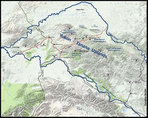
Map of Alaska's Yukon-Tanana Uplands
The Steese Highway is the longest roadway through the Yukon-Tanana Uplands, and shares space with all the traffic outbound from Fairbanks heading to the Elliott Highway and the Dalton Highway. Fairbanks area residents often call it the Steese Expressway. From Fairbanks to the village of Circle, on the Yukon River, is a distance of 160 miles. The Steese Highway is paved for the first 80 miles north of Fairbanks, then turns into a dirt road. Congress designated the Steese Highway as a National Scenic Highway. The roadway was originally built to service the gold mining activities in the region. The White Mountains National Recreation Area is best accessed from the Steese Highway at the Nome Creek Road junction, 57 miles north of Fairbanks. The Steese National Conservation Area can be accessed by the Steese Highway and through the Circle Hot Springs Road, 122 miles north of Fairbanks.
The Elliott Highway begins at the town of Fox, about 10 miles north of Fairbanks. It extends 152 miles to Manley Hot Springs. It is paved all the way to the junction with the Dalton Highway, near Livengood. From there, the rest of the road is unpaved. The town of Minto is accessible by way of a side road from the Elliott Highway, and the village of Tofty is accessible by a rough 25-mile ATV road from Manley Hot Springs. The stretch from Livengood to Manley Hot Springs is very remote with little traffic and is vulnerable to washouts and blizzards. Cell phone service along this stretch is pretty much non-existent. This is not a good place to break down.
The Dalton Highway is a 414-mile road through the Alaskan Wilderness that goes as far north as the shores of the Arctic Ocean. It begins at a junction with the Elliott Highway about 80 miles north of Fairbanks. The Dalton Highway has been called the “last great wilderness road on earth”. At 55 miles, the Dalton Highway leaves the Yukon-Tanana Uplands when it crosses the Yukon River and continues its journey north to the Arctic Ocean.
The Taylor Highway provides travelers with some of the best scenery in the state. The 160-mile road runs from Tetlin Junction to the village of Eagle, on the Yukon River. This route is popular with rafters and kayakers, since it provides access points to both the Yukon and the Fortymile Wild and Scenic River. A branch highway from the Taylor Highway, the Top of the World Highway, also called the “Klondike Loop” goes east over high ridges to Dawson City in the Yukon Territory. The first 60 miles of the Taylor Highway is paved, and the rest is gravel. Winter snows are the reason for the road to be officially closed from October to April, but it is still available to use for snowmobilers.

Alaskan Caribou
Chena Hot Springs Road provides access to the Chena River State Recreation Area and Chena Hot Springs Resort. The 56-mile road from Fairbanks is paved and well-maintained. The resort offers shuttle service for those without a vehicle. Camping opportunities are abundant there with cabins and three campgrounds available. Hikers enjoy access to Chena Dome and Bear Paw Butte, as well as several trails in the area. Angel Rocks and Granite Tors are also popular hikes, and both offer some good rock climbing routes. The Chena River offers great opportunities for canoeing and kayaking.
Air Traffic in the Yukon-Tanana Uplands
Small landing strips are found at almost every community in the Yukon-Tanana Uplands. In addition, landing strips are found at key locations for guided hunting and fishing trips and access to public recreation areas. This link will take you to a website that provides a wealth of contacts for charter air service in the Yukon-Tanana Uplands and elsewhere in Alaska: FlyAlaska.net
Boat Traffic Resources for the Yukon-Tanana Uplands
The links below provide access to websites that give watercraft advice and links to service providers.
Yukon River Trip Planning
Alaska Jet Boat & Riverboat Tours
Alaska River Trip Planning
Summits & Trails of the Yukon-Tanana Uplands

Chena Dome, by hgrapid
Literally, there are hundreds of ranked summits in the Yukon – Tanana Uplands. Most of the summits are un-named and difficult to access. If one cannot charter a plane or helicopter for the remote summits, the only options are then to access the summits near the few highways that traverse the Yukon – Tanana Uplands. Lists of John maintains extensive lists of summits throughout Alaska, with details and maps for each peak. Trails exist for some of the summits, while most other summits require an off-trail approach. Because of the population concentration in the Fairbanks area, there are obviously more named summits and more trails readily accessible there. The list of summits and trails below are separated by area of access. There are other named summits in these areas, but most of them require roadway or off-trail ascents. This list is not exhaustive, but does cover many of the more commonly-visited summits.
Ester Dome, by fortaz107
Fairbanks & Chena River State Recreation Area
Ester Dome
Bear Paw Butte
Chena Dome Trail
Angel Rocks Trail
Granite Tors Trail
Murphy Dome

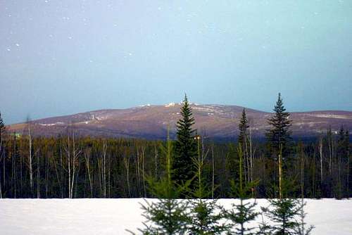
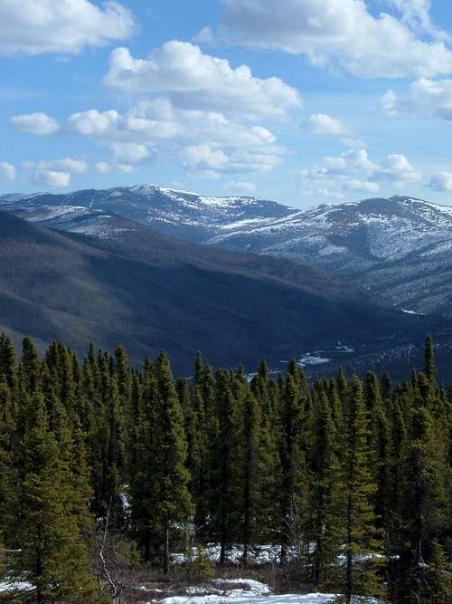
Mount Prindle View from the Steese Highway
Steese Highway Area
Mount Prindle
Table Top Mountain Trail
Pinnell Mountain Trail
Mastodon Dome Trail
Cache Mountain / White Mountains NRA Trails
Another popular summit along this route would include Pedro Dome, which can be accessed from Pedro Dome Road. Pedro Dome Road is next to Cleary Summit on the Steese Highway. Mount Ryan is also in this area, and can be accessed by the Fairbanks-Circle Historic Trail, for those who do not mind sharing a trail with ATV’s and 4X4’s.

Wickersham Dome, by Steve Marr
Elliot Highway Area
Wickersham Dome Trail
Grapefruit Rocks Trail
Tolovana Dome
Moose Mountain Summit View, by Tobin Petty
Big Delta & Taylor Highway Area
Bert Mountain Trail
Mosquito Fork Hiking Trail
Quartz Lake Loop Trail
Two other significant summits along the Taylor Highway would include Mount Fairplay and Taylor Mountain. Also, two of the highest summits in the Yukon-Tanana Uplands, Mount Harper and Mount Eldridge, are located further inland from the highway and require other means to access them.
Some other useful links to map resources are posted below.
USGS Topo Maps for Alaska
Alaska State Parks Trails
White Mountains National Recreation Area
Southeast Fork American Creek, by Tobin Petty
Located just one hour’s drive north of Fairbanks, The White Mountain National Recreation Area occupies 1 million acres of the rugged and remote White Mountains. The recreation area offers visitors hiking, rock climbing, camping, canoeing, kayaking, and rafting opportunities. Beaver Creek, a nationally designated wild river, flows through the White Mountains on its way to join the Yukon River. The area is managed by the Bureau of Reclamation. Mount Prindle, at 5,286 feet, is the highpoint in the recreation area. Table Top Mountain and Cache Mountain are two other mountains popular with visitors. The recreation area has a dozen public-use cabins and 250 miles of groomed trails, which makes the area a great winter destination to snowmobile, snowshoe, run dog sleds and ski. The White Mountains are accessible on the west by the Elliott Highway, through a trail network by Wickersham Dome. On the east side, visitors can access the recreation area by the Steese Highway and Nome Creek Road in the Mount Prindle area. For more information, click on any of the links below:
White Mountains National Recreation Area
White Mountain National Recreation Area Trails Report
Downloadable pdf Map for the White Mountain National Recreation Area
Steese National Conservation Area
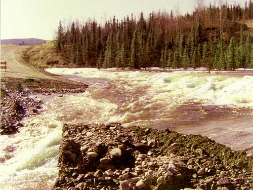
Steese Highway Washout
93 miles northeast of Fairbanks is one of the top recreation areas in the Yukon-Tanana Uplands. The Steese National Conservation Area (NCA) covers 1.2 million acres of wild Alaskan back country. There are two units in this area, with the north unit bordering the east side of the White Mountain National Recreation Area. The south unit lies across the Steese Highway to the southeast. The Pinnell Mountain Trail runs through the NCA, giving hikers and climbers better access to the summits and valleys in this remote region. The Birch Creek Wild and Scenic River runs through the NCA, offering visitors some great opportunities for river float trips and camping. The NCA is an important area to migrating caribou, plus Dall sheep are found here – something out of the norm for much of interior Alaska. Photographers appreciate all the opportunities these and other wildlife species provide here, including moose, bears, wolves, raptors and fox. For more information, check out the links below.
Steese National Conservation Area
Steese National Conservation Area downloadable pdf map
Yukon-Charley Rivers National Preserve
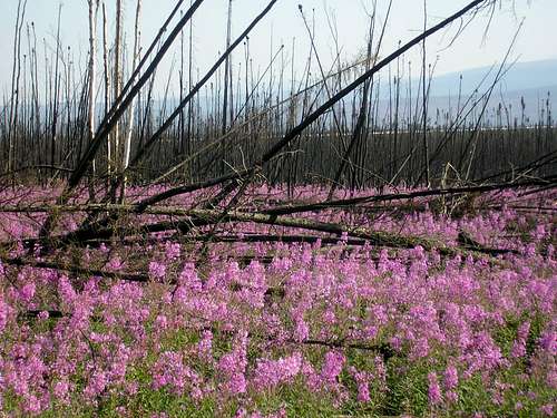
Alaskan Fireweed, by colint
Located between the Canadian border and the south unit of the Steese National Recreation Area, the Yukon-Charley Rivers National preserve protects 115-miles of the 1,800-mile Yukon River and the entire Charley River basin. The 2.5-million acre preserve is larger than the state of Delaware, yet there is no road access into the preserve. Access is only by air or by boats traveling on the Yukon River. Like so much of the rest of the Yukon-Tanana Uplands, the area is rich in wildlife and offers great photo ops, including Peregrine falcons nesting in high bluffs along the river. However the largest attraction of this preserve is the rivers. Whether one is rafting the mighty Yukon River or doing a whitewater trip down the Charley River, this just might be as good as it gets for river trips in Alaska. The Forty Mile River, a designated Wild and Scenic River is just to the south of the Yukon-Charley National Preserve, and adds yet another great whitewater opportunity. For those who love solitude, great camping and fishing, beautiful scenery and adventure, this is your place.
Yukon-Charley Rivers National Preserve
Planning a River Float Trip
Yukon-Charley National Preserve Map
Chena River State Recreation Area

Angel Rocks at Chena River State Recreation Area, by Steve Marr

Chena Dome, by hgrapid
Located not far from the Fairbanks area, the Chena River State Recreation Area is a quarter-million acre state park in Alaska. This is a very popular area for a variety of reasons. Fishing, rafting, kayaking and canoeing on the Chena River is popular, and the campgrounds in the state park offer multi-day adventure options. The rock climbing and hiking opportunities are good, plus there are trails for sled dogs, snow machines and ATV’s. At the end of the road into the state park, is the Chena Hot Springs Resort. For more information on this state park, check out the link below.
Chena River State Recreation Area
Tanana Valley State Forest

Bull Moose
North Fork Chena River, by Tobin Petty
One of the largest forests in Alaska is the Tanana Valley State Forest. This forest covers over 1.8 million acres and extends 265 miles from the Canadian border west to Manley Hot Springs. This forest is known for its black spruce, white spruce, paper birch, balsam poplar, quaking aspen and tamarack trees. The Eagle Trail State Recreational Site is the only developed campground in the Tanana Valley State Forest. For a pdf map of the state forest, click on the link below.
Tanana Valley State Forest
Managing Agencies & Red Tape

Dalton Highway view of the Yukon River, by Steve Marr
About 88% of the land in the state of Alaska is publicly-owned. However, this does not mean that everything is easy to access. But it does mean that private property restrictions are not as widespread as in the rest of the USA. Native American corporations hold over 40 million acres of land in private ownership in Alaska, making their tribal restrictions the single largest private property consideration in Alaska. The entire Yukon-Tanana Uplands region was for many centuries Athabascan tribal territory. For those who desire to visit native land, contacting the appropriate management corporation is essential. For more information on Native corporations in Alaska, click on either of these links:
Alaska Native Corporations
Explore Alaska Native Corporations
The agencies below manage various public lands in the Yukon-Tanana Uplands. Since regulations, fees, boundaries and permit requirements can change periodically, it is best to check the site for the area you wish to visit, or at least call their Alaska office with any questions or requests you may have.
Valley View, by hgrapid
Alaska State Parks
DNR PIC - Fairbanks
3700 Airport Way
Fairbanks, AK 99709-4699
phone: (907) 451-2705
Bureau of Land Management
Fairbanks District Office
1150 University Avenue
Fairbanks, Alaska 99709
(907) 474-2200 or
(800)-437-7021
Email: EasternInterior@blm.gov
U.S. Fish & Wildlife Service Alaska Region
101 12th Ave. #110
Fairbanks, AK 99701
(907) 456-0203
National Park Service – Alaska Regional Office
240 W. 5th Ave.
Anchorage, AK 99501
(907) 644-3510
Alaska Division of Forestry
3700 Airport Way
Fairbanks, AK 99709
Phone: (907) 451-2600
When to Climb & Explore
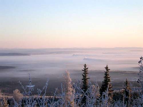
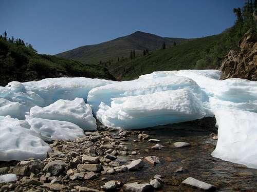
Tanana Valley Ice Fog, by fortaz107
The winters in the interior of Alaska are legendary for their deadly cold. The all-time record low for Alaska is -80 degrees, and temperatures in the -50 to -60 degree range happen during many winters in Alaska’s Interior. While the Fairbanks area generally does not see much wind to compound those extreme temperatures, other areas do occasionally see significant winds, driving wind chills at times well below -100 degrees. When the snow starts melting in the spring, deadly flooding can occur along streams. While the Interior is the coldest part of Alaska, it is also the hottest part, with an all-time record high of 100 degrees, recorded in 1915. However, temperatures even in the 90’s are pretty rare. So summer heat is generally not a major issue. Most spring flooding is done by sometime in June, and significant snowfall does not usually begin until October, though it can happen earlier – especially at higher elevations. With all that said, it should be an axiom that carefully monitoring the weather is a high priority for planning any outings in the Yukon-Tanana Uplands. The links below will provide active forecasts and conditions:
NOAA National Weather Service Alaska Region Headquarters
Weather Underground Forecasts & Conditions
Alaska hunting seasons may be a concern, depending on where you wish to venture. You can check Alaska hunting season information and contact information at the link below:
Alaska Hunting Information & Seasons
Camping & Lodging Resources
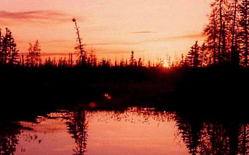
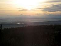
Sunset on the Chena Slough, near North Pole
In addition to the camping resources listed above for the Steese NCA, White Mountain NRA, the Chena River SRA and the Tanana State Forest, several links for more campground resources are listed below.
BLM Campgrounds in Alaska
Explore Fairbanks Campground List
Alaska Public Lands Campground Guide
Alaska State Park Campgrounds
Tanana Valley Campground and Park