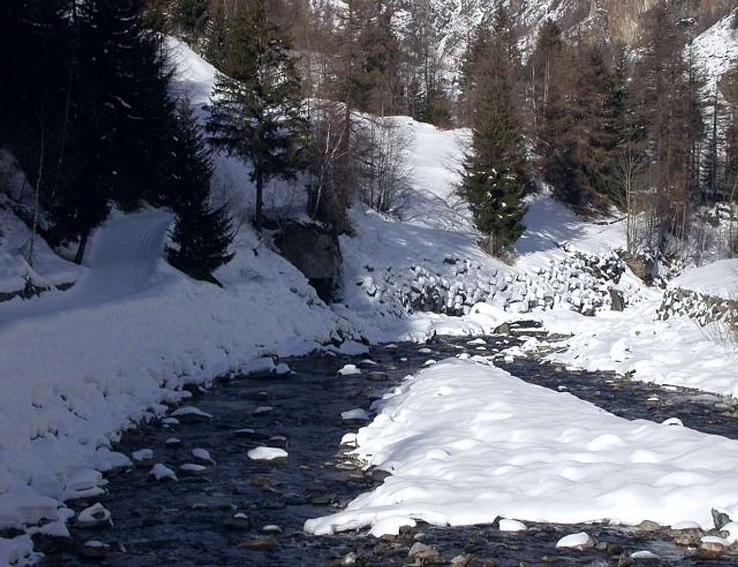
Stream Overview Torrent
All pictures of this third page are by emilius, Antonio Giani, Romuald Kosina, livioz, SalVal, pcirani@tiscali.it & Osw.
![]()
In this trip we wanted to highlight the torrents that run through the small valleys of Cogne's Valley inserting themselves after into Grand'Eyvia (Great Water).
A "revenue" of wild waters that collects, in addition to the main streams that we see below, a cluster of secondary torrents often broken into by beautiful waterfalls in splendid race shows above vertiginous rock faces. These courses aqcua form a crown around Cogne and its villages starting from the North with the small valleys of Tsa-Setze Arpisson / Grauson-Lussert-Doreire to continue in the East with the Urtier and "close" to the South with Acque Rosse, Bardoney, Valeille, Valnontey, Lauson, Pousset, Trayo and Nomenon. In addition to these many other streams flowing into small secondary valleys that then are inserted on the main mentioned above, where often the name is unknown or forgotten for a long time and often reminded almost exclusively by the old inhabitants of the territory. Or not reported correctly toponymically from the various topographic maps in vogue.
From the Torrents Arpisson, Lussert-Doreire-Grauson, Urtier, Bardoney, Valeille, Valnontey, Lauson, Pousset, Trajo, Nomenon until Grand'Eyvia and Baltea.
![]()
In codesto particolar viaggio abbiamo voluto evidenziare i vari torrenti percorrenti i valloni della Val di Cogne inserendosi poi nella Grand'Eyvia (Grande Acqua).
Un "gettito" d'acque selvagge che raccoglie, oltre ai torrenti principali che vediamo qui sotto, un nugolo di rivi secondari spesso interrotti nella loro corsa da belle cascate in splendida mostra sopra a vertiginose pareti rocciose. Questi corsi d'acqua formano corona circondante Cogne e villaggi iniziando da Nord con i Valloni di Tsa Setze-Arpisson/Grauson-Lussert-Doreire per continuare ad Oriente con l'Urtier e "chiudere" a Sud con Acque Rosse, Bardoney, Valeille, Valnontey, Lauson, Pousset, Trayo e Nomenon. Oltre a questi molti altri torrenti scorrono in valloncelli secondari andando poi ad inserirsi sui principali sopra citati, dove spesso il nome risulta sconosciuto oppure dimenticato ormai da molto tempo e spesso ricordato quasi esclusivamente dai vecchi abitanti del territorio. O non riportato in modo toponomasticamente corretto dalle mappe cartografiche.
Dai Torrenti di Arpisson, Lussert-Doreire-Grauson, Urtier, Bardoney, Valeille, Valnontey, Lauson, Pousset, Trajo e Nomenon insino a Grand'Eyvia e Dora Baltea.
![]()
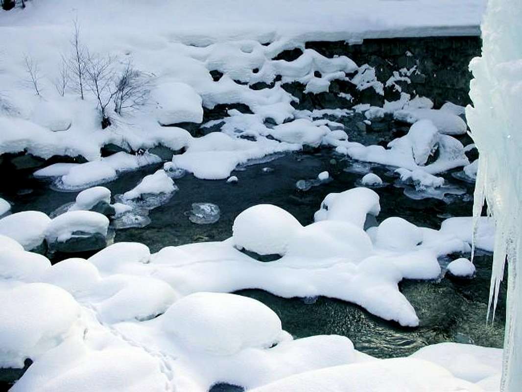
The torrents and streams begin when "die" glaciers, giving form to any hint of life with their fresh and still unspoiled waters, as willed by the Mother Nature.
The same quench the Mountaineer and Hikers returning from the goal achieved by giving him a first signal of peace, safety and contentment. After so much hard work ...
I torrenti iniziano là dove "muoiono" i ghiacciai, dando forma a qualsiasi spunto di vita con l'acque fresche ed ancora incontaminate, come sol in Madre Natura.
Le stesse dissetano l'Alpinista e l'Escursionista al rientro dalla meta raggiunta donandogli un primo segnale di riposo, sicurezza ed appagamento. Dopo tante dure fatiche ...
![]()
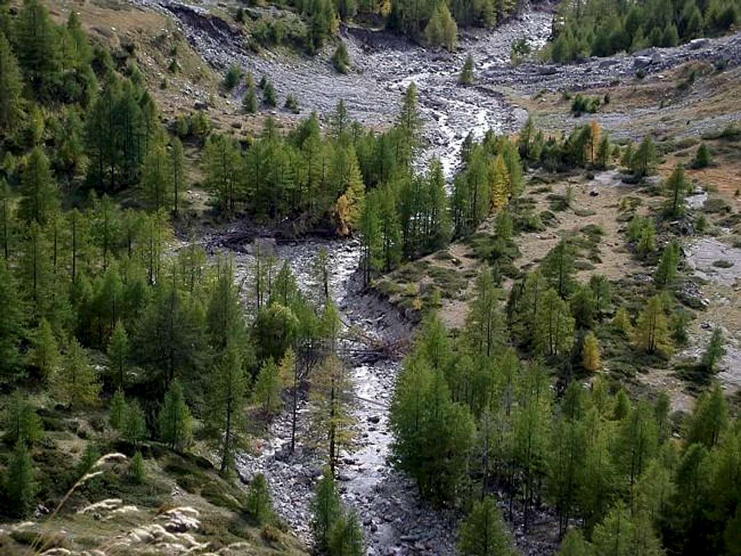
Then all together down to the middle course of Baltea coming from Gran Paradiso and Grivola to the Municipalities of Aymavilles Villeneuve. Finally to River Po.But many of them by scrolling lose their identity, especially in the higher or original parts, falling almost into oblivion and, passing to another life by the old mountain inhabitant, they become totally unknown for new generations.
For this reason, organizing research trips, it is important to go to their progressive sistematic rediscovery ...
![]()
Poi tutti insieme giù verso il corso centrale della Dora Baltea arrivando dal Gran Paradiso e dalla Grivola fino ai Comuni di Aymavilles e Villeneuve. Infine al Po.
Ma molti di loro scorrendo perdono la propria identità, soprattutto nelle parti più elevate od originarie, cadendo quasi del tutto nel dimenticatoio e, passando ad altra vita da parte dei vecchi montanari, diventano del tutto sconosciuti per le nuove generazioni.
Per sto motivo, organizzando dei viaggi di ricerca, é bene andare alla loro riscoperta ...
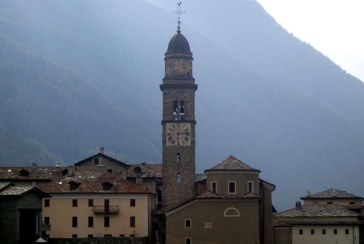
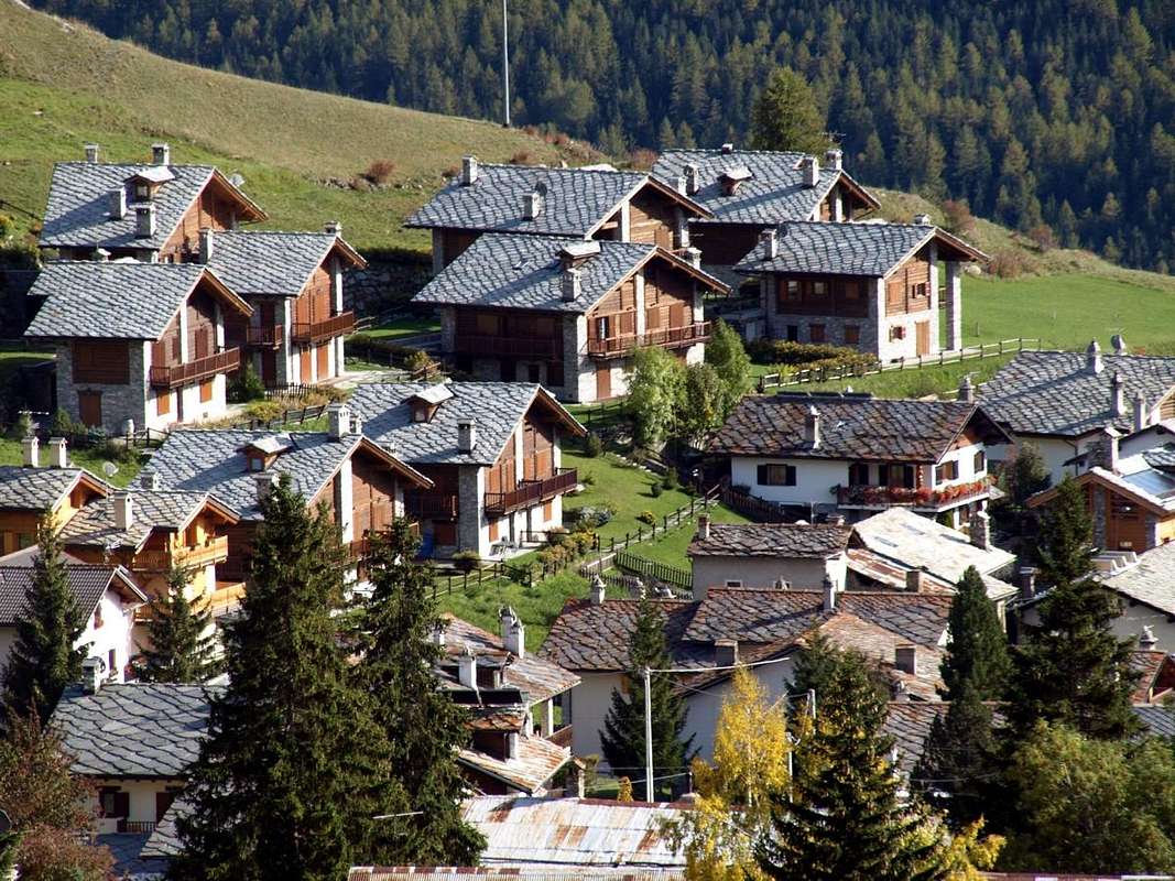
Getting There from Aymavilles to Cogne Valley
By car:
- From TORINO, MILANO, etc: Motorway A5. Exit at IVREA or Quincinetto (PIEDMONT) also Pont Saint Martin, Verrès, Châtillon, AOSTA East (Nus) and West (Aymavilles) Municipalities (AOSTA Valley).
From IVREA Town towards Pont St. Martin, Donnas, Bard, Verrès, St. Vincent, Châtillon, Nus, Quart, St. Christophe, Aosta, Sarre, Aymavilles and Cogne Municipalities.
![]()
From Aymavilles to Cogne Valley
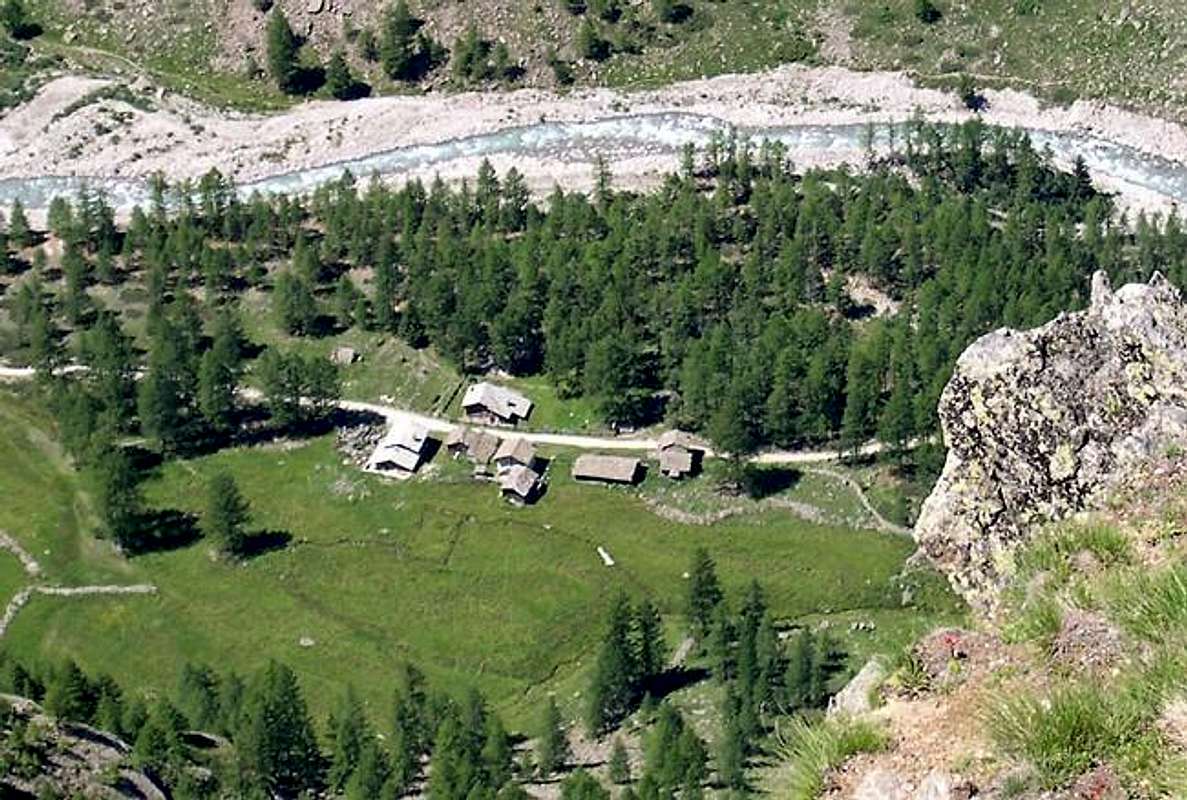
From Aymavilles (646m) towards Cogne Valley with Regional Main Road: Vieyes (1132/58m) Fraction, Mario Gontier private Shelter, through small path in Nomenon Vallon. Continue to Sylvenoire (1331m), Laval's Bridge (1364m) before Epinel Crétaz Hamlets (1434m, 1494m), Cogne (1534m) Resort, through Main Road.
To Valnontey (1678m), through Municipal Road: to Money, Alessandro Martinotti, Stefano Borghi, Carlo Pol, Marcello Gerard and Ettore Grappein, Lionello and Lucio Leonessa, Mario Balzola, Luciano Gratton (this last from Epinel or Crétaz) Bivouacs, through paths, moraines and glacier, and Vittorio Sella Refuge, through muletrack). From Lillaz Fraction (1607m) to Sogno di Berdzé, Denis Gérard and Guido Antoldi and Laura Malvezzi Refuges, by dirt road, muletrack or paths in Urtier and Valeille Vallon. To Gimillan Village (1785m), Franco Nebbia Bivouac, with path in Upper Arpisson Vallon. All the three last through Regional Roads from Cogne.
![]()
It is not necessary to take Motorway A5: you can drive on State Road n° 26, in the direction of AOSTA - IVREA - TURIN.
By plane:
- Aeroporto Internazionale "Corrado Gex" Saint Christophe (Aosta)
Scrambling along Torrents & Waterfalls
On the our trip we wanted to highlight the main streams in the major valleys of Val di Cogne. Without forgetting some very small torrent certainly little known.
Among the latter there are some really
"mysterious" as those by the coast between Punta del Dinc
(2663m), above the Alpe Senayet near the Village of Vieyes, and that of Arpisson
(3035m) above the Gimillan Fraction that go down towards the Grand'Eyvia with very steep paths and often impassable because of the inclusion between high and cliff edges or impossible walls. Often their path is marked by a slender thread of water that falls from shimmering smooth marked damp on patches slabs where they join into streams that reach the valley floor. An endless and unstoppable run until they go to
"die" in
Grand'Eyvia or the
Great Water that from Gran Paradiso reaches the Dora Baltea.
We list some starting from West-northwest under Col de la Pierre to get to East-southeast over Cogne Commune where it opens the Valley of Grauson before the one of Urtier:
Torrent Grand Couta
Torrent of Drinc
Torrent Val Lessert
Torrent Tavaillon
Torrent Tsa Sètse
Torrent Piscicail
Torrent Arpisson
Torrent Molère
Torrent Tarambel
Torrent Gimillan
Stream Grauson.This is only an example because all the neighborhood of Grand'Eyvia with its many valleys offer a similar situation. But also along the main street of the
Great Water it is not always the transition easier, indeed in certain locations such as between the Laval bridge and Pondel Village becomes adventurous or practically impossible even
very dangerous.
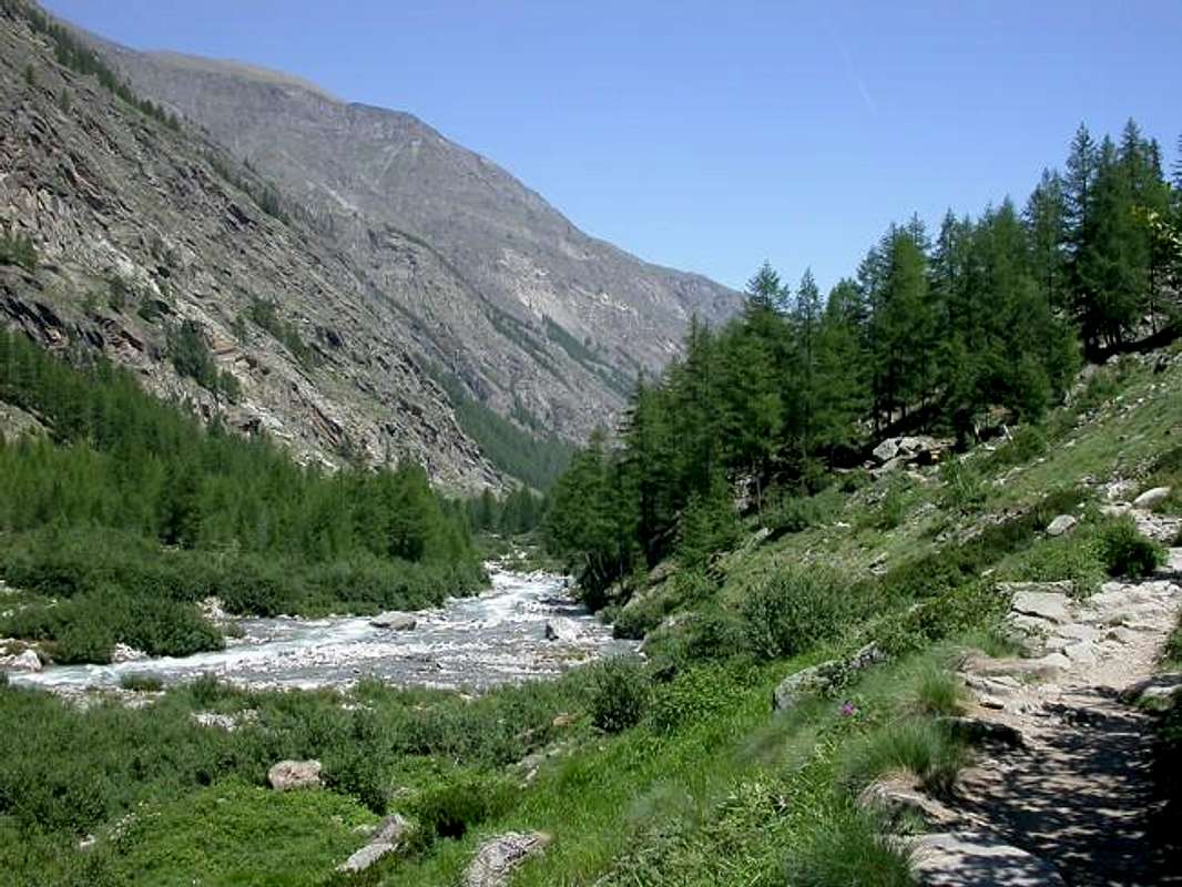
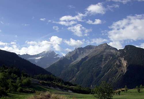
From Gran Paradiso Chain towards the Dora Baltea at entrance in Cogne Valley
Nel viaggio abbiamo voluto evidenziare i torrenti principali nei più importanti valloni della Val di Cogne. Senza dimenticare però alcuni torrentelli poco conosciuti.
Tra questi ultimi ne esistono alcuni veramente
"misteriosi" come quelli che dalla costiera tra la Punta del Dinc
(2663 m), sopra l'Alpe Senayet nei pressi del Villaggio di Vieyes, e quella d'Arpisson
(3035 m) sopra Gimillan scendono verso la Grand'Eyvia con dei percorsi ripidissimi e spesso non percorribili a causa dell'inserimento tra alte e selvagge pareti rocciose o strapiombi impercorribili. Spesso il loro scorrere viene segnato da esile filo d'acqua che scende luccicando tra lisce placche segnate d'umido per poi riunirsi in ruscelletti che raggiungono il fondovalle. Corsa infinita ed inarrestabile fino a quando vanno a
"morire" nella
Grand'Eyvia o la
Grande Acqua che dal "Granpa" raggiunge la
Dora Baltea.
Elenchiamo alcuni partendo da Ovest-nordovest sotto il Col de la Pierre per arrivare ad Est-sudest sopra il Comune di Cogne dove si apre il Vallone del Grauson prima dell'Urtier:
Torrente Gran Couta
Torrente del Drinc
Torrente Val Lessert
Torrente Tavaillon
Torrente Tsa Sètse
Torrente Piscicail
Torrente Arpisson
Torrente Molère
Torrente Tarambel
Torrente Gimillan
Torrente Grauson.
Questo é soltanto un esempio poiché tutto il circondario della Grand'Eyvia con i suoi numerosi valloni offre una situazione analoga. Ma anche percorrendo il corso principale della
Grande Acqua non sempre il passaggio risulta agevole, anzi in certe località come tra il Ponte di Laval ed il Villaggio di Pondel diventa avventuroso o
praticamente impossibile.
Comments
No comments posted yet.