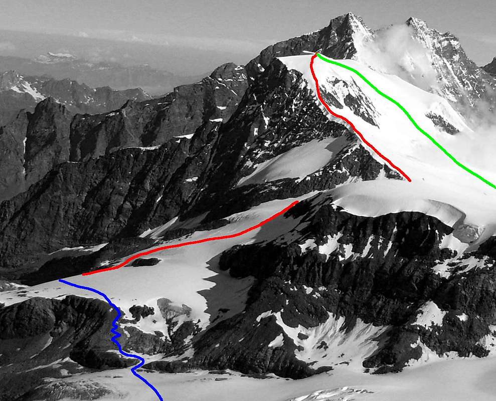
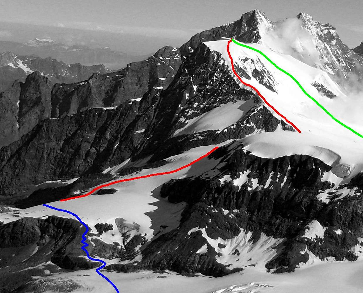
Alphubel as seen from Rimpfischhorn summit:
Red- SE Ridge, PD, up to 40° starting from Täsch hut (2701 m)
Green- normal route from Saas Fee, up to 35°
another Alphubel Topo here
Blue- Rimpfischhorn approach from the Täsch hut (2701 m)
In the distance: Taschhorn (left) and Dom.
Photo by Jck (Jacek)


