Amphu Labsa
The Amphu Labsa is a pass of about 19,000 feet / 5,800 meters that connects the remote Hongu Valley with Imja Valley a few miles south of Mount Everest. As with many features in this region there are various spellings to be found, including Amphu Labcha and Amphu Labsta.
The first reference to it’s crossing that I have found is in Eric Shipton’s 1952 book,
The Mount Everest Reconnaissance Expedition, where he and Ed Hillary, exploring the region south of Everest with Sherpa Angdorje “
succeeded with some difficulty in crossing a col of about 19,000 feet high over into the basin of the Hongu Khola, where we camped on the shores of a big lake”.
The pass is indicated on the book’s sketch map, and also in Hillary’s 1955 book
East of Everest, but no name is given.
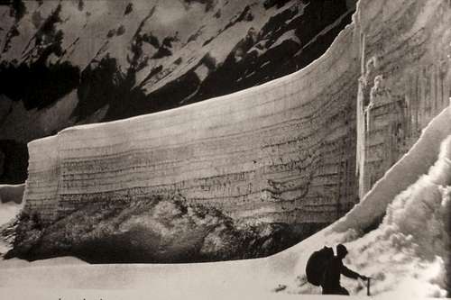
I’ve crossed the pass twice, first in 1994 coming up from the south after climbing Mera Peak. I returned to the region in 2002, approaching from the east on the spectacular trek up the Arun and Barun Valleys, past Makalu base camp and over the 20,000 foot passes Sherpani Col and West Col. The Amphu Labsa is the crux of these treks.
In recent months I’ve received several requests for photos taken on the pass, so I’m putting this album together. If you have photos taken from the crossing of the Amphu Labsa please add them here.
Crossing the Amphu Labsa 1951


Comments
Post a Comment