Viewing: 1-1 of 1

peerzat - Apr 15, 2006 4:21 pm - Voted 10/10
great!what an awesome resource.
thank you.
Viewing: 1-1 of 1
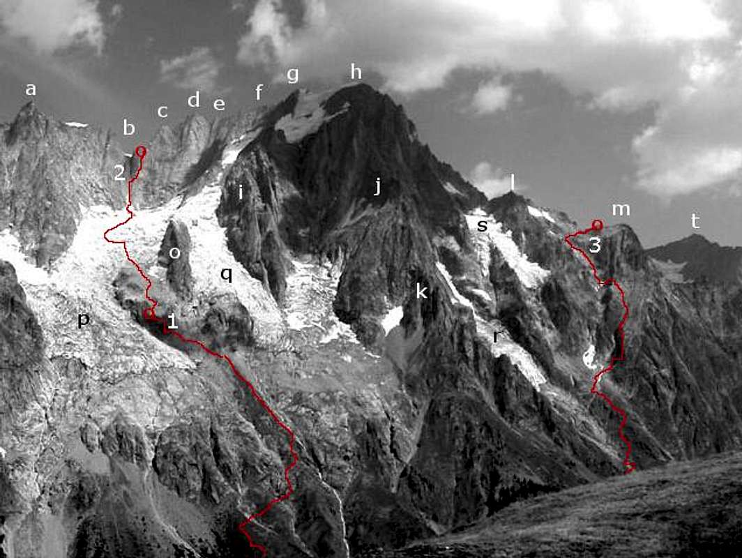
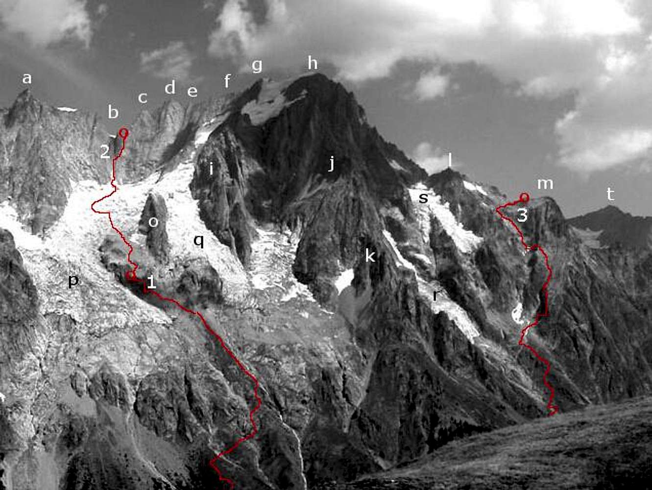
(a) Dome De Rochefort (4015m); (b) Col Des Grandes Jorasses (3818) - the red circle mark the position of the Canzio bivouac hut; (c) Pointe Young (3996m); (d) Punta Margherita (4066m); (e) Punta Elena (4045m); (f) Pointe Croz (4110m); (g) Pointe Whymper (4184m); (h) Pointe Walker (4208m); (i) the Tour Des Jorasses (3813m.); (j) the Aiguilles De Pra Sec (3549m), made of very sound rock, but quite remote - several interesting rock routes have been opened on their flanks; (k) the Petites Aiguilles De Pra Sec (3097); (l) Aiguille De Tronchey (3495m); (m) Aiguille De L'Eveque (3258m), the red circle mark the position of the Jachia bivouac hut; (o) the Rognon De La Bouteille - or "the bottle" - (3191m), called this way because seen from Planpicieux has a definite bottle shape; (p) the Planpinciex glacier; (q) the Grandes Jorasses glacier; (r) the Pra Sec glacier, not touched by human beings until 1972!; (s) the Tronchey glacier; (t) Mont Greuvetta (3684m)
(1) The access to the Boccalatte hut (2804m);
(2) The rarely climbed direct access to the Col Des Grandes Jorasses and the Canzio bivouac hut; a difficult and dangerous route that can be used only in emergencies
(3) the access to the Jachia bivouac hut (3264m), the lower bit is the direct start from the Tronchey hamlet, other starts are possible.
what an awesome resource.
thank you.


Comments
Post a Comment