Toggle navigation
Mountains
Routes
Images
Trip Reports
Forum
What's New
People
Areas & Ranges
Articles
Trailheads
Canyons
Huts & Campgrounds
Albums
Logistical Centers
Fact Sheets
Lists
Custom Objects
Gear
Plans & Partners
WELCOME TO SUMMITPOST
SIGN IN
REGISTER
East Face Direct
Additional Parents
Image
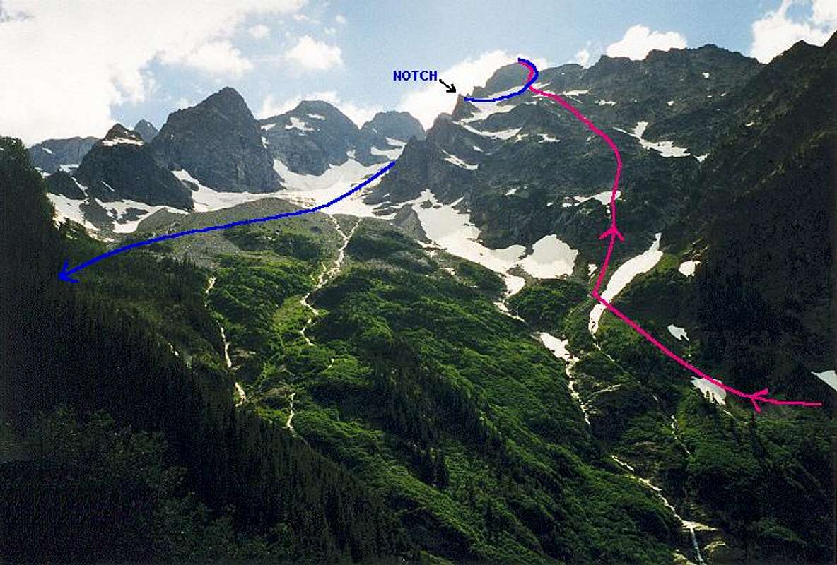
Annotated view of the East...
View High-Resolution Image
Annotated view of the East...
Annotated view of the East Face Direct (pink line) and Southeast "Glacier" (blue line) routes. Photo taken from the Copper Creek Trail after the climb on July 11, 1998.
« PREV
NEXT »
Klenke
on
Mar 12, 2004 2:47 pm
Comments & voting
Other parents
Lat/Lon:
48.17500°N / 120.8°W
Image ID:
45001
3208 Hits
71.06
% Score
1
Votes
Log in to vote
Comments
No comments posted yet.
to post!
Don't have an account?
East Face Direct
(Route)
« PREV
Viewing
#7 of 7
GALLERY
You are at
the Last
Image
Klenke's Image Gallery
« PREV
Viewing
#4330 of 5376
GALLERY
NEXT »
Copper Peak
(Mountain/Rock)
Loading....
×
You need to login in order to vote!
User Name
Password
Remember me
Forgot your password?
Log me out when I close my browser.
Keep me logged in all the time.
sign in as a user
Don't have an account?
Register now for FREE
Rating available
Suggested routes for you
People who climb the same things as you
Comments Available
Create Albums
Register Here


