An Adventure to Remember
I have always loved the Pioneers Mountains. The peaks are high and rugged, the rock is generally good, and there are hundreds of lakes. All this combines to make this range my favorite in the state of Idaho. Perhaps the area that has intrigued me most is the remote southern section of the range. Although not quite as high as the central Pioneers the mountains here still top 11,000 ft. and are every bit as rugged and scenic. However, there are very few people who ever venture into this area. All this makes the potential for epic adventure in this region very great. I’m about to tell you about one such adventure.
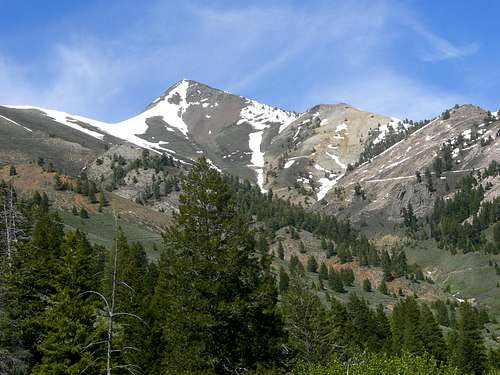
The Southern Pioneers are drier than the central part of the range and tend to melt out earlier making many of the mountains here excellent spring climbs. This being a heavy snow year I was looking for a high peak that would either be snow free or would be an easier snow climb by this time. After doing a little research and consulting some friends I settled on seldom climbed Antares Peak in this area.
![Antares Peak]() Antares Peak
Antares PeakThe Ascent
Mike Fox and Nick Karl accepted the invitation to join me on the trip. We met at a small primitive campground situated near the peak and enjoyed our dinner and a campfire before turning in for the night.
At 5:00 AM we were up and getting ready for the day ahead. The sun was not yet up but it was light and we were soon ready to begin. We drove the rough road to the starting point and were soon on our way. Our plan was to follow a route taken by a friend of mine that follows a gentle ridge over a sub peak (The Snowdome at 10,249 ft.) and up the West side of Antares. Having a good view of the route the night before had convinced us that it would be fairly straightforward and that we would have little snow to deal with.
![First Light on the Pioneers]() Sunrise on the Pioneers
Sunrise on the Pioneers
The ridge starts as a broad sagebrush covered hill and quickly narrows to a rocky ridge. As we climbed the ridge more and more of the Central Pioneers came into view and the rising sun made the massive amounts of snow on the peaks glow with golden light. It was incredibly beautiful! The ridge was easy and we made good time as we approached the Snowdome which was (surprise!) covered in snow.
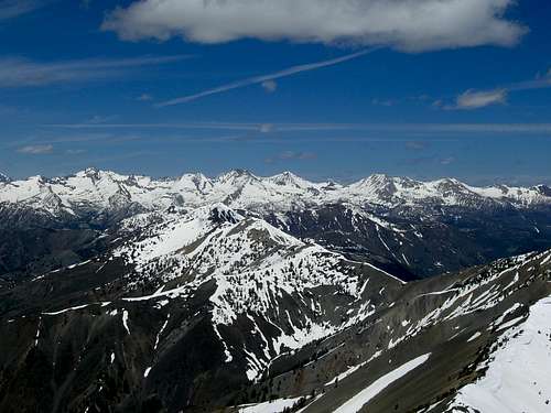
![Pioneer View]() Pioneer View 1
Pioneer View 1![Pioneer View]() Pioneer View 2
Pioneer View 2Defeat
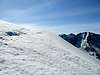
![Snowdome]() The Snowdome
The Snowdome![Trouble on the Snowdome]() Turning point
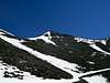
Turning pointWhen we reached the Snowdome we tested the snow and found it to be very hard and stable so we broke out the crampons and ice axes and headed over the top. It was surprisingly steep but was a lot of fun until we got to the other side. Mike was ahead of me and was scouting out the route. He informed me that we had a problem.
![Across the Snowdome]() Steep Snow
Steep SnowThe other side of the Snowdome was even steeper and the snow was so soft that crampons would be useless. What made matters worse was that there were two huge cornices that met here. We would have to walk on both if we were to proceed. No one was comfortable with this dangerous situation so we sat down on a bare patch of rock to decide what to do.
Retreat
Nick decided that he had had enough for the day but Mike and I still wanted to do something. It was still only 10 AM anyways. We debated whether we should just go home, pick a plan B peak to try, or find a new route up Antares. What was most frustrating was that we could see that there was a snow free route to the top of the peak on another ridge, but getting there would mean we’d have to descend more than a thousand feet and gain it all back after hiking to the new ridge. We figured that instead of choosing a new peak to do we might as well finish this one off even if it meant tacking on a couple more miles and another thousand feet. Mike and I made the descent while Nick decided to head back down the canyon and hang out at the truck.
Repeat
![The New Route]() New Route
New RouteOnce we got below the snow we followed an old mining road around to the South face of Antares. The face was steep but nothing too terrible. We gained elevation fast on the steep slope and soon were back above 10,000 ft. where we gained the South ridge and began some easy class 3 climbing. The rock on the ridge looked like it would fall apart if you touched it but it was actually quite solid. It took us about 20 minutes to reach the summit from this point.
The Summit
![Antares Summit Ridge]() False Summit
False SummitWhen we got to the summit area we looked up and saw a huge cornice blocking the way. We also saw what looked like the true summit beyond it. We thought our day was over only 50 feet from the summit but as we got closer and got a better view we realized that it had melted out on the windward side and left us plenty of space to walk over to the true summit. It was an easy walk and we were soon there.
The view from the top was simply amazing. We couldn’t have asked for better weather too. We had a clear view of the entire Pioneer Range as well as much of the Lost River Range including Mount Borah. It was however really windy and cold so we put on every layer we had, took tons of pictures, and found a place out of the wind to sit down and have lunch. Once we were out of the wind it was quite pleasant and we enjoyed our lunch as we took in the view. We stayed about half an hour and decided it was time to head home.
![Success!]() Success!
Success!![The Summit Team]() Splattski Summit Shot
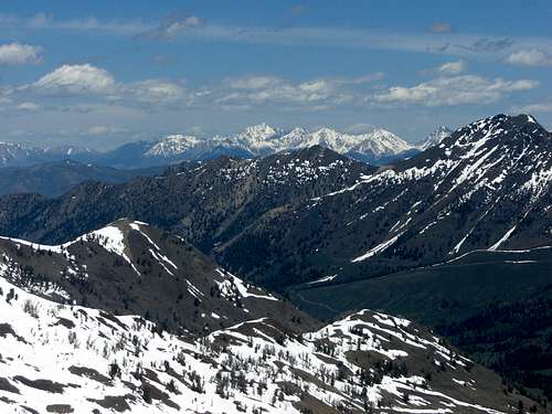
Splattski Summit Shot![Antares Summit View: Northwest]() Northwest view
Northwest view![Smiley Mountain]() Smiley Mountain
Smiley Mountain![Antares Summit View: South]() View South
View South![Borah View]() Borah View
Borah ViewThe Descent
![The Descent]() Going Down
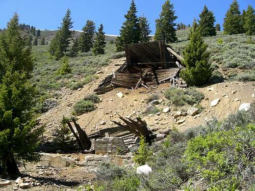
Going DownWe retraced our route until we got to the old mining road which we decided to follow down the canyon to give our legs a break. The walk was pleasant but probably tacked on a couple of miles due to all the switchbacks. The road led to an old abandoned mining camp with a few cabins and the remains of an ore processing plant.
![Old Mine]() Old Mine
Old Mine
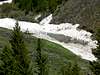
As we got lower we could see a lot of avalanche debris in the bottom of the canyon. There were three major avalanche chutes we could see and it looked like all three of them had had major slides during the winter. The miners who had built the mining camp hadn’t planned very well because the camp was right at the convergence of all three chutes. One slide had nearly taken out what buildings were left and had slammed into the opposite wall of the canyon creating a 30 ft. pile of hard snow, dirt, and trees. The creek had carved a cave under the snow and was flowing through it.
We were able to follow the road almost all the way down the canyon until it crossed the creek, which was flowing very high and rapidly. We decided to bushwhack and sidehill to avoid crossing it. In about another 2 miles we exited the canyon and made our way back to where the truck was parked.
It turned out to be just under a 10 hour day, covering 11.5 miles with 5,800+ feet of gain but it was well worth it. We were glad that we had decided to continue rather than giving up in defeat at the Snowdome and going home. The peak was amazing, the views outstanding, and the weather perfect. Who could ask for a better outing?
![Garfield Canyon View]() Great Day!
Great Day!


Comments
Post a Comment