
-
 15730 Hits
-
 81.84% Score
-
 14 Votes
|
|
Area/Range |
|---|---|
|
|
48.50657°N / 114.02647°W |
|
|
6651 ft / 2027 m |
|
|
Overview:

Near the outlet of Lake McDonald lies the southern terminus of the Apgar Mountains. The Apgar Range is a little known range that lies on the western border of Glacier National Park. The Apgar Range is a mere 6 by 3 inch strip of land on a ruler. This equates to about 50 square miles of land.
If you like trees more than mountains this is the perfect range for you. To reach these summits you have to pass a lot of trees.
| To visit Glacier National Park is to enter a place where Heaven touches Earth affording brief glimpses into the Wonders of Creation. |
The "Crown of the Continent" is located in northwestern Montana and shares a border with Waterton International Peace Park in Canada. Driving the world renowned Going-to-the-Sun Road to Logan Pass is a great way to see Glacier. Typically Logan Pass and Going-to-the-Sun Road opens near the end of June but it can be as early as the middle of June and as late as after July Fourth. The road isn’t open in the winter but you can ski there.
Layout designed for best viewing on a "1024 x 768" screen.
History:
Apgar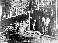 The Apgar Range in Glacier National Park was named for Milo Apgar who settled here from Maine in 1892. He evidently crossed over Marias Pass with a two-wheeled cart. He and his traveling companion, Charlie Howe, homesteaded at the foot of Lake McDonald.
 There are a number of trees in the area that are not native and they were part of his homestead.
Rubideau Springs
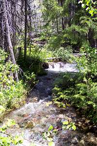
Located near Apgar Lookout these springs have long provided much of the water supply for the park’s headquarters. Perhaps they are named for a family of North Fork loggers or a homesteader who settled in the area about 1905.
McGee Meadows

Located on the Camas Creek Road, McGee Meadows was most likely named for an old settler in this area named Thomas N. McGee. Thomas married the daughter of a Blackfeet chief named Buffalo Run.
The above information is from Place Names of Glacier National Park by Jack Holterman.
Fires

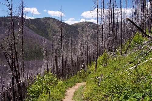
Each year there are about 14 fires in Glacier National Park. Most of them are lightening caused and they are allowed to run there course. The only fighting of fires that is done is structure protection.
The last significant fire was in 2003 when the Roberts Fire, a man caused fire, rapidly grew to over 3,200 acres in the first 24 hours. As it grew it combined with the lightening caused Wedge Fire and between the two fires a total of over 110,000 acres were burned. In Glacier National Park alone these two fires burned almost 75,000 acres. The remnants of this fire can be seen walking the trail to Apgar Lookout as well as on Howe Ridge on the North side of Lake McDonald.
Geographic Boundaries:
 |  |
|---|
The Apgar Range runs northwest from near the West Entrance of Glacier National Park near West Glacier, Montana. It is near the southern end that Apgar Lookout is found. The northern terminus is located at the Camas Creek Entrance Station below Huckleberry Mountain.
To the west of the Apgar Range lies the Wild and scenic North Fork of the Flathead River which serves as the western boundary of Glacier National Park. On the eastern side of the Apgar Mountains is a road called the Camas Creek Road by the locals. On some maps it is called the Glacier Route 8 Road.
 kristinaAL photo kristinaAL photo |
 |  |
Red Tape:
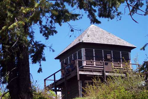 Apgar Lookout
Please follow all of the rules and regulations that the park publishes on line. Ignorance is no excuse for failing to follow the rules.
There are no established campgrounds in the Apgar Range. A back country permit would need to be obtained to camp in this range.
For current National Park Entrance Fees: Current Park Information
For all the Rules and Regulations governing Glacier National Park look at the Rules and Regulations. You can find a PDF files here with a lengthy treatises about what you can and can't do but it could keep you out of jail.
You do not have to register for day climbs in Glacier National Park but it is recommended. Backcountry travel regulations can be found at Backcountry Travel. There is also information from the Park Service on Mountain Climbing in Glacier.
As with all hiking and climbing in Glacier National Park use caution and practice good manners with the wildlife. You are in bear country. Carry your bear deterrent, don’t hike alone and make some noise. For more information please go to the Park's website for Bear Information. The U.S. Forest Service also has helpful information on Grizzly Bear Management.
The Peaks:
 Apgar Lookout Trail
 Apgar Lookout Trailhead
There are two named points in the Apgar Mountains. These being Apgar Lookout (which isn’t really a peak) and Huckleberry Mountain which are as already identified the southern and northern terminus respectively. There are additional points that are identified by cartographers. The unnamed point marked 6651 is the tallest point in the Apgar Mountains and lies at almost the middle of the range in all directions.
| Rank | Summit Name | Elevation in Feet |
|---|---|---|
| 1 | Point 6651 | 6651 |
| 2 | Huckleberry Mountain | 6593 |
| 3 | Point 6405 | 6405 |
| 4 | Point 6309 | 6309 |
| 5 | Point 6304 | 6304 |
| 6 | Point 5274* | 5274 |
| 7 | Point 5274* | 5274 |
| 8 | Apgar Mountain and Lookout | 5236 |
| 9 | Point 4320 | 4320 |
* The duplicate references to Point 5274 is not a typo. There are two points in the Apgar Range that are 5,274 feet in elevation.
Hiking the Trails:

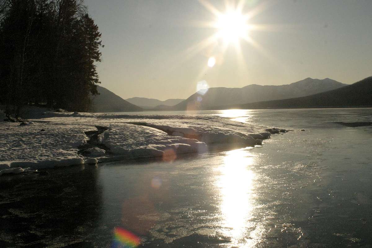
 Photo from the Apgar webcam, by bnegrin
There are just three established trails in the Apgar Mountains. Two are fairly well known and one has more than likely passed away into obscurity due to little usage and poor access.
The Apgar Lookout Trail:
[img:413994:alignleft:thumb:Apgar Lookout Trailhead]
This trail is 2.8 miles one-way and climbs 2,019 feet en-route. This is an easy hike with a trail all the way to the Apgar Lookout. There are rewarding views of Lake McDonald, the Lewis and Livingston Range as well as the mountains near Sperry Glacier.
Apgar Lookout Trail is reached by taking the Apgar Horse Corral Road, halfway between Apgar and West Glacier Entrance. The signage is clearly marked on the Going-to-the-Sun Highway. If you reach either the Entrance Station or the four-way stop turn around and look for the signs from the other direction. After turning onto Apgar Horse Corral Road follow road past the left hand turn to the Glacier Institute to a Y-intersection at the Quarter Circle Ranch, keeping to the left along the horse corral/pasture, follow the road to the Quarter Circle Bridge which crosses McDonald Creek at the confluence of the Flathead River and follow the road for approximately one mile.
The Huckleberry Mountain and Lookout Trail:
[img:427515:alignleft:thumb:Huckleberry Mountain and Lookout Trailhead Sign]
This trail is 6 miles in one direction and climbs 2,725 feet. As with the Apgar Lookout trail a good trail can be followed all the way to the summit. Views into the North Fork drainage of the Flathead River as well as the northern portion of Glacier National Park can be gained in this climb. This trailhead is located on the Camas Creek Road.
Obscure Trail #3:
This trail begins at the old ranger station located at the confluence of the Middle Fork and the North Fork of the Flathead River. This trailhead can be found by following directions to the Apgar Lookout trailhead. After crossing the Quarter Circle Bridge on McDonald Creek this trailhead is on the river side of the road and is somewhat difficult to see unless you are looking for it. The service road is gated.
This service road travels for about 4.8 miles to the old Glacier Rim Ranger Station which is abandoned. From the Ranger Station the trail heads in a northwest direction and meanders for about 4 miles through fairly flat terrain until arriving at a gaging station on the North Fork of the Flathead River. A gaging station is built to measure the amount of flow coming down a river.
For those mountain bike enthusiasts this service road is one of the VERY few places in Glacier that are NOT CLOSED to bikes. Before riding in Glacier please check current rules and regulations. Mountain bikes are NOT allowed on any Glacier National Park trails.
Flora and Fauna:
[img:502619:alignleft:thumb:]
 |
 |
 |
The Apgar Range is home to most of Montana’s ungulates including elk, mule deer, whitetail deer, Shiras moose, grizzly bear, black bear and mountain lions.
This is bear and mountain lion country. Carry your bear deterrant spray.
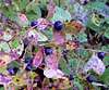
The alpine meadows abound with wildflowers. And did I mention trees? There a lots of them!
Seasons and Conditions:
|
|---|
The Apgar Range can be accessed throughout the year.
Camping and Gear:
[img:499354:alignright:medium:Photo from the Apgar webcam, by bnegrin]The nearest National Park Campground is located at Apgar on the shore of Lake McDonald. Apgar campground is the largest campground in Glacier National Park. It is near Apgar Village, where you will find the Apgar visitor center, gift shops, a camp store, and a casual restaurant. Horseback ride reservations, boat rentals, a shuttle service, and Red Bus tour reservations are also located in Apgar Village.
Apgar Campground is open for primitive camping April 1 through May 1 and again in the Fall from October 14 through November 30. Primitive camping is $10.00 per night.
There is also a campground at Fish Creek Campground which is near Apgar. Fish Creek campground is located just off the Camas Road approximately 2.5 miles from Apgar Village on the west side of Glacier National Park. It is the second largest campground in the park.
Gear Recommendations:
It is possible to get turned around in this country because most of it is trees and there are very few open areas until reaching the exposed ridge tops. If traveling off the two main trails carry a compass or GPS and map and leave a trip itinerary with contacts.
Bring extra water, food and the usual hiking/climbing equipment and a camera.
Bear deterrant spray is always an excellent idea as well.
Resources:
Apgar Cam with Peaks Identified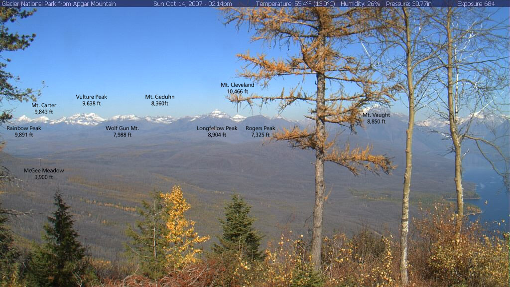
Apgar Webcam Page
Glacier National Park in Pictures
Glacier Mountaineering Society
Map
Visit Montana