
-
 27394 Hits
-
 82.46% Score
-
 15 Votes
|
|
Area/Range |
|---|---|
|
|
47.24008°N / 9.39331°E |
|
|
Hiking, Mountaineering, Trad Climbing, Sport Climbing, Toprope, Bouldering, Ice Climbing, Aid Climbing, Big Wall, Mixed, Scrambling, Via Ferrata, Skiing |
|
|
Spring, Summer, Fall, Winter |
|
|
8209 ft / 2502 m |
|
|
Appenzellerland
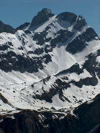
Altmann
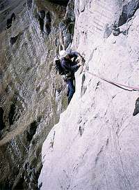
Climbing on the Frümsel
The Appenzell Alps refer to a small group of mountains in the northeast corner of Switzerland, 20 miles long and stretching only about 10 miles across. The range is located in the cantons of St. Gallen and Appenzell. Despite the small size of the Appenzell Alps, the range offers many activities, from year-round skiing, to trad climbing, to hundreds of miles of hiking trails. The highest point in the range, the Säntis, is crowned with a 70 meter tall weather antenae and is easily visible from the surrounding plains. On a clear day, the peak is even visible from Neuchâtel, over 100 miles to the west. With many activities available to the outdoor enthusiast, combined with easy access, the Appenzell Alps, or Alpstein as they are locally referred to, are a prime destination.
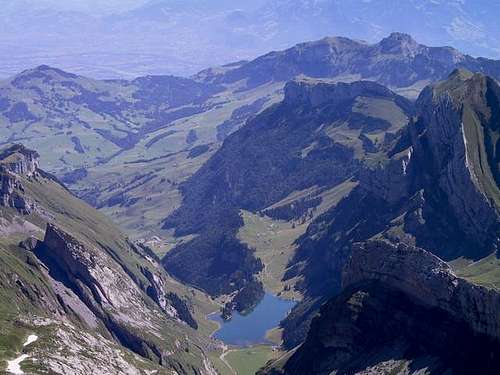 Seealpsee
Getting There
The largest city in the vicinity of the Appenzell Alps is St. Gallen (Saint Gall). The city of St. Gallen is accessed easily by the E60 freeway from Zurich. From St. Gallen, head south on just about any of the major roads (ie, the roads that are signed Herisau, Appenzell, Waldstadt, Urnäsch, etc). For excursions in the area around the Säntis, the most popular place of departure is Schwägalp, which can be reached from Herisau. Head toward Waldstadt on Alpsteinstrasse. From Waldstadt, continue on Herisaustrasse to Urnäsch. In Urnäsch, Herisaustrasse becomes Schwägalpstrasse, and this will lead you directly to Schwägalp. Driving time from Herisau to Schwägalp is about 45 minutes.
The Alpstein can also be reached from the south, from the Toggenburg area. The towns of Wildhaus, Unterwasser, and Alt. St. Johann are very popular places to embark from. Peaks around the Säntis as well as the Churfirsten are accessible from here. There are two ways to get to Toggenburg. From the Zurich area, take E60 east to the city of Wil. Exit the freeway at highway 16, signed Toggenburg. Look for signs pointing to Wattwil and Toggenburg. The exit is easy to spot. Once on highway 16, follow this all the up through Wattwil and into the mountains, always follwing the well-marked signs to Wildhaus. Wildhaus can also be reached from the east. From E43 in the town of Buchs, take the highway 16 exit, heading west, once again this is signed Toggenburg. Take highway 16 through the towns of Buchs and Grabs. After this, the road will begin to climb up to the Wildhaus area.
The road signs are very obvious here in Switzerland, and it is very hard to get lost.
 Area Map
Weather
The Alpstein receive large amounts of snowfall in the winter, and snowstorms can strikeas early as September and as late as May. In the summer, afternoon thunder storms are very common. Frequent rain showers keep the grass green all throughout the summer. Temperatures in the summer range from hot and muggy in the valleys, to cool and crisp in the highlands.
Here is a link to the weather station atop the Säntis. 
Skiing
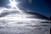 Skiing on Selun
The most popular ski area of the Alpstein is the Chäserrugg, which is one of the Churfirsten peaks. Here is the website.
Another popular place to ski is the Kronberg, which is located in the northern foothills of the Alpstein, above the tiny hamlet of Jakobsbad.
Many other ski areas exist in the range.