Avalanche Mountain 1-5-2014
View 2014-1-5 Avalanche Mountain in a larger map
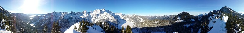
This small subpeak of Snoqualmie Mountain provides surprisingly expansive views of the surrounding Cascade Mountains considering it's prominence is barely over 400'. Situated NE of Snow Lake, the shortest approach is via the High Lakes Trail from the Alpental/NWFS Parking Lot. I was a little sore after
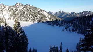
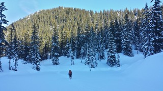
climbing Mount Townsend with Maverick the day before, so the short approach and reasonable elevation gain as well as a chance to see Snow Lake completely frozen over made this one an easy choice for a clear sunny day. Within the first mile and having seen nobody on the trail I was beginning to regret leaving both dogs behind, but a fair amount of exposure on the narrow ridge to the summit and several off leash dogs on the trail during our descent changed that thought.
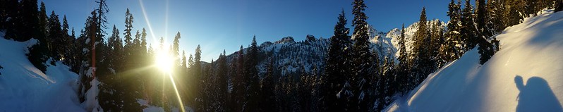
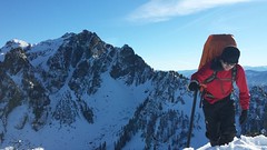
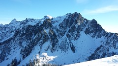
Very little snow below 4500' meant that the lifts at Alpental were closed. The parking lot was nearly empty when we arrived at a leisurely 7:30, not a common sight on a fair weather Sunday in January. While gearing up we chatted with two groups of 2 that had pulled in just after us and both mentioned that they would be climbing Chair Peak. At the last switchback before the saddle to Snow Lake we stopped after hearing what I thought sounded like a bear cub crying (or maybe a human in agony) in the valley below. We watched someone move around a snow field directly below Bryant Peak and discussed the possibility that someone could be in need of help. After about 15 minutes they began to climb around on some icy cliffs and we decided that if the noise we heard was someone calling for help, it would not have stopped after just a few calls. Before continuing on Colin noticed four distant dots climbing above Source Lake toward the NE Ridge of Chair Peak. We watched their progress over the next few hours as we moved in the opposite direction.


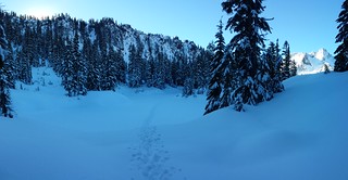
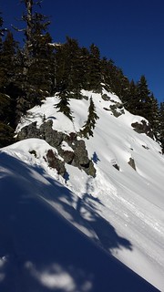
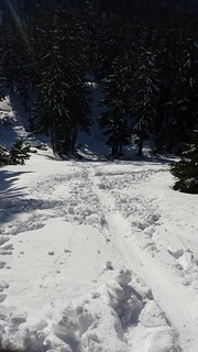
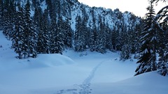
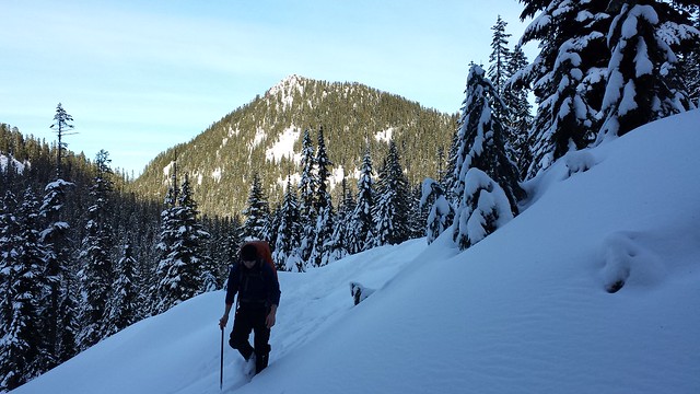
I knew that the usual route leaves the High Lakes Trail at the creek just past the cabin foundation and cruises around (or over, depending on conditions) a tarn before ascending via the South Ridge. Rather than continuing down the trail into the lake basin, Colin suggested we instead climb East along the ridge between Chair Peak and Snoqualmie Mountain and attempt to pick up the South ridge of Avalanche where it began. Our target came into view as we climbed the narrowing ridge until snowy slopes gave way to jagged rock, then took a break to plot our route from there and watch the progress of the Chair Peak climbers. At least two separate paths were visible in the snowy basin below crossing over each of two frozen tarns, respectively, one of them gaining the ridge just beyond the last of the cliffy section we needed to bypass.
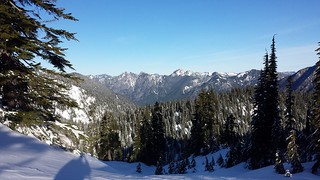
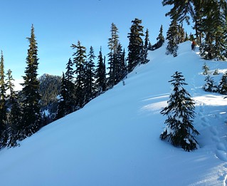
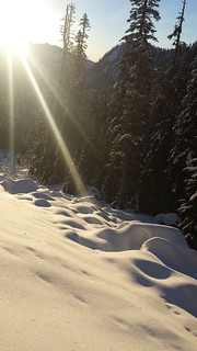
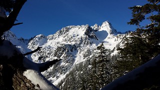
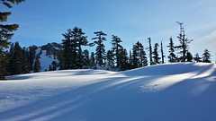
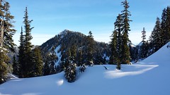
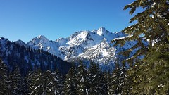
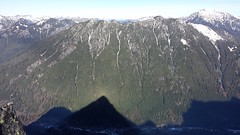
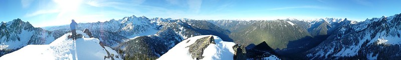
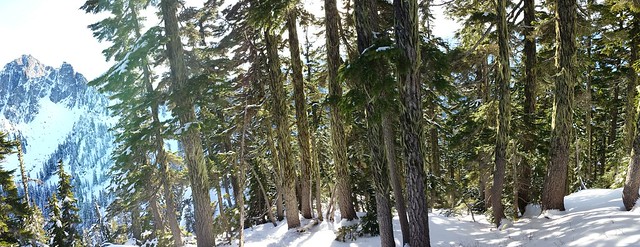
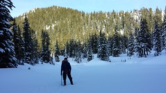
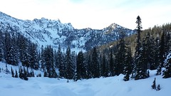
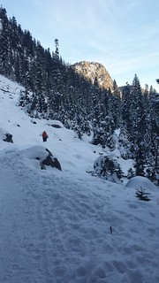
We back-tracked to a mellow slope and plunged/slid down to the closest snow trench just as a group with a few dogs descended toward the main trail. We followed the freshly packed trench through the basin and across the smaller tarn into lichen-covered timber. Only 2-3 inches of powder covered the iced over tarn compared to the 2-3 feet elsewhere. Snow conditions really could not have been much better, we could sink our boots a few inches into the steep slopes for solid traction and we never longed for snowshoes even in the afternoon sun. Once atop the ridge we were greeted with views of Burnt Boot, Mount Thomas and the jagged ridge from Chimney Rock to Chikamin Peak.
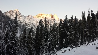
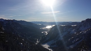
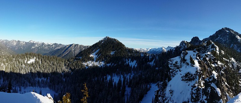
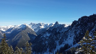
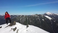
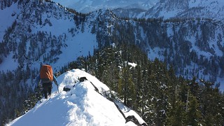
A few short sections of the ridge became narrow and slightly exposed on the East side. Near the top we opted for bare rock over exposed lee slopes where possible. The low winter sun's heat was mostly negated by persistent winds but stellar mountain views kept us at the summit for a good 30 minutes. The footbridge to Goldmyer Hotsprings was visible in the Middlefork Valley below.It was particularly cool to see
all four of the peaks Colin and I had climbed together over the weekend we had first met last summer. We were both pretty convinced that we could make out movement at the summit of Chair Peak.


For a little added ease and confidence we swapped microspikes for crampons before descending the ridge, then swapped back for a long full-speed glissade back into the basin. On the way out we left the trench just past where we had first joined it and cut our own route back to the trail at the saddle. We cut the first few switchbacks and passed a couple groups with kids and dogs and arrived back at the parking lot before sunset, stoked on another fun summit trip that provided more than we expected.
8.5 miles round trip
~3000' elevation gain
9 hours car-to-car
Comments
No comments posted yet.
