
|
|
Route |
|---|---|
|
|
39.67830°N / 106.33°W |
|
|
Hiking |
|
|
Summer, Fall |
|
|
Half a day |
|
|
Overview
 Trailhead
Several times, I left the road thinking it might be possible to take a more direct route, but each of these encounters with the forest eventually brought me back to the road for a better means of reaching the mountain. This is not a hike where you can see your goal along the way. The only times I spotted the summit were (1) when I had gone too far NE and had a large valley to drop into unless I backtracked, and (2) when I finally was within ½ mile of the summit ridge. A compass and/or GPS may be a welcome companion on this climb.
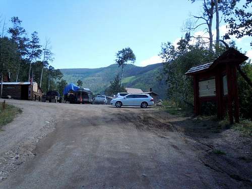
Getting There
From I70 in Vail, exit 176 is the best. On the north side of I70 there is a traffic circle with an exit that heads NE onto Spraddle Creek road. At the start, the road is paved, but the paved section ends at a gate into a private subdivision. At this point a dirt road continues after a sharp right turn from the pavement. Within about another 200 feet, you reach the Vail stables where there is parking for several vehicles on the right by a forest service kiosk.If you have high clearance (or low regard for your vehicle), you can continue driving, but on rough roads I find it more enjoyable to just hike.
Route Description
 Route in red
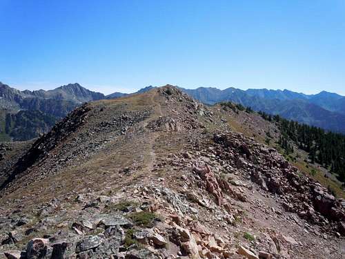 View east on summit ridge
 View toward East Vail
 View toward West Vail
From this point, the route heads through the trees in a northerly direction on the south ridge until you finally spot the summit ridge blocking your path. I headed slightly NW on an ascending traverse to climb the talus up to the ridge top. From there you just hike east over a couple of false summits to the summit and enjoy your accomplishment.
 View north toward Gore Range