
|
|
Mountain/Rock |
|---|---|
|
|
39.09925°N / 120.248°W |
|
|
Placer |
|
|
Hiking |
|
|
Summer, Fall |
|
|
8652 ft / 2637 m |
|
|
Overview
The Barker Ridge is a prominent ridge that rises northwest of Barker Pass located west of Lake Tahoe. The ridge runs about 1.3 miles north to south, with two noticeable summits; one of which has 390’ of prominence above the saddle with the nearest mountain.
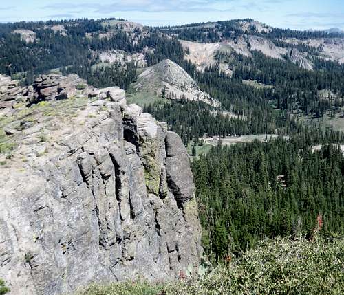
The Barker Ridge and Barker Peak from the Ellis Peak Trail
The high point of the ridge, Peak 8652, is only about 1 ¼ miles from Twin Peaks 8,878'. Peak 8652 is the northern summit. The southern summit is Point 8620, and it rises 140’ above the saddle it shares with Peak 8652. The ridge has excellent views, including views of Lake Tahoe and surrounding mountains.
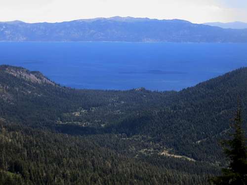
Lake Tahoe from the Barker Ridge
The ridge is accessed from the Pacific Crest Trail (PCT). A use trail accesses the ridge at about Mile 1126.3. The ridge is considered off the beaten path, which is why it is unnamed on topographic maps. Scrambling is required to reach the ridge top, so it is seldom visited. However, it is quite easy to get to from the PCT.
The Barker Pass area is best accessed starting in late June through October. Snow levels depend on the season, but West Tahoe mountains get more snow than their eastern counterparts. This is an excellent snowshoeing area when the pass is open. However, the pass usually opens in late May/early June (depending on the year) and closes in early to mid-November.
Getting There
Take Highway 89 to Barker Pass Road on the west side of the road. The road also has a sign for the Blackwood Canyon Sno-Park. If approaching from the south, it is just north of Homewood. If approaching from the north, it is just in Tahoe Pines. The turn-off is right across from the Lake Tahoe shoreline. A sign points to Barker Pass. Drive to the end of the pavement in a little over 7 miles. Then continue on a well-graded dirt road for less than half a mile to the PCT trailhead.
Route Information
Hike the PCT for approximately one and a half miles. The trail comes out of the forest and approaches a big rock formation. On the left (west) side of the trail, a faint use trail heads up towards the ridge. After about 100 yards, the trail ends and you have to scramble up rocks to reach the ridge.
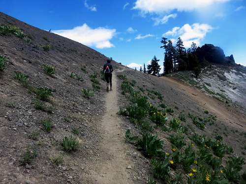
Nearing the turn off point to the Barker Ridge
Point 8620 is the first summit reached, only about 0.4 miles off of the PCT, but after a gain of 360’. From there, hike down the rocks to the saddle along the ridge. Peak 8652 is about ¾ miles north of Point 8620. There is no trail, but there is open forest with excellent views along the way.
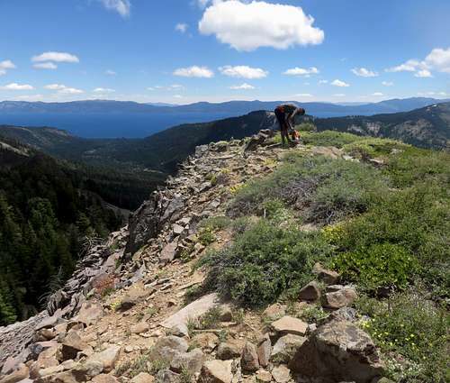
On top of Peak 8652 looking towards Lake Tahoe
Hiking both summits requires about 5 ½ miles round trip, gaining about 1,200’ to access both summits.